
Downtown in San Antonio in Bexar County, Texas — The American South (West South Central)
San Pedro Creek
| — | Sesquicentennial of Texas Statehood 1845-1995 | — |

Photographed by James Hulse, December 30, 2022
1. San Pedro Creek Marker
In 1709 Franciscan Fathers Antonio Olivares and Isidro Espinosa came upon an Indian campsite at the natural springs (1.4 miles north) which form the headwaters of this creek. They named the creek San Pedro and noted the area as a superior site for a settlement.
On May 1, 1718, Olivares and Martin de Alarcon, Spanish Governor of Coahuila and Texas, founded Mission San Antonio de Valero near here on San Pedro Creek. On May 5, 1718, Alarcon selected a site near San Pedro Springs for a presidio and the founding of Villa de Bejar "at the place called San Antonio".
An irrigation canal (acequia) system, begun in the 1720s from San Pedro Springs and extending south along the creek, provided water for the families of the first settlers, presidio soldiers, and Canary Island settlers. San Antonio's first streetcar line, which began in 1878, operated from Alamo Plaza to San Pedro Springs, then a popular tourist destination and site of numerous social and cultural events.
The San Pedro Springs, creek, and irrigation system played vital roles in the founding and early development of the Spanish presidio and mission settlement
this page online
Erected 1995 by Texas Historical Commission. (Marker Number 4551.)
Topics. This historical marker is listed in these topic lists: Colonial Era • Hispanic Americans • Indigenous Peoples and Communities • Religion & Religious Structures. A significant historical date for this entry is May 1, 1718.
Location. 29° 25.877′ N, 98° 29.85′ W. Marker is in San Antonio, Texas, in Bexar County. It is in Downtown. It is at the intersection of Camaron Street and North Santa Rosa Street, on the left when traveling north on Camaron Street. The marker is located at the east side of the San Pedro Creek Culture Park on the bridge. Touch for map. Marker is at or near this postal address: 715 Camaron St, San Antonio TX 78207, United States of America. Touch for directions.

Regionally, this marker is in South Texas. It is also in the American South. Globally, it is in North America, a Gulf of Mexico state, the Western Hemisphere, the Western World, and the Anglosphere. Historically, it finds itself in what was once New Spain, the Republic of Texas, and one of the
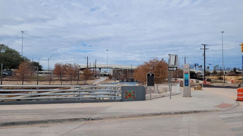
Photographed by James Hulse, December 30, 2022
2. The view of the San Pedro Creek Marker along the North Santa Rosa Street bridge
Other nearby markers. At least 8 other markers are within walking distance of this marker: San Pedro Creek: A Crossroads of Cultures (within shouting distance of this marker); Birth of a Community (within shouting distance of this marker); A Chronicle of Floods and Their Legacy of Calamities (within shouting distance of this marker); San Pedro Creek and the Saga of a City (within shouting distance of this marker); John William and María Jesusa Curbelo-Delgado Smith (about 300 feet away, measured in a direct line); Christopher Columbus Italian Society Hall (about 400 feet away); The Taming of San Pedro Creek (about 500 feet away); Italian American Community in San Antonio (about 500 feet away). Touch for a list and map of all markers in San Antonio.
Also see . . .
1. San Antonio de Valero Mission. Texas State Historical Association (Submitted on January 6, 2023, by James Hulse of Medina, Texas.)
2. San Pedro Creek (Bexar County). Texas State Historical Association (Submitted on January 6, 2023, by James Hulse of Medina, Texas.)

Photographed by James Hulse, December 30, 2022
3. The view of the San Pedro Creek Culture Park from the bridge
Credits. This page was last revised on March 11, 2026. It was originally submitted on January 6, 2023, by James Hulse of Medina, Texas. This page has been viewed 457 times since then and 44 times this year. Last updated on March 10, 2026, by Dave W of Co, Colorado. Photos: 1, 2, 3. submitted on January 6, 2023, by James Hulse of Medina, Texas. • Devry Becker Jones was the editor who published this page.
