
Near Williamsburg in James City County, Virginia — The American South (Mid-Atlantic)
Early Settlement and Cemetery
Freedom Park
Photographed by Brandon D Cross, June 21, 2023
1. Early Settlement and Cemetery Marker
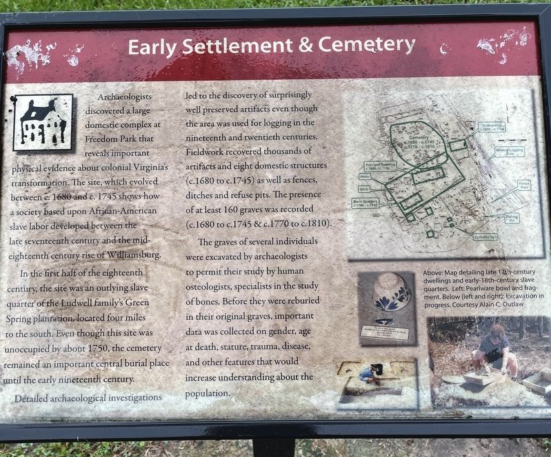
Archaeologists discovered a large domestic complex at Freedom Park that reveals important physical evidence about colonial Virginia's transformation. The site, which evolved between c.1680 and c.1745 shows how a society based upon African-American slave labor developed between the late seventeenth century and the mid-eighteenth century rise of Williamsburg.
In the first half of the eighteenth century, the site was an outlying slave quarter of the Ludwell family's Green Spring plantation, located four miles to the south. Even though this site was unoccupied by about 1750, the cemetery remained an important central burial place until the early nineteenth century.
Detailed archaeological investigations led to the discovery of surprisingly well preserved artifacts even though the area was used for logging in the nineteenth and twentieth centuries. Fieldwork recovered thousands of artifacts and eight domestic structures (c.1680 to c.1745) as well as fences, ditches and refuse pits. The presence of at least 160 graves was recorded (c.1680 to c.1745 & c.1770 to c.1810).
The graves of several individuals were excavated
this page online
(caption)
Above: Map detailing late 17th-century dwellings and early-18th-century slave quarters. Left: Pearlware bowl and fragment. Below (left and right): Excavation in progress. Courtesy Alain C. Outlaw
Erected by Freedom Park.
Topics. This historical marker is listed in these topic lists: African Americans • Anthropology & Archaeology • Cemeteries & Burial Sites • Settlements & Settlers. A significant historical year for this entry is 1680.
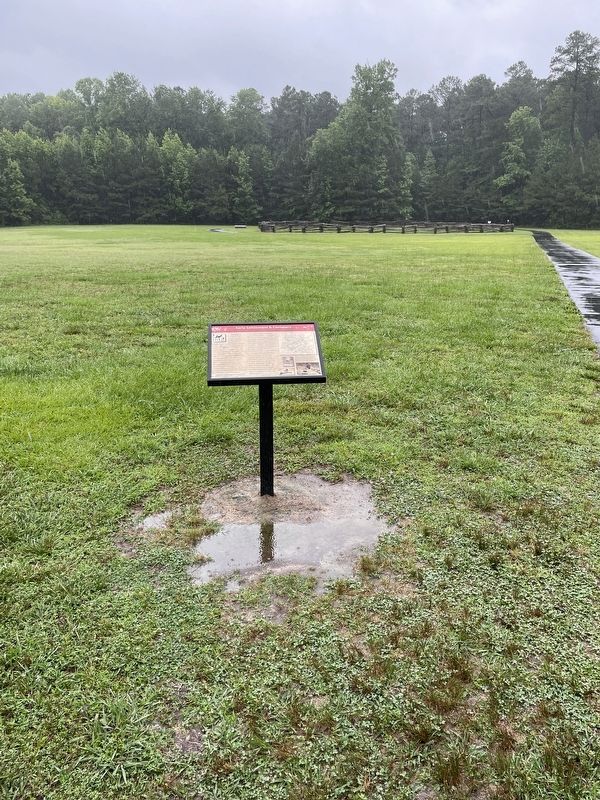
Location. This marker has been replaced by another marker nearby. It was located near 37° 19.179′ N, 76° 48.004′ W. Marker was near Williamsburg, Virginia, in James City County. It could be reached from Hotwater Trail one mile west of Centerville Road (Virginia Route 614), on the right when traveling west. This marker is located on the grounds of Freedom Park. Touch for map.
Photographed by Brandon D Cross, June 21, 2023
2. Early Settlement and Cemetery Marker

Regionally, this marker was on Virginia’s Peninsula, in Coastal Virginia, and in the Hampton Roads Metropolitan Area. It was also in the American South, specifically in the Upper South, in the Tidewater, and on the Eastern Seaboard. Globally, it was in the North Atlantic Region, North America, the Western Hemisphere, the Western World, and the Anglosphere. Historically, it found itself in what was once the territory of the Mississippian Culture, one of the original Thirteen Colonies, one of the Confederate States of America, and the Antebellum South.
Other nearby markers. At least 8 other markers are within walking distance of this location: Welcome to the Hot Water Tract (here, next to this marker); Archaeological Analysis of Hot Water Tract (about 300 feet away, measured in a direct line); Welcome to Freedom Park (about 300 feet away); Timeline of the Hot Water Tract (about 300 feet away); Engagement at Spencer's Ordinary (about 400 feet away); Free Black Settlement (about 600 feet away); Jackson Home (about 600 feet away); Brown Home (about 700 feet away). Touch for a list and map of all markers in Williamsburg.
Related markers. Click here for a list of markers that are related to this marker. These three markers replaced this marker in more detail across the walking path.
Credits. This page was last revised on March 13, 2026. It was originally submitted on June 21, 2023, by Brandon D Cross of Flagler Beach, Florida. This page has been viewed 732 times since then and 47 times this year. Last updated on March 13, 2026, by Evan Dwyer of Richmond, Virginia. Photos: 1, 2. submitted on June 21, 2023, by Brandon D Cross of Flagler Beach, Florida. • Devry Becker Jones was the editor who published this page.
