Centerville near Williamsburg in James City County, Virginia — The American South (Mid-Atlantic)
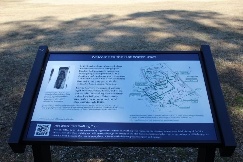
Welcome to the Hot Water Tract
Photographed by Evan Dwyer, February 14, 2026
1. Welcome to the Hot Water Tract Marker
During fieldwork thousands of artifacts, eight buildings, fences, ditches, and refuse pits were discovered along with a cemetery with at least 160 graves. This cemetery remained an important central burial place until the early 1800s.
Sources: Alain C. Outlaw, Archaeological & Cultural Solutions, Douglas Owsley and Kari Bruwelheide, Department of Anthropology, National History Museum, Smithsonian Institution; and Martha W. McCartney, Twin Paths to Freedom: The History and Archaeology of James City County's Free Black Communities.
Donated by the estate of Josephine B. Chandler
Hot Water Tract Walking Tour
Scan the QR code or visit jamescitycountyva.gov/4100 to listen to a walking tour regarding the cemetery complex and brief history of the Hot Water Tract. This short walking tour will journey
this page online
(Captions
Rectangular grave shaft, hexagonal coffin and human remains, c. 2004. Source: Progress/Planning Report for Freedom Park prepared by Archaeological and Cultural Solutions, Inc. Scaled in Feet.
Archaeological features found at domestic complex 44JC851, c. 2004. Source: rogress/Planning Report for Freedom Park prepared by Archaeological and Cultural Solutions, Inc.
*After the publication of this book, some terms and language have evolved.
Erected by James City County Parks & Recreation.
Topics. This historical marker is listed in these topic lists: African Americans • Anthropology & Archaeology • Cemeteries & Burial Sites • Settlements & Settlers.
Location. 37° 19.178′ N, 76° 48.003′ W. Marker is near Williamsburg, Virginia, in James City County. It is in Centerville. It can be reached from Hotwater Trail one mile west of Centerville Road (Virginia Route 614),
Photographed by Evan Dwyer, February 14, 2026
2. Welcome to the Hot Water Tract Marker
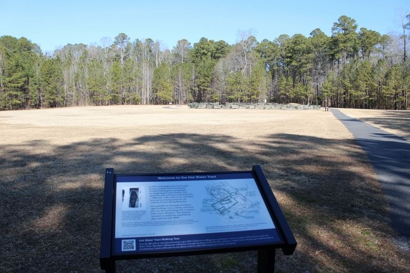
The fenced area beyond is the cemetery. Two other markers and a monument to the unknown dead are visible surrounding it.

Regionally, this marker is on Virginia’s Peninsula, in Coastal Virginia, and in the Hampton Roads Metropolitan Area. It is also in the American South, specifically in the Upper South, in the Tidewater, and on the Eastern Seaboard. Globally, it is in the North Atlantic Region, North America, the Western Hemisphere, the Western World, and the Anglosphere. Historically, it finds itself in what was once the territory of the Mississippian Culture, one of the original Thirteen Colonies, one of the Confederate States of America, and the Antebellum South.
Other nearby markers. At least 8 other markers are within walking distance of this marker: Archaeological Analysis of Hot Water Tract (about 300 feet away, measured in a direct line); Welcome to Freedom Park (about 300 feet away); Timeline of the Hot Water Tract (about 300 feet away); Engagement at Spencer's Ordinary (about 400 feet away);
Photographed by Evan Dwyer, February 14, 2026
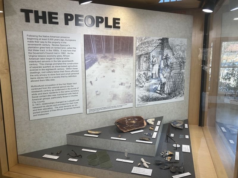
3. Hot Water Tract Exhibit
Within the Freedom Park Interpretive Center.
Another marker is no longer nearby. Early Settlement and Cemetery (was here, next to this marker but has been replaced with another marker now near it).
Related marker. Click here for another marker that is related to this marker. It preceded this marker in the same location.
Photographed by Evan Dwyer, February 14, 2026
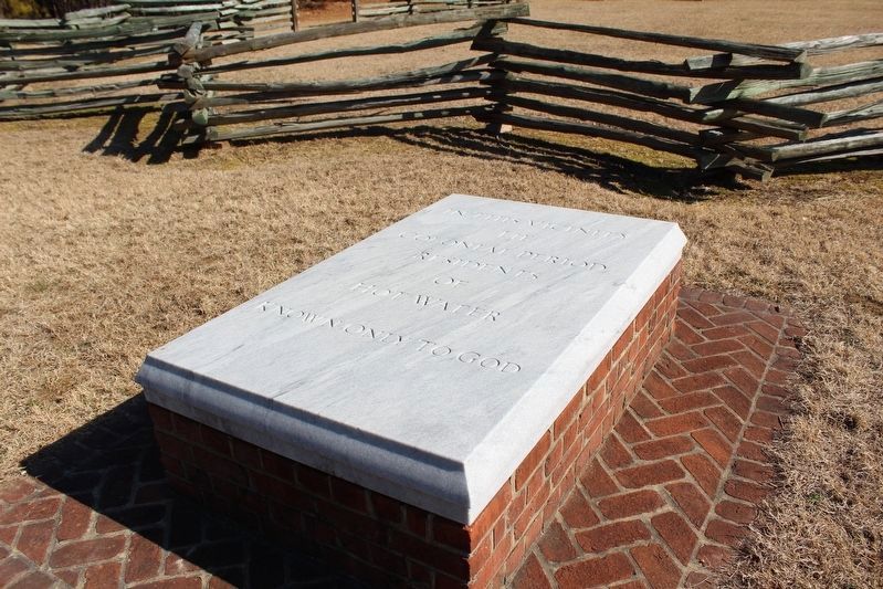
4. Hot Water Tract Cemetery Monument
Installed to commemorate the ~160 unknown persons buried in the adjacent, fenced-in cemetery.
Photographed by Evan Dwyer, February 14, 2026
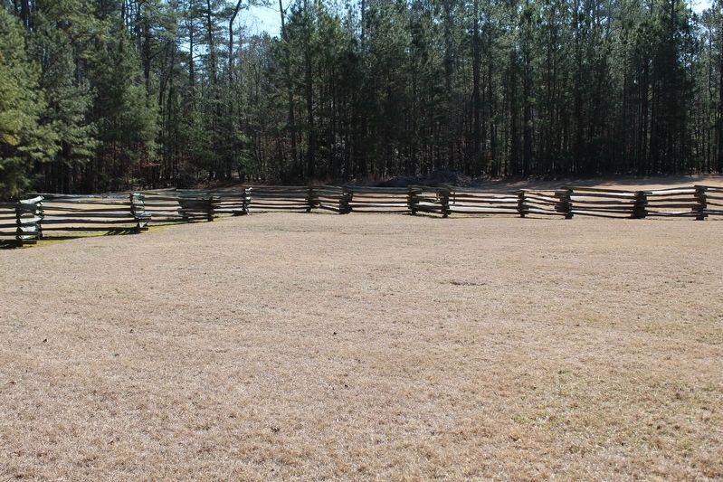
5. Hot Water Tract Cemetery
The cemetery itself has no markers (wooden markers rotted away, field stone markers were removed for other uses - carved marble or stone markers were not common at the time the cemetery was active, nor would slaves or laborers have had the means, or support, to acquire such a marker). However, on close examination the visitor can see the dips and lumps in the ground, the dips indicating burial sites where the earth has settled over the dug grave.
Credits. This page was last revised on March 13, 2026. It was originally submitted on March 13, 2026, by Evan Dwyer of Richmond, Virginia. This page has been viewed 37 times since then. Photos: 1, 2, 3, 4, 5. submitted on March 13, 2026, by Evan Dwyer of Richmond, Virginia. • Bernard Fisher was the editor who published this page.
