
Bradenton in Manatee County, Florida — The American South (South Atlantic)
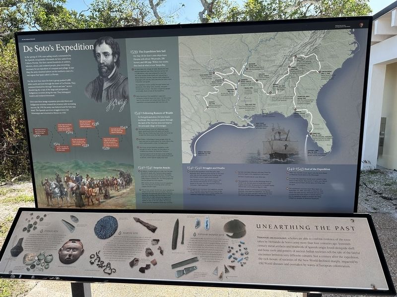
De Soto's Expedition
| — | De Soto National Memorial | — |
Photographed by Pete Skillman, March 11, 2026
1. De Soto's Expedition Marker
For the next four years De Soto's group pushed 4,000 miles north and west through the heart of La Florida. They sustained themselves through "shock and awe" tactics: plundering the crops of the large and prosperous Indigenous societies along the way. They kidnapped leaders and enslaved thousands.
Over time their savage reputation preceded them and Indigenous societies resisted the invasion with increasing success. By 1542 the army was battered and De Soto was dead. The Spanish survivors straggled down the Mississippi and returned to Mexico in 1543.
1500
Hernando de Soto is born in Jerez de los Caballeros, Spain.
1514
At age 14, De Soto sets off on an expedition to the West Indies.
1524
Under Pedro Arias Davila, De Soto takes part
this page online
1532
As a key commander for Pizarro, De Soto is part of the conquering of the Inca civilization.
1536
Rich from his travels, De Soto returns to Spain and marries Isabella de Bobadilla.
1539
King Charles of Spain makes De Soto governor of Cuba and gives his permission for him to set up a colony in La Florida.
1542
Hernando de Soto dies near present day Natchez, Mississippi.
1539 The Expedition Sets Sail
On May 18 De Soto's nine ships leave Havana with about 700 people, 200 horses, and 400 pigs. Within two weeks they land at what is now Tampa Bay.
- De Soto takes the village of Uzita. Nearby his men retrieve Spaniard Juan Ortiz, the lone survivor of a 1528 mission, who was enslaved for years by the Uzita cacique (male chief) until rescued by a Native American woman. Familiar with Indigenous languages and cultures, Ortiz become's De Soto's main interpreter and guide.
The expedition moves quickly through forests and grasslands, then deep rivers, swamps, and palm thickets show it down. The area's Indigenous people continually shoot arrows at the expedition. - Upon learning of the expedition's approach, Anhayca's residents leave their town. De Soto camps here for the winter with ample food. Many of the expedition's enslaved people die from the cold.
1540 Following Rumors of Wealth
To find gold and silver, De Soto heads northeast. His expedition passes through the land of the Toa but does not head to the principal village of Ocmulgee. - The cacica (female chief) at Cofitachequi seeks peace, greeting De Soto with pearls and goods. When she says Chiaha may have mines, he forces her to take him there across the high mountains.
- At Chiaha, Cofitachequi's cacica escapes while De Soto rests and his scouts search for mines. When they return without gold or silver, he heads south.
- The Coosa cacique leads the expedition south through his lands. He warns De Soto about his neighboring cacique, the fearsome Tuscaluza.
Tuscaluza says he will let De Soto winter at Mabila. This suits De Soto's plan to send a detachment south to Achuse, where Spanish supply ships wait.
1540-1541 Surprise Attacks - At Mabila, a walled town on a wide river, De Soto demands to speak with Tuscaluza about supplies. Tuscaluza's warriors ambush De Soto. The battle ends when the Spaniards set the town on fire. Over 2,000 Indigenous people die. The fleeing Spaniards lose few people but most supplies.
With mutiny stirring, De Soto turns his expedition west. They face the oncoming winter with low supplies and dim hopes. - The Chicaza cacique lets De Soto use an abandoned village and provides food and supplies. Relations sour when the Spaniards execute several Chicaza people for stealing a pig. The Chicaza, in turn, attack them at night using arrows tipped with flaming herbs. Barely escaping, the expedition battles on the run for two weeks. The Chicaza pursue until the expedition leaves their territory.
1541-1542 Struggles and Deaths - In spring the expedition meets the swift, wide Mississippi River. Believing gold may be on the river's other side, De Soto spends months building rafts, then follows rumors of gold north and west.
The expedition comes upon people living in tipis who mention the presence of non-Indigenous people to the west. This may have been Francisco Coronado's 1540 expedition. - Struggling over mountains, the expedition reaches the Tula people, who have plenty of food for the winter. The Tula attack. After multiple battles, the expedition heads back toward the river.
- De Soto overtakes Utiangue and stays there for what he hopes is the expedition's last winter.
De Soto's trusted adviser Juan Ortiz dies. - The expedition returns to the Mississippi River as winter ends. De Soto plans to build ships to get supplies downriver. He becomes ill, his health rapidly deteriorates, and he dies on May 21, 1542.
De Soto's second-in-command, Luis de Moscoso Alvarado, now leads the expedition. He abandons De Soto's river plan and goes west to find and over-land route to New Spain (today's Mexico).
1542-1543 End of the Expedition - After two months scouts report only dry land ahead, so Moscoso heads back to the Mississippi.
- In winter the expedition builds seven vessels to take them to New Spain; they launch in early June. Native residents pursue them almost daily until they near the gulf.
- The expedition's survivors reach New Spain on September 10, 1543, with little to show for their nearly four-year journey. Hernando de Soto once conquered the Incan Empire in South America, but his expedition failed to conquer the many Indigenous peoples of America's Southeast.
(Points
Photographed by Pete Skillman, March 11, 2026
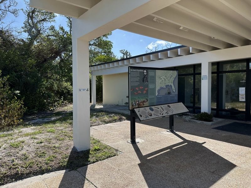
2. De Soto's Expedition Marker - wide view
- Tampa Bay
May 30, 1539
De Soto National Memorial
The ships land near an Indigenous town built partly on mounds. - Anhayca
Winter 1539-40
Expedition camps. Many enslaved die from cold.
Ocmulgee Area
Spring 1540
With few enslaved persons left to carry supplies, the expedition struggles. - Cofitachequi
May 1, 1540
Cacica forced to guide expedition west over mountains for gold. - Chiaha
May 1540
De Soto rests while his scouts search for gold unsuccessfully. - Coosa
June 1540
Cacique leads De Soto to Tuscaluza's lands. - Mabila
October 18, 1540
Battle of Mabila kills over 2,000 people.
"Neither by force nor persuasion could they brought under the authority and dominion of the Spaniards."
Winter 1540
"A nobleman...with his flesh showing...amidst frost and cold." - Chicaza
Winter 1540-41
Expedition leaves under attack. - Quizquiz
Spring 1541
Expedition builds rafts to cross the Mississippi River. - Tula
Early October 1541
Strong Tula fighters fend off De Soto. - Utiangue
Winter 1541-42
Expedition's coldest winter. Ortiz dies. - Guachoya
May 1542
De Soto dies. Moscoso leads expedition west. - Guasco
July 1542
Moscoso backtracks to the Mississippi River. - Aminoya
Winter 1542-43
Expedition builds vessels for return to New Spain.
Early June 1543
"There arrived at dawn a most handsome fleet of more than a thousand canoes." - Gulf Coast
Late June 1543
Expedition survivors sail to New Spain.
Panuco, New Spain
September 10, 1543
Expedition ends.
Unearthing the Past
Through archaeology, scholars are able to confirm evidence of the route taken by Hernando de Soto's army more than four centuries ago. Sixteenth century metal artifacts and beadwork of Spanish origin found alongside shell and bone tools and pottery of ancient Indian societies tell the tale of the fateful encounter between very different cultures. Just a century after the expedition, the rich mosaic of societies of the New World declined sharply, impacted by Old World diseases and overtaken by waves of European colonization.
Tatham Mound Site
Discovered in 1984, the excavation of this mound just north of Tampa Bay uncovered the remains of more than 70 people who may have died as a result of European disease introduced by the de Soto expedition. At least two of the human bones display sword wounds. One native woman was discovered clutching a metal plate and small rolled tube made from Spanish armor. Colorful glass beads given as gifts to Florida's native peoples by the Spaniards allow archaeologists to identify the site as a place on or near the route of the de Soto expedition.
Martin Site
Believed to be de Soto's first winter camp, the Martin site is probably part of the Apalachee town of Anhayca, principal town in a complex chiefdom (socially stratified with chiefs, a noble elite, and commoners) which covered a large territory in the Florida panhandle. The Apalachee warriors, "very tall, very valiant, and full of spirit," laid siege to their town during its occupation by de Soto's army. Important artifacts uncovered at this site include tiny S-shaped iron links, fragments of the chain mail worn by the Spaniards. A written account notes that this type of armor was "thrown aside" after an Apalachee archer demonstrated that he could easily pierce it with cane arrows.
Parkin Site
Located in Arkansas just northwest of de Soto's crossing of the Mississippi River, the Parkin site lay in the midst of the densely populated Central Mississippi Valley. Believed to be the Indian village of Casqui, the site features a central mound for the chief and nobles, and large, well laid out fields as is typical of highly organized Mississippian cultures. Among the artifacts are many head pots, usually found with human burials, and believed to represent trophy heads--portraits of enemy warriors killed in battle.
Erected 2025 by National Park Service.
Topics. This historical marker is listed in these topic lists: Anthropology & Archaeology • Exploration • Hispanic Americans • Indigenous Peoples and Communities.
Location. 27° 31.439′ N, 82° 38.638′ W. Marker is in Bradenton, Florida, in Manatee County. It can be reached from 75th Street Northwest. Touch for map. Marker is at or near this postal address: 8300 75th St NW, Bradenton FL 34209, United States of America. Touch for directions.

Regionally, this marker is on Florida’s Gulf Coast and on Tampa Bay. It is also in the American South and on the Gulf Coast. Globally, it is in the North Atlantic Region, North America, a Gulf of Mexico state, the Western Hemisphere, the Western World, and the Anglosphere. Historically, it finds itself in what was once New Spain, the territory of the Mississippian Culture, one of the Confederate States of America, and the Antebellum South.
Other nearby markers. At least 8 other markers are within walking distance of this marker: Memorial Trail (a few steps from this marker); Landfall (within shouting distance of this marker); Hernando de Soto (within shouting distance of this marker); La Florida's Early Peoples (within shouting distance of this marker); Arrival (within shouting distance of this marker); Marking the Trail (within shouting distance of this marker); The Spanish Crown (within shouting distance of this marker); DeSoto Trail (within shouting distance of this marker). Touch for a list and map of all markers in Bradenton.
Another marker is no longer nearby. De Soto Trail Monument (was within shouting distance of this marker but has been permanently removed).
Credits. This page was last revised on March 13, 2026. It was originally submitted on March 13, 2026, by Pete Skillman of Townsend, Delaware. This page has been viewed 31 times since then. Photos: 1, 2. submitted on March 13, 2026, by Pete Skillman of Townsend, Delaware.
