Ballajá in San Juan in Municipio de San Juan, Puerto Rico — The Caribbean (The West Indies)
Kites
Chiringas
| — | San Juan National Historic Site | — |

Photographed by Bradley Owen, March 18, 2026
1. Kites Marker
This hillside, once a battlefield below El Morro, is often littered with string and plastic, residue from kites that once flew high overhead. Pursuing a popular tradition in Puerto Rico, kite flyers flock to the large green lawn, or esplanade, in front of El Morro to launch their kites in the dependable breezes found there. Unfortunately, abandoned kites and kite string litter this area and harm the wildlife and waters of San Juan Bay.
(Spanish):
En esta colina, antes campo de batalla al frente de El Morro, a menudo se encuentra el hilo y el plástico de chiringas (cometas en Latinoamérica) que alguna vez volaron en el cielo. Siguiendo una popular tradición puertorriqueña, muchos aficionados a las chiringas, se reúnen en este campo verde o explanada, para volar sus chiringas debido a los fuertes vientos que soplan aquí. Desafortunadamente, las chiringas e hilo abandonados ensucian esta área y dañan la vida silvestre y las aguas de la Bahía de San Juan.
(English and Spanish Captions):
Each year half a million people use the grounds of El Morro for picnics, sports, and other activities.
Cada año, medio millon de personas utiliza el terreno de El Morro para hacer picnics, deportes y otras activi dades.
Every spring the National Park Service hosts a Kite Festival to share and promote environmentally friendly ways to enjoy the park.
Todas las primaveras, el National Park Service organiza un festival de chiringas para compartir y promover maneras de disfrutar. del parque protegiendo su medio ambiente.
Trash that litters the historic area challenges National Park Service preservation efforts and hurts plants and animals.
La basura que ensucia el área histórica dificulta los esfuerzos de conservación del National Park Service y daña las plantas y los animales.
Erected by National
this page online
Topics. This historical marker is listed in these topic lists: Environment • Notable Events • Parks & Recreational Areas.
Location. 18° 28.111′ N, 66° 7.288′ W. Marker is in San Juan in Municipio de San Juan, Puerto Rico. It is in Ballajá. It is on Calle del Morro north of Calle Norzagaray, on the left when traveling north. Marker is located on the grounds of Castillo San Felipe del Morro. Touch for map. Marker is at or near this postal address: 501 Calle Norzagaray, San Juan PR 00901, United States of America. Touch for directions.

Regionally, it is one of the Greater Antilles on the Caribbean Sea, on in the Atlantic Ocean, in North America, in the Western Hemisphere, in the Western World, and in the Anglosphere. Historically, it finds itself in what was once a Spanish colony.
Other nearby markers. At least 8 other markers are within walking distance of this marker: The Dutch Attack of 1625 (about 400 feet away, measured in a direct line); Plaza del Cuartel (about 400 feet away); A Defense of the 1st Order (approx.
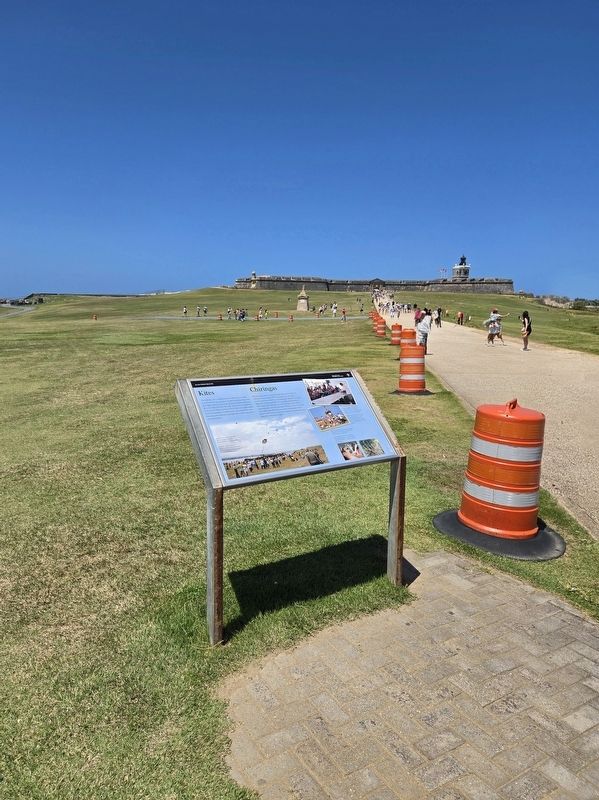
Photographed by Bradley Owen, March 18, 2026
2. Kites Marker
Another marker is no longer nearby. Defending San Juan / Defensa de San Juan (was within shouting distance of this marker but has been permanently removed).
Credits. This page was last revised on March 28, 2026. It was originally submitted on March 28, 2026, by Bradley Owen of Morgantown, West Virginia. This page has been viewed 17 times since then. Photos: 1, 2. submitted on March 28, 2026, by Bradley Owen of Morgantown, West Virginia.
