Marina in San Juan in Municipio de San Juan, Puerto Rico — The Caribbean (The West Indies)
Bastión de las Palmas
San Juan National Historic Site
| — | National Park Service, U.S. Department of the Interior | — |
Photographed by Bradley Owen, March 18, 2026
1. Bastión de las Palmas Marker

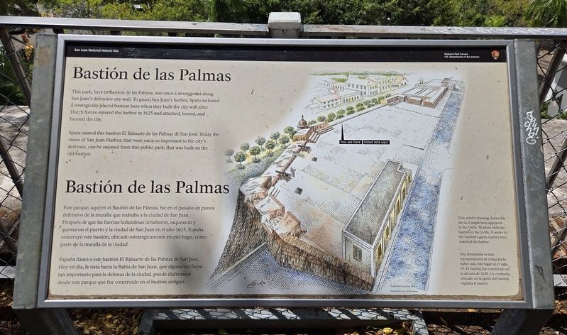
This park, here in Bastion de las Palmas, was once a strongpoint along San Juan's defensive city wall. To guard San Juan's harbor, Spain included a strategically placed bastion here when they built the city wall after Dutch forces entered the harbor in 1625 and attacked, looted, and burned the city.
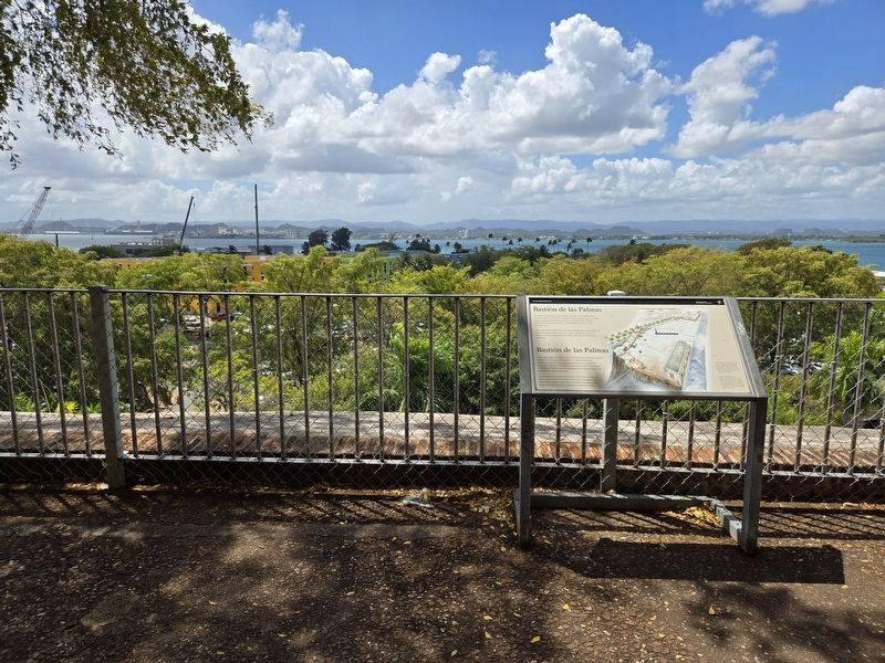
Spain named this bastion El Baluarte de las Palmas de San José. Today the views of San Juan Harbor, that were once so important to the city's defenses, can be enjoyed from this public park, that was built on the old bastion.
España llamó a este bastión El Baluarte de las Palmas de San José. Hoy en día, la vista hacia la Bahía de San Juan, que alguna vez fuera tan importante para la defensa de la ciudad, puede disfrutarse desde este parque que fue
this page online
This artist's drawing shows this site as it might have appeared in the 1800s. Workers built the bastion in the 1630s. A sentry in the bastion's garita (sentry box) watched the harbor.
Erected by National Park Service, U.S. Department of the Interior.
Topics. This historical marker is listed in these topic lists: Colonial Era • Forts and Castles • Parks & Recreational Areas • Wars, Non-US. A significant historical year for this entry is 1625.
Location. 18° 27.83′ N, 66° 7.017′ W. Marker is in San Juan in Municipio de San Juan, Puerto Rico. It is in Marina. It is at the intersection of Calle Tetuan and Calle de San Jose, on the right when traveling east on Calle Tetuan. Touch for map. Marker is at or near this postal address: 100 Calle Tetuan, San Juan PR 00901, United States of America. Touch for directions.

Regionally, it is one
Photographed by Bradley Owen, March 18, 2026
2. Bastión de las Palmas Marker
Other nearby markers. At least 8 other markers are within walking distance of this marker: Francisco de Miranda (a few steps from this marker); Bastión de las Palmas de San José (a few steps from this marker); Casa Natal de Don Ramón Power y Giralt (within shouting distance of this marker); Capilla del Santo Cristo de la Salud / Chapel of Christ the Savior (about 300 feet away, measured in a direct line); Doña Felisa Rincón De Gautier (about 300 feet away); Parque de las Palomas (about 300 feet away); Piña Colada Made Famous (about 300 feet away); a different marker also named Parque de las Palomas (about 300 feet away). Touch for a list and map of all markers in San Juan.
Credits. This page was last revised on April 1, 2026. It was originally submitted on April 1, 2026, by Bradley Owen of Morgantown, West Virginia. This page has been viewed 17 times since then. Photos: 1, 2. submitted on April 1, 2026, by Bradley Owen of Morgantown, West Virginia.
