Hamden in South Central Region, Connecticut — The American Northeast (New England)
Sleeping Giant: Stories of an Indigenous Place
Photographed by Conrad Ward, April 6, 2025
1. Sleeping Giant: Stories of an Indigenous Place Marker
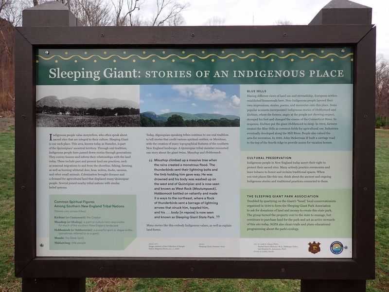
Indigenous people value storytellers, who often speak about sacred sites that are integral to their culture. Sleeping Giant is one such place. This area, known today as Hamden, is part of the Quinnipiacs' ancestral territory. Through oral tradition, Indigenous people have passed down stories through generations. They convey lessons and inform their relationships with the land today. These include past and present land use practices, such as seasonal migrations to and from the shoreline, fishing, farming, as well as hunting whitetail deer, bear, wolves, ducks, racoons, and other small animals. Colonization brought diseases and a demand for agriculture land that displaced many Quinnipiac people. Several joined nearby tribal nations with similar belief systems.
Today, Algonquian-speaking tribes continue to use oral tradition to tell stories that credit various spiritual entities, or Manitous, with the creation of many topographical features of the southern New England landscape. A Quinnipiac tribal member recounted one story about the giant twins, Maushop and Hobbomock:
"Maushop climbed up a massive tree when the rains created a monstrous flood. The thunderbirds sent their lightning bolts and the limb holding him gave way. He was drowned and his body was washed up on the west end of Quinnipiac and is now seen and known as West Rock (Mautumpseck). Hobbomock battled on valiantly and made it a ways to the northeast, where a flock of thunderbirds sent a barrage of lightning arrows that struck him, toppled him, and his . . . body [in repose] is now seen and known as Sleeping Giant State Park."
Many
this page online
Blue Hills
Having different views of land use and stewardship, European settlers established homesteads here. Non-Indigenous people layered their own impressions, stories, poems, and memories onto this place. Some popular accounts incorporated Indigenous stories of Hobbomock and Kiehtan, where the former, angry at the people not showing respect, stomped his foot and changed the course of the Connecticut River. In response, Kiethan put the giant Hobbomock to sleep. In 1804, farmers created the Blue Hills as common fields for agricultural use. Industries eventually developed along the Mill River. People also valued the area for recreation. In 1888, John Dickerman II built a carriage road to the top of the fourth ridge to provide access for vacation homes.
Cultural Preservation
Indigenous people in New England today assert their right to protect their sacred sites. Many actively practice ceremonies and leave tobacco to honor and reclaim traditional space. When you visit places like this one, think about the ancient and ongoing Indigenous stories and traditional
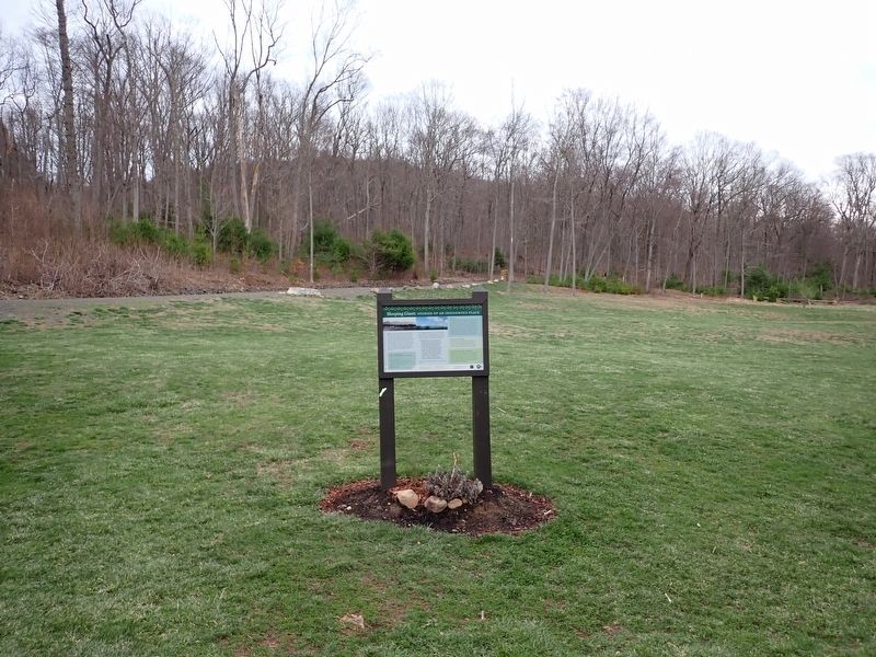
Photographed by Conrad Ward, April 6, 2025
2. Sleeping Giant: Stories of an Indigenous Place Marker
The Sleeping Giant Park Association
Troubled by quarrying on the Giant's "head," local conservationists organized in 1924 to form the Sleeping Giant Park Association to ask for donations of land and money to create this state park. The group turned the property over to the state to manage, but continues to purchase land for the park and act as active stewards of this site today. SGPA also clears trails and plans educational programming about the park's ecology.
Common Spiritual Figures Among Southern New England Tribal Nations
(Names vary across tribes)
Kiehtan (or Cantanowit): the Creator
Maushop (or Moshup): a giant or culture hero responsible for much of the southern New England landscape
Hobbomock (or Hobbomocko): a powerful spirit or shape-shifter (sometimes referred to as a giant)
Mundo: the Great Spirit
Makiawisug: little people
Above left:
Image courtesy of the Collection of Joseph Taylor, Magrisso Forte, LLC., c. 1900
Above:
Sleeping Giant, Summer 2022
Text by: Leah S. Glaser, Ph.D., Rachel Sayet/Akitusut, M.A. (Mohegan Tribe), and Stephen K. Amerman, Ph.D.
Design by: Lesley Zurolo
Erected by Connecticut State Parks & Connecticut Energy & Environment.
Topics. This historical marker is listed in these topic lists: Environment • Indigenous Peoples and Communities • Parks & Recreational Areas • Religion & Religious Structures. A significant historical year for this entry is 1804.
Location. 41° 25.294′ N, 72° 53.944′ W. Marker is in Hamden in South Central Region, Connecticut. It is on Mt. Carmel Avenue 0.3 miles east of Whitney Avenue (Connecticut Route 10), on the left when traveling east. The marker is located near the start of the Tower Trail. Touch for map. Marker is at or near this postal address: 200 Mt Carmel Ave, Hamden CT 06518, United States of America. Touch for directions.

Regionally, this marker is in the Connecticut River Valley, on the Connecticut Shoreline, and in Greater New Haven. It is also in the American Northeast and in New England. Globally, it is in North America, the Western Hemisphere, the Western World, and the Anglosphere. Historically, it finds itself in what was once New Haven County and also one of the original Thirteen Colonies.
Other nearby markers. At least 8 other markers are within walking distance of this marker: Edgar Laing Heermance (within shouting distance of this marker); Sleeping Giant State Park: The Tower Path (about 400 feet away, measured in a direct line); Walter Owen Filley (about 500 feet away); Sleeping Giant Quarry (approx. 0.3 miles away); Judge Cook's Oxen Road (approx. 0.3 miles away); a different marker also named Judge Cook's Oxen Road (approx. half a mile away); Heaton Trail (approx. 0.6 miles away); Sleeping Giant State Park (approx. 0.8 miles away). Touch for a list and map of all markers in Hamden.
Credits. This page was last revised on May 19, 2026. It was originally submitted on April 6, 2026, by Conrad Ward of Guilford, Connecticut. This page has been viewed 51 times since then. Photos: 1, 2. submitted on April 6, 2026, by Conrad Ward of Guilford, Connecticut. • Devry Becker Jones was the editor who published this page.
