Hamden in South Central Region, Connecticut — The American Northeast (New England)
Sleeping Giant State Park: The Tower Path
Photographed by Conrad Ward
1. Sleeping Giant State Park: The Tower Path Marker
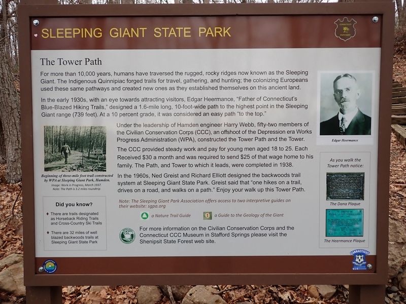
For more than 10,000 years, humans have traversed the rugged, rocky ridges known as the Sleeping Giant. The Indigenous Quinnipiac forged trails for travel, gathering, and hunting; the colonizing Europeans used these same pathways and created new ones as they established themselves on this ancient land.
In the early 1930s, with an eye towards attracting visitors, Edgar Heermance, "Father of Connecticut's Blue-Blazed Hiking Trails," designed a 1.6-mile long, 10-foot-wide path to the highest point in the Sleeping Giant range (739 feet). At a 10 percent grade it was considered an easy path "to the top."
Under the leadership of Hamden engineer Harry Webb, fifty-two members of the Civilian Conservation Corps (CCC), an offshoot of the Depression era Works Progress Administration (WPA), constructed the Tower Path and the Tower.
The CCC provided steady work and pay for young men aged 18 to 25. Each Received $30 a month and was required to send $25 of that wage home to his family. The Path, and Tower to which it leads, were completed in 1938.
In the 1960s, Ned Greist and Richard Elliott designed the backwoods trail
this page online
(Image caption, left)
Beginning of three-mile foot trail constructed by WPA at Sleeping Giant Park, Hamden.
Image: Work in progress, March 1937.
Note: The Path is 3.2 miles roundtrip.
(Image caption, right)
Edgar Heermance
As you walk the Tower Path notice:
The Dana Plaque
The Heermance Plaque
Did you Know?
• There are trails designated as Horseback Riding Trails and Cross-Country Ski Trails
• There are 32 miles of well blazed backwoods trails at Sleeping Giant State Park
Note: The Sleeping Giant Park Association offers access to two interpretive guides on their website: sgpa.org
a Nature Trail Guide • a Guide to the Geology of the Giant
For more information on the Civilian Conservation Corps and the Connecticut CCC Museum in Stafford Springs please visit the Shenipsit State Forest web site.
Erected by Connecticut State Parks & Connecticut Energy & Environment.
Topics. This historical marker is listed in these topic lists: Anthropology & Archaeology
Photographed by Conrad Ward, April 6, 2025
2. Sleeping Giant State Park: The Tower Path Marker
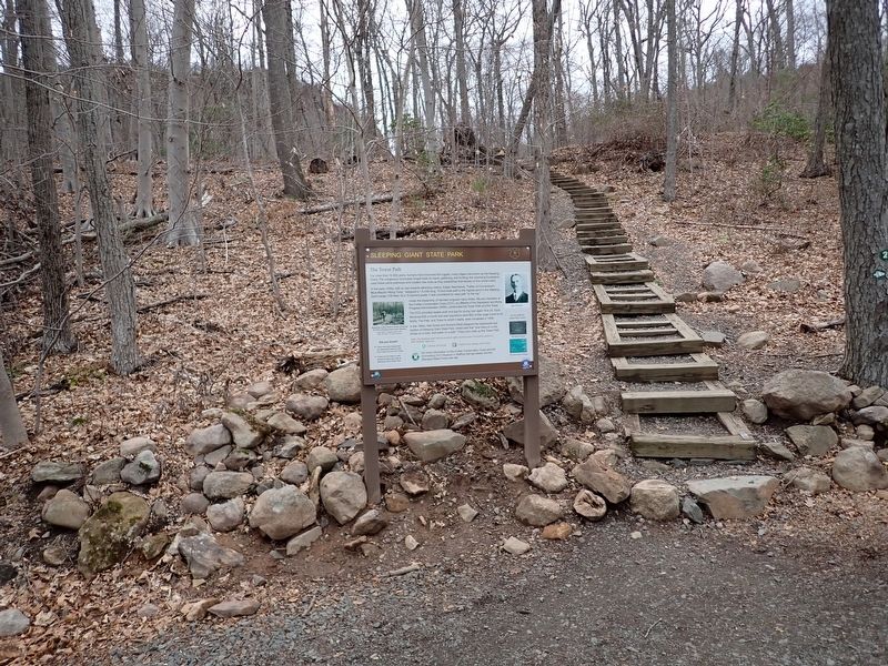
Location. 41° 25.339′ N, 72° 53.87′ W. Marker is in Hamden in South Central Region, Connecticut. It can be reached from Tower Path north of Mt. Carmel Avenue, on the right when traveling east. The marker stands in Sleeping Giant State Park. Touch for map. Marker is at or near this postal address: 200 Tower Path, Hamden CT 06518, United States of America. Touch for directions.

Regionally, this marker is in the Connecticut River Valley, on the Connecticut Shoreline, and in Greater New Haven. It is also in the American Northeast and in New England. Globally, it is in North America, the Western Hemisphere, the Western World, and the Anglosphere. Historically, it finds itself in what was once New Haven County and also one of the original Thirteen Colonies.
Other nearby markers. At least 8 other markers are within walking distance of this marker: Edgar Laing Heermance (about 300 feet away, measured in a direct line); Sleeping Giant: Stories of an Indigenous Place (about 400 feet away); Walter Owen Filley (approx. 0.2 miles away); Judge Cook's Oxen Road (approx. ¼ mile away); Sleeping Giant Quarry (approx. 0.3 miles away); a different marker also named Judge Cook's Oxen Road (approx. 0.4 miles away); Heaton Trail (approx. 0.6 miles away); Sleeping Giant State Park (approx. 0.7 miles away). Touch for a list and map of all markers in Hamden.
Also see . . . Sleeping Giant State Park (Official Website). (Submitted on April 7, 2026.)
Credits. This page was last revised on May 19, 2026. It was originally submitted on April 7, 2026, by Conrad Ward of Guilford, Connecticut. This page has been viewed 43 times since then. Photos: 1, 2. submitted on April 7, 2026, by Conrad Ward of Guilford, Connecticut. • Devry Becker Jones was the editor who published this page.
