Near West Richland in Benton County, Washington — The American West (Northwest)
The Longmire Wagon Train
⎯⎯⎯
Camp Columbia
Photographed by Clayton Pickett, April 11, 2026
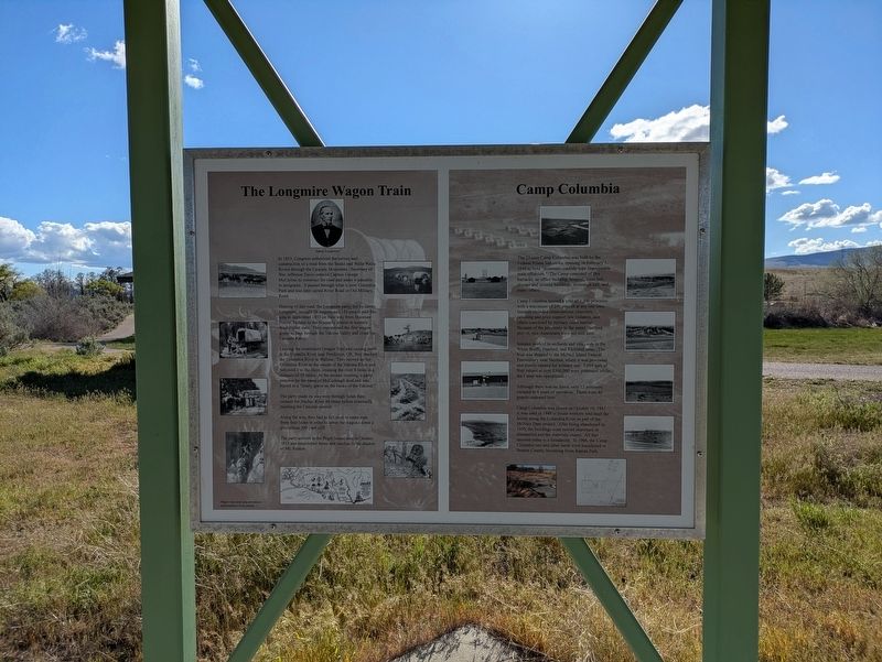
1. The Longmire Wagon Train / Camp Columbia Marker
The Longmire Wagon Train
In 1853, Congress authorized the survey and construction of a road from the Snake and Walla Walla Rivers through the Cascade Mountains. Secretary of War Jefferson Davis ordered Captain George McClellan to construct the road and make it passable to emigrants . It passed through what is now Columbia Park and was later called River Road or Old Military Road.
Hearing of this road, the Longmire party, led by James Longmire, brought 36 wagons and 150 people past this area in September 1853 on their way from Shawnee Prairie, Indiana to the Nisqually prairie in western Washington state. They represented the first wagon group to pass through the Yakima Valley and cross the Cascade Range.
Leaving the established Oregon Trail and turning north at the Umatilla River near Pendleton, OR, they reached the Columbia River at Wallula. They moved up the Columbia River to the mouth of the Yakima River and followed it to the Horn, crossing the river 8 times in a distance of 10 miles. At the second crossing, a party member by the name of McCullough died and was buried in a “lonely grave on the banks of the Yakima.”
this page online
The party made its way west through Selah then crossed the Naches River 68 times before eventually reaching the Cascade summit.
Along the way, they had to kill oxen to make rope from their hides in order to lower the wagons down a precipitous 300-yard cliff.
The party arrived in the Puget Sound area in October 1853 and established farms and ranches in the shadow of Mt. Rainier.
Camp Columbia
The 25-acre Camp Columbia was built by the Federal Prison Industries, opening on February 1, 1944 to hold “minimum-custody-type improvable male offenders.” The Camp consisted of five barracks, an office building, hospital, mess hall, storage and utilities buildings, recreation hall, and many others.
Camp Columbia housed a total of 1,300 prisoners with a maximum of 290 present at any one time. Inmates included conscientious objectors, rationing and price support law violators, and others convicted by military court martial. Because of the proximity to the secret Hanford project, non-Americans were not sent here.
Inmates worked in orchards and vineyards in the White Bluffs, Hanford, and Richland areas. The fruit was shipped
Photographed by Clayton Pickett, April 11, 2026
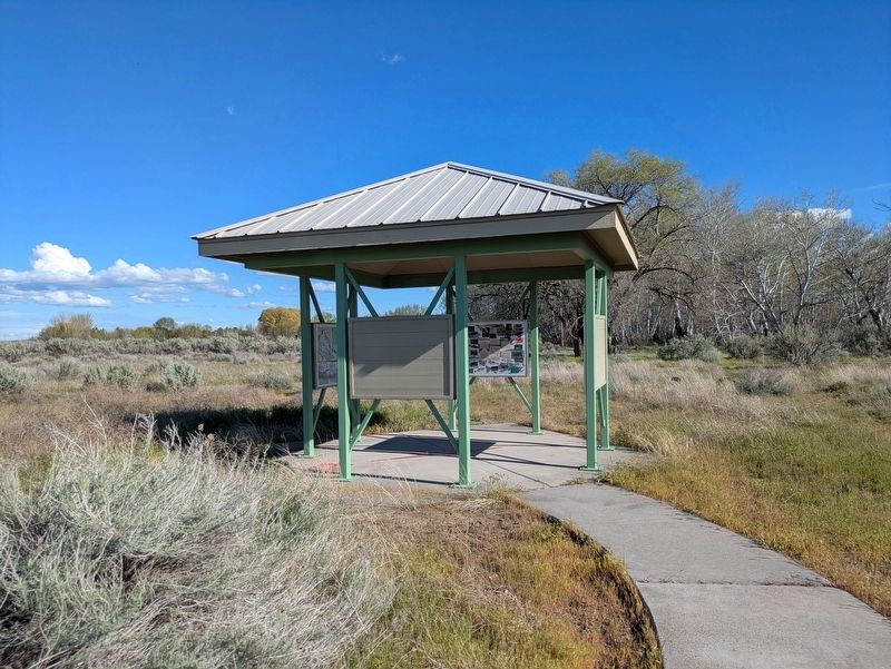
2. Information kiosk in Horn Rapids Park containing this historic marker.
Although there was no fence, only 12 prisoners escaped in 4 years of operation. There were 40 guards stationed here.
Camp Columbia was closed on October 10, 1947. It was used in 1949 to house workers who built the levees along the Columbia River as part of the McNary Dam project. After being abandoned in 1950, the buildings were moved elsewhere or dismantled and the materials reused. All that remains today is a foundation. In 1966, the Camp Columbia site and other lands were transferred to Benton County, becoming Horn Rapids Park.
Topics. This historical marker is listed in these topic lists: Cemeteries & Burial Sites • Law Enforcement • Roads & Vehicles • War, World II. A significant historical year for this entry is 1853.
Location. 46° 22.805′ N, 119° 26.142′ W. Marker is near West Richland, Washington, in Benton County. It can be reached from Washington Route 225 one mile west of Route 240, on the left when traveling south. Located within Horn Rapids County Park. Turn left at the junction after entering the park. Touch for map. Marker is in this post office area: West Richland WA 99353, United States of America. Touch for directions.

Regionally, this marker is in the Columbia Basin and in Yakima Valley. It is also in the American Mountain West and in the Lewis & Clark Corridor. Globally, it is in North America, on the Pacific Rim, in the Western Hemisphere, in the Western World, and in the Anglosphere.
Other nearby markers. At least 8 other markers are within 9 miles of this marker, measured as the crow flies: Vietnam Veterans Memorial (approx. 7 miles away); A River of History (approx. 7½ miles away); The Manhattan Project (approx. 8.2 miles away); USS Triton (SSRN 586) History (approx. 8.2 miles away); First to Circumnavigate the Earth Submerged (approx. 8.2 miles away); USS Triton Specifications (approx. 8.2 miles away); Irrigation in Early Kiona-Benton City (approx. 8.8 miles away); Black Pioneers (approx. 8.8 miles away). Touch for a list and map of all markers in West Richland.
Also see . . .
1. First emigrant wagon train crosses Naches Pass through the Cascade Mountains in the fall of 1853. (Submitted on April 12, 2026, by Clayton Pickett of Richland, Washington.)
2. Camp Columbia (Horn Rapids County Park). (Submitted on April 12, 2026, by Clayton Pickett of Richland, Washington.)
Credits. This page was last revised on April 18, 2026. It was originally submitted on April 12, 2026, by Clayton Pickett of Richland, Washington. This page has been viewed 28 times since then. Photos: 1, 2. submitted on April 12, 2026, by Clayton Pickett of Richland, Washington. • James Hulse was the editor who published this page.
