Near Rincon in Effingham County, Georgia — The American South (South Atlantic)
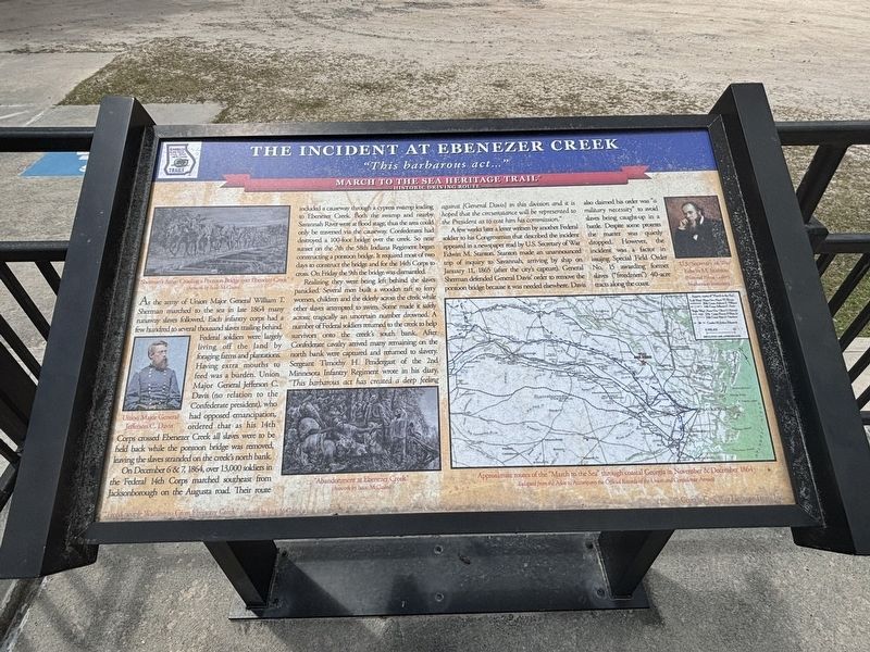
The Incident at Ebenezer Creek
| — | March to the Sea Heritage Trail | — |
Photographed by Mac Lang, April 17, 2026
1. The Incident at Ebenezer Creek Marker
As the army of Union Major General William T. Sherman marched to the sea in late 1864 many runway slaves followed. Each infantry core had a few hundred to several thousand slaves trailing behind. Federal soldiers were largely living off the land by foraging farms and plantations. Having extra mouths to feed was a burden. Union Major General Jefferson C. Davis (no relation to the Confederate president), who had opposed emancipation, ordered that as his 14th Corps crossed Ebeneezer Creek all slaves were to be held back while the pontoon bridge was removed, leaving the slaves stranded on the creek’s north bank. On December 6 & 7, 1864, over 13,000 soldiers in the Federal 14th Corps marched southeast from Jacksonborough on the Augusta road. Their route included a causeway through a cypress swamp leading to Ebeneezer Creek. Both the swamp and nearby Savannah River were at flood stage, thus the area could only be traversed via the causeway. Confederates had destroyed a 100-foot bridge over the creek. So near sunset on the 7th the 58th Indiana Regiment began constructing a pontoon bridge. It required most of two days to construct
this page online
Realizing they were being left behind the slaves panicked. Several men built a wooden raft to ferry, women, children, and the elderly across the creek while other slaves attempted to swim. Some made it safely across; tragically an uncertain number drowned. A number of Federal soldiers returned to the creek to help survivors onto the creek’s south bank. After Confederate cavalry arrived many remaining on the north bank were captured and returned to slavery. Sergeant Timothy H. Pendergast of the 2nd Minnesota Infantry Regiment wrote in his diary, “this barbarous act has created a deep feeling against [General Davis] in this division, and it is hoped that the circumstance will be represented to the President as to cost him his commission.“
A few weeks later a letter written by another federal soldier to his Congressman that described the incident appeared in a newspaper read by U.S. Secretary of war Edward M. Stanton. Stanton made an unannounced trip of inquiry to Savannah, arriving by ship on January 11, 1865 (after the city’s capture). General
Photographed by Mac Lang, April 17, 2026
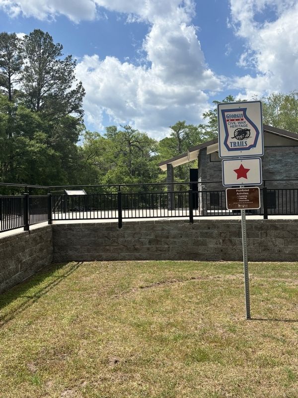
2. The Incident at Ebenezer Creek Georgia Civil War Heritage Trail Marker
Topics. This historical marker is listed in these topic lists: Abolition & Underground RR • African Americans • War, US Civil • Waterways & Vessels. A significant historical date for this entry is January 11, 1865.
Location. 32° 22.784′ N, 81° 12.527′ W. Marker is near Rincon, Georgia, in Effingham County. It is on Tommy Long Road west of High Bluff Road, on the left when traveling west. Touch for map. Marker is at or near this postal address: 158 Tommy Long Rd, Rincon GA 31326, United States of America. Touch for directions.

Regionally, this marker is on the Coastal Plain and in Greater Savannah. It is also in the American South and specifically in the Deep South. Globally, it is in North America, the Western Hemisphere, the Western World, and the Anglosphere. Historically, it finds itself in what was once New Spain, the territory of the Mississippian Culture, one of the original Thirteen Colonies, one of the Confederate States of America, and the Antebellum South.
Other nearby markers. At least 8 other markers are within 2 miles of this marker, measured as the crow flies: The Salzburgers (approx. 1.6 miles away); William Bartram Trail (approx. 1.6 miles away); Old River Road (approx. 1.6 miles away); March to the Sea: Ebenezer Creek (approx. 1.6 miles away); Jerusalem Church Cemetery (approx. 1.6 miles away); Silk Culture at Ebenezer (approx. 1.6 miles away); Site of First Orphanage in Georgia 1738 (approx. 1.6 miles away); The Town of Ebenezer (approx. 1.6 miles away). Touch for a list and map of all markers in Rincon.
Credits. This page was last revised on April 17, 2026. It was originally submitted on April 17, 2026, by Mac Lang of Columbus, Ohio. This page has been viewed 51 times since then. Photos: 1, 2. submitted on April 17, 2026, by Mac Lang of Columbus, Ohio. • Devry Becker Jones was the editor who published this page.
