West Richland in Benton County, Washington — The American West (Northwest)
A River of History

Photographed by Clayton Pickett, April 15, 2026
1. A River of History Marker
The mouth of the Yakima River, known in the native language as Táptat, has been an abundant natural resource for thousands of years, providing food, water and shelter for people and animals.
Bountiful populations of salmon once sustained the people of the village of Čamná on the north bank of the Yakima at its mouth. The people of Čamná and the surrounding area, known as the Čamnapam, were closely related to the Wanapum and Walla Walla people, who all fished along the shores of the rivers here. The confluence of the Yakima and the Columbia Rivers lies within the traditional homeland of the Confederated Tribes of the Umatilla.
Later, as Euro-American settlers came west, the Yakima River provided lush vegetation for their cattle. Steamboats ferried goods up and down the river, and those goods were loaded onto railroads connecting our city to communities across the country. The river’s legacy continues to flow through the city, as seen in the bustling mix of agriculture, industry, and recreation throughout West Richland.
A City Blooms in the Desert
The city’s transformation into a major agricultural area followed
this page online
The new dam filled irrigation canals on both banks of the river, which wheat farmers and cattle ranchers put to good use. They used the canals to create an even larger irrigation network and converted the area's arid shrub-steppe landscape into a commodity.
Today, the Yakima River continues to be the life source for agriculture in the Columbia Basin and nearby Yakima Valley. Abundant irrigation water combined with lots of subshins provides ideal conditions for a variety of crops. Timothy hay, alfalfa, potatoes, and grapes are all grown here, and our region's farmers lead the nation in the production of apples and premium wines.
One City, Two Names
Without a name of its own, early landowners Carl and Vera Heminger made plans for a model city called Heminger City. However, when the vote was cast, residents chose the name of Enterprise. Outraged, the Hemingers founded their city a mile west. Residents of Heminger and Enterprise eventually combined their small towns as West Richland. The city was incorporated June 7, 1955.
Row, Row, Row Your Boat…
Crossing the choppy Yakima River in a rickety rowboat was not the best way to get to school, but it was the only way. In 1896, children attending the Van Horn School put up with this rough commute until one mother, Lena Fallon, petitioned to build a bridge. Soon after, the Fallon Bridge was constructed north of present-day Van Giesen Street.
Topics.
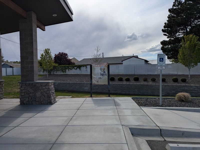
Photographed by Clayton Pickett, April 15, 2026
2. A River of History Marker
Location. 46° 17.803′ N, 119° 20.074′ W. Marker is in West Richland, Washington, in Benton County. It is on West Van Giesen Street (Washington Route 224) 0.1 miles east of South 35th Avenue, on the right when traveling east. Touch for map. Marker is at or near this postal address: 3525 W Van Giesen St, West Richland WA 99353, United States of America. Touch for directions.

Regionally, this marker is in the Columbia Basin and in Yakima Valley. It is also in the American Mountain West and in the Lewis & Clark Corridor. Globally, it is in North America, on the Pacific Rim, in the Western Hemisphere, in the Western World, and in the Anglosphere.
Other nearby markers. At least 8 other markers are within 4 miles of this marker, measured as the crow flies: Vietnam Veterans Memorial (approx. 0.7 miles away); VFW Post 7952 Vietnam Veterans Memorial (approx. 1½ miles away); In Honor of Central United Protestant Church (2016) (approx. 2.6 miles away); Col. Thomas William Symons (approx. 2.7 miles away); F.A. Friermood House (approx. 3.3 miles away); Historic Amon Park Arch (approx. 3.3 miles away); The Columbia River (approx. 3.4 miles away); The City of Richland (approx. 3.4 miles away).
Credits. This page was last revised on April 18, 2026. It was originally submitted on April 18, 2026, by Clayton Pickett of Richland, Washington. This page has been viewed 16 times since then. Photos: 1, 2. submitted on April 18, 2026, by Clayton Pickett of Richland, Washington. • James Hulse was the editor who published this page.
