
Yorktown in York County, Virginia — The American South (Mid-Atlantic)
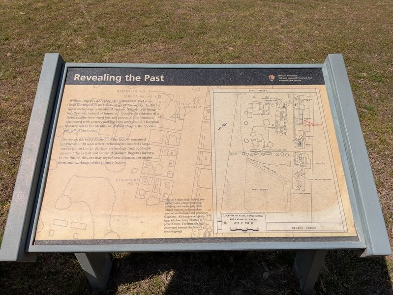
Revealing the Past
Historic Yorktown
| — | Colonial National Historical Park | — |
Photographed by Evan Dwyer, April 11, 2026
1. Revealing the Past Marker
However, the exact location of the factory remained unknown until 1966 when archaeologists located a large waster pit on Lot 51. Further archeology from 1966-1981 revealed the extent and scope of William Rogers's factory. In the future, this site may reveal new information on the form and workings of the pottery factory.
(caption) The site's major finds include two pottery kilns, a large workshop complex, two waster pits, other related features, and more than 300,000 earthenware and stoneware fragments. All features except the large kiln have been reburied to protect them. The large kiln was discovered beneath the floor of a modern garage.
Erected by National Park Service, U.S. Department
this page online
Topics. This historical marker is listed in these topic lists: Anthropology & Archaeology • Colonial Era • Industry & Commerce. A significant historical year for this entry is 1966.
Location. 37° 14.013′ N, 76° 30.511′ W. Marker is in Yorktown, Virginia, in York County. It is on Read Street 0.1 miles south of Main Street, on the left when traveling south. Touch for map. Marker is at or near this postal address: 221 Read Street, Yorktown VA 23690, United States of America. Touch for directions.

Regionally, this marker is on Virginia’s Peninsula, in Coastal Virginia, and in the Hampton Roads Metropolitan Area. It is also in the American South, specifically in the Upper South, in the Tidewater, and on the Eastern Seaboard. Globally, it is in the North Atlantic Region, North America, the Western Hemisphere, the Western World, and the Anglosphere. Historically, it finds itself in what was once the territory of the Mississippian Culture, one of the original Thirteen Colonies, one of the Confederate States of America, and the Antebellum South.
Other nearby markers. At least 8 other markers are within
Photographed by Evan Dwyer, April 11, 2026
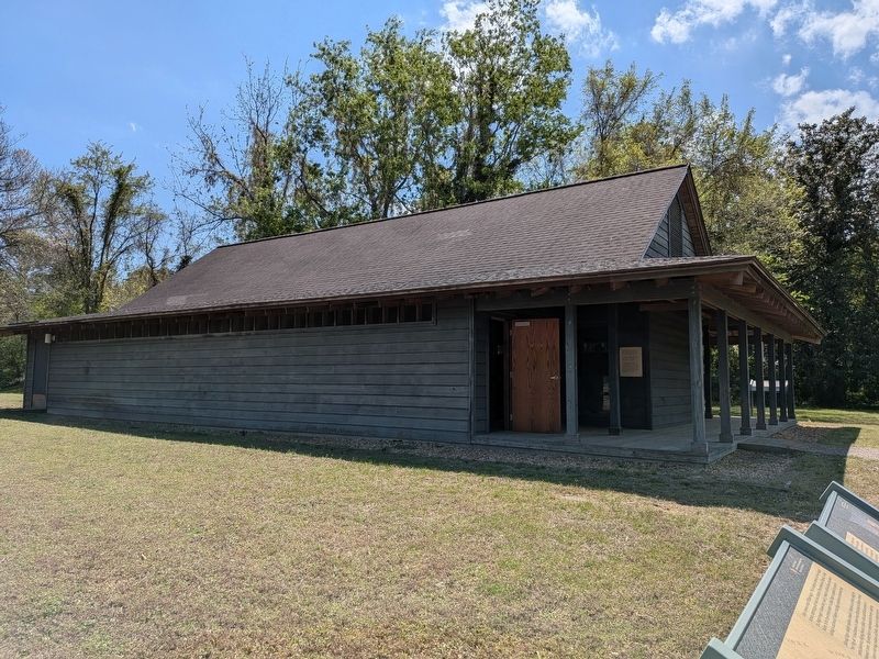
2. Large Kiln Enclosure
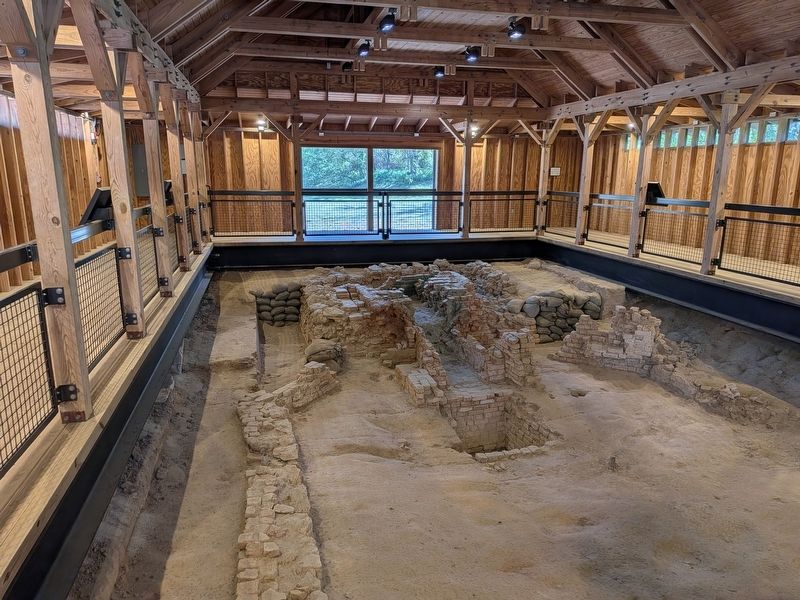
The kiln ruins left excavated are within this enclosure. The marker is off to the right on the sidewalk. The complex described in the marker extend both to the right (front of the building) and behind it towards Nelson Street.
Photographed by Evan Dwyer, April 11, 2026
3. Pottery Factory Kiln Ruins
Inside the NPS protective shed.
Credits. This page was last revised on May 6, 2026. It was originally submitted on April 18, 2026, by Evan Dwyer of Richmond, Virginia. This page has been viewed 16 times since then. Photos: 1, 2, 3. submitted on April 18, 2026, by Evan Dwyer of Richmond, Virginia. • Bernard Fisher was the editor who published this page.
