D Street / West Broadway in Boston in Suffolk County, Massachusetts — The American Northeast (New England)
From Paradise to Prison
South Boston
Photographed by Conrad Ward, November 17, 2024
1. From Paradise to Prison Marker
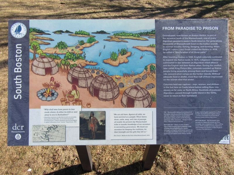
Quonehassit, now known as Boston Harbor, is part of the ancestral lands of the Massachusett, one of many Algonkian peoples in eastern North America. For generations, thousands of Massachusett lived on the harbor islands in warmer months, fishing, foraging, and farming. When English captain John Smith visited the Harbor in 1614, he called it "the Paradise of all those parts."
After founding Boston in 1630, English colonists continued to expand into Native lands. In 1675, indigenous resistance culminated in war between an Algonkian tribal alliance and the English and their Native allies. During the conflict, later called King Philip's War, colonists rounded up Native people living peacefully among them and forced them into concentration camps on the harbor islands. Without adequate food or shelter, more than half of those imprisoned on the islands died that winter.
Colonists held war captives — men, women, and children — in the fort here on Castle Island before selling them into slavery as far away as North Africa. Hundreds of enslaved Algonkians passed through Castle Island in the 1670s, never to return to their
this page online
"Why shall wee have peace to bee made slaves, & either be kild or sent away to sea to Barbadoes?"
- Algonkian warriors on why they would not surrender during King Philip's War, as recounted by James Quannapaquait, a Native emissary sent by the English to gather information from "enemy" Algonkians, 1676
"We are all here. Against all odds, we have survived as a people. Ritual dance drum, rattle, song, and rites of passage all enable the present day Massachusett tribe to transfer knowledge of our ancestors to succeeding generations. We thank our ancestors for keeping the traditions, for their foresight and the gifts they left us."
-Ren Green, Medicine Sac'hem of the Massachusett, 2018
[Captions:]
The bountiful tideland environment of the harbor islands provided the Massachusett with fish, shellfish, berries, wood splints for basket-making, fertile soil for farming, and many other resources. ~ Painting by Robert Peters, a Mashpee Wampanoag artist
Detail of John Smith's map of New England (first published 1616) showing Quonehassit/Boston Harbor. Although no English settlements existed yet, Smith depicted Native towns with European buildings and asked Crown Prince Charles to give them English names in an effort to claim the land as an English colony. ~ Courtesy of the Norman B. Leventhal Map & Education Center at Boston Public Library
This European-style portrait of a Native American sac'hem, or leader, was completed ca. 1700, making it one of the earliest surviving depictions of an indigenous person in New England. ~ Courtesy of the RISD Museum
Erected by Boston
Photographed by Conrad Ward, November 17, 2024
2. From Paradise to Prison Marker
Topics and series. This memorial is listed in these topic lists: Colonial Era • Indigenous Peoples and Communities • Wars, US Indian. In addition, it is included in the King Philip's War 1675-1676 series list. A significant historical year for this entry is 1614.
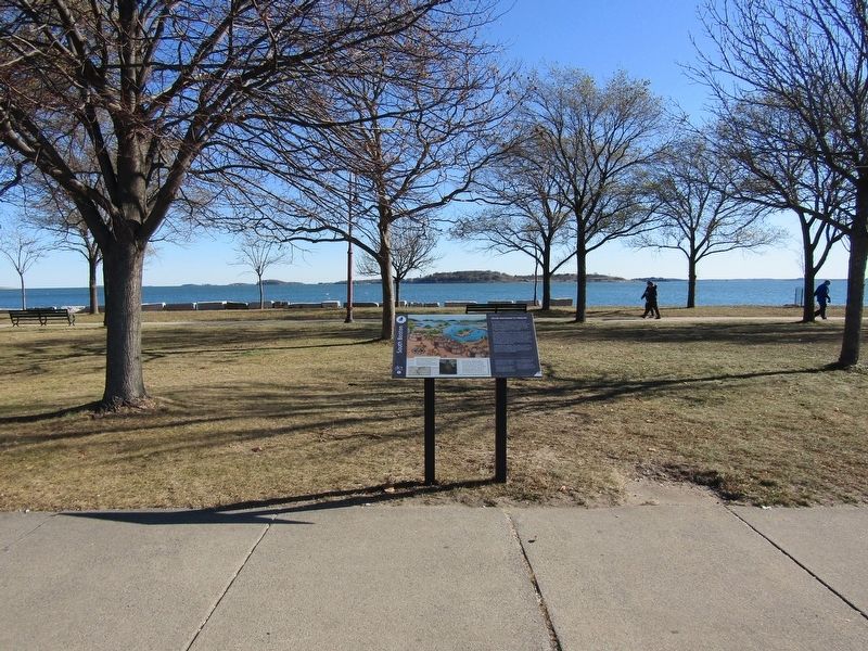
Location. 42° 20.141′ N, 71° 0.73′ W. Memorial is in Boston, Massachusetts, in Suffolk County. It is in D Street / West Broadway. It can be reached from Head Island Causeway south of Harborwalk, on the right when traveling south. The marker stands on Castle Island. Touch for map. Memorial is at or near this postal address: 2010 Head Island Causeway, South Boston MA 02127, United States of America. Touch for directions.

Regionally, this memorial is in Massachusetts’ Historic Boston. It is also in the American Northeast, in New England, and on the Eastern Seaboard. Globally, it is in the North Atlantic Region, North America, the Western Hemisphere, the Western World, and the Anglosphere. Historically, it finds itself in what was once one of the original Thirteen Colonies.
Other nearby markers. At least 8 other markers are within walking distance of this marker: Bob Greene the Firefighter... (about 600 feet away, measured in a direct line); Harbor Mines Explosion (about 700 feet away); Many Forts, Many Uses (about 800 feet away); South Boston Korean War Memorial (approx. 0.2 miles away); Harbor of Shame No More (approx. 0.2 miles away); Creating Pleasure Bay (approx. 0.2 miles away); Donald McKay Monument (approx. ¼ mile away); John E. Powers (approx. 0.6 miles away). Touch for a list and map of all markers in Boston.
More about this memorial. The year of erection was between 2021 & 2023
Credits. This page was last revised on April 19, 2026. It was originally submitted on April 26, 2025, by Conrad Ward of Guilford, Connecticut. This page has been viewed 192 times since then and 51 times this year. Last updated on April 19, 2026, by G.W.Bartlett of Hingham, Massachusetts. Photos: 1, 2. submitted on April 26, 2025, by Conrad Ward of Guilford, Connecticut. • Devry Becker Jones was the editor who published this page.
