Anacostia Park in Southeast Washington in Washington, District of Columbia — The American Northeast (Mid-Atlantic)
The First People of Anacostia
Anacostia Park
| — | National Park Service, U.S. Department of the Interior | — |
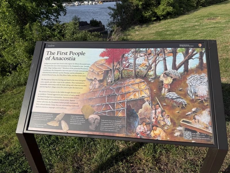
Indigenous people have lived in this region for fifteen thousand years. This particular area is the homeland of the Anaquash-a-tan, "people of the village trading center." Members of the powerful Piscataway Confederacy, the Anaquash-a-tan were part of a trade network that stretched from tidewater up the Potomac and its tributaries, to western Pennsylvania, the Ohio River Valley, and the Great Lakes.
The Piscataway fished for herring and shad in the rivers and grew corn, squash, and other crops in the uplands. They maintained a sustainable relationship with the land, taking only what was needed, and moving their villages every five years to give the land a rest.
The arrival of Europeans in the 1600s brought diseases such as smallpox. Colonial aggression and seizure of native lands decimated Indigenous communities. Survivors were driven from their lands and resettled in remote areas. Against intense adversity, the Piscataway Indian people maintained their cultural identity. Today they are rejuvenating traditional land practices, languages, and traditions.
[Captions:]
Archaeological discoveries along the Potomac River help us understand the technologies that local Indigenous people used in everyday life.
Flaked tools from 3,000 to 5,000 years ago.
Pottery fragment from 2,300 to 2,900 years ago. The texture was created by striking the wet clay with a cord-wrapped paddle.
Trade goods among the Piscataway Confederacy tribes included shark teeth, wampum beads, shell gorgets, and soapstone bowls and pipes. This gorget (neck ornament) is carved from a whelk (sea snail) shell.
Erected by National
this page online
Topics. This historical marker is listed in these topic lists: Anthropology & Archaeology • Colonial Era • Indigenous Peoples and Communities • Settlements & Settlers.
Location. 38° 52.573′ N, 76° 58.553′ W. Marker is in Southeast Washington in Washington, District of Columbia. It is in Anacostia Park. It is on Anacostia Riverwalk Trail Southeast east of Nicholson Street Southeast, on the left when traveling east. Touch for map. Marker is at or near this postal address: 8825 Anacostia Riverwalk Trl, Washington DC 20020, United States of America. Touch for directions.

Regionally, this marker is in the Washington Metropolitan Area. It is also in the American Northeast, in the Upper South, in the Mid-Atlantic, in the Tidewater, and in the Chesapeake Bay Region. Globally, it is in North America, the Western Hemisphere, the Western World, and the Anglosphere.
Other nearby markers. At least 8 other markers are within walking distance of this marker: Bridge to the Heart of Washington (about 300 feet away, measured

Credits. This page was last revised on April 19, 2026. It was originally submitted on April 19, 2026, by Devry Becker Jones of Washington, District of Columbia. This page has been viewed 18 times since then. Photos: 1, 2. submitted on April 19, 2026, by Devry Becker Jones of Washington, District of Columbia.
