East Dover Hundred in Kent County, Delaware — The American Northeast (Mid-Atlantic)
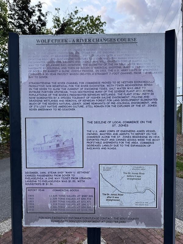
Wolf Creek - A River Changes Course
Photographed by Pete Skillman, April 24, 2026
1. Wolf Creek - A River Changes Course Marker
Straightening the river channel for commerece proved to be neither economically productive nor beneficial for the river ecosystem. With fewer meandering bends in the river to slow the current of incoming tides, salt water was able to intrude further upstream, thus destroying many of the diverse plant and animal populations of the river's freshwater riparian wetlands. The plant community is now dominated
this page online
The Decline of Local Commerce on the St. Jones
The U.S. Army Corps of Engineers asked vessel owners, masters and agents to report on the commerce along the St. Jones beginning in 1914. Exported fruit and canned goods were the most profitable shipments for the area. Commerce decreased largely due to the expansion of railways and roads.
December, 1896. Steam ship "Mary U. Githens" carried passengers from Dover to Philadelphia. A one way ticket from Lebanon Landing to Philadelphia was $1.00, with roundtrips @ $1.50.
| Report Year | | Commercial Goods |
| 1915 | 11,825 tons valued at $587,926 |
| 1922 | 2,229 tons valued at $59,719 |
| 1923 | 2,597 tons valued at $73,471 |
| 1924 | 3,319 tons valued at $94,117 |
| 1929 | 2,360 tons valued at $54,562 |
| 1932 | 2,635 tons valued at $104,754 |
For non-emergency information please
Photographed by Pete Skillman, April 24, 2026
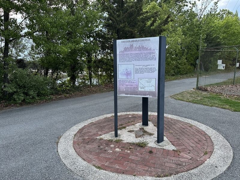
2. Wolf Creek - A River Changes Course Marker - wide view
Topics. This historical marker is listed in these topic lists: Environment • Indigenous Peoples and Communities • Industry & Commerce • Waterways & Vessels. A significant historical year for this entry is 1933.
Location. 39° 7.753′ N, 75° 29.769′ W. Marker is in Dover, Delaware, in Kent County. It is in East Dover Hundred. It is on East Lebanon Road, on the right when traveling south. Touch for map. Marker is at or near this postal address: 1681 E Lebanon Rd, Dover DE 19901, United States of America. Touch for directions.

Regionally, this marker is in the American Mid-Atlantic, on the Delmarva Peninsula, and on the Eastern Seaboard. Globally, it is in the North Atlantic Region, North America, the Western Hemisphere, the Western World, and the Anglosphere. Historically, it finds itself in what was once New Netherland, one of the original Thirteen Colonies, and the Antebellum South.
Other nearby markers. At least 8 other markers are within 2 miles of this marker, measured as the crow flies: St. Jones River Wildlife and Habitats (here, next to this marker); St. Jones River Wild Life and Habitats (approx. 0.6 miles away); Fish Resources and Water Quality of the St. Jones River (approx. 0.6 miles away); September 11, 2001 Memorial (approx. 1.3 miles away); American Legion Veterans Memorial (approx. 1.3 miles away); Kent County Theatre Guild (approx. 1.4 miles away); Dover (approx. 1.6 miles away); East Dover Hundred (approx. 2 miles away). Touch for a list and map of all markers in Dover.
Credits. This page was last revised on May 15, 2026. It was originally submitted on April 24, 2026, by Pete Skillman of Wilmington, Delaware. This page has been viewed 19 times since then. Photos: 1, 2. submitted on April 24, 2026, by Pete Skillman of Wilmington, Delaware.
