
Near Moneta in Bedford County, Virginia — The American South (Mid-Atlantic)
Bedford County
Area 791 square miles
⎯⎯⎯
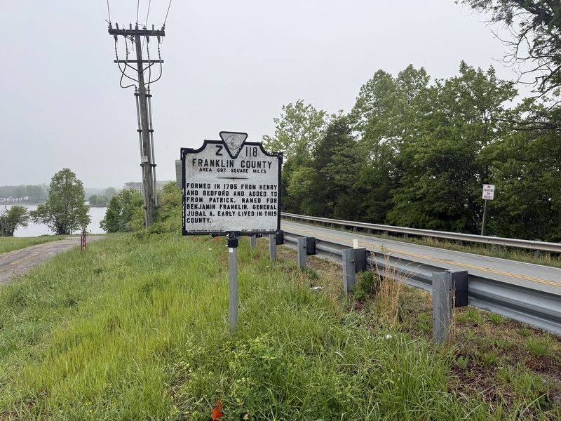
Franklin County
Area 697 square miles

Bedford County Area 791 square miles. Formed in 1753 from Lunenburg and Albemarle, and named for the fourth Duke of Bedford, English statesman. The Peaks of Otter are in this county.
Franklin County Area 697 square miles. Formed in 1785 from Henry and Bedford and added to from Patrick. Named for Benjamin Franklin. General Jubal A. Early lived in this county.
Erected 1929 by Conservation & Development Commission. (Marker Number Z-118.)
Topics and series. This historical marker is listed in these topic lists: Colonial Era • Natural Features • Political Subdivisions • War, US Civil. In addition, it is included in the Virginia Department of Historic Resources (DHR) series list. A significant historical year for this entry is 1753.
Location. 37° 8.812′ N, 79° 39.827′ W. Marker is near Moneta, Virginia, in Bedford County. It is on Moneta Road (Virginia Route 122) south of Waterwheel Drive, on the right when traveling north. Touch for map. Marker is at or near this postal address: 16869 Moneta Rd, Moneta VA 24121, United States of America. Touch for directions.

Regionally, this marker is in Southwest Virginia.
this page online
Other nearby markers. At least 8 other markers are within 5 miles of this marker, measured as the crow flies: Smith Mountain Lake: Franklin County (approx. 0.4 miles away); Booker T. Washington Birthplace (approx. 4.1 miles away); Booker's Lifelong Love of Animals (approx. 4.1 miles away); Animals for Food and Farm Work (approx. 4.1 miles away); Slavery in the Tobacco Kingdom (approx. 4.2 miles away); Booker T. Washington's Birthplace (approx. 4.2 miles away); The Day of Freedom (approx. 4.2 miles away); Plantation Trail (approx. 4.2 miles away).
Other markers no longer nearby. Freed Here, At Last (was approx. 4.2 miles away but has been replaced with another marker now near it); How Tobacco Farms Used Slavery (was approx. 4.2 miles away but has been


Credits. This page was last revised on April 29, 2026. It was originally submitted on April 29, 2026, by Devry Becker Jones of Washington, District of Columbia. This page has been viewed 11 times since then. Photos: 1, 2, 3, 4. submitted on April 29, 2026, by Devry Becker Jones of Washington, District of Columbia.
