
Trade in Johnson County, Tennessee — The American South (East South Central)
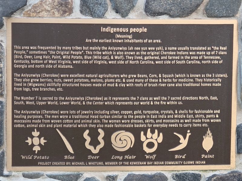
Indigenous People
(Meaning)
Are the earliest known inhabitants of an area
Photographed by Mark Parker, April 28, 2026
1. Indigenous People Marker
This area was frequented by many tribes but mainly the Aniyunwiya (ah nee yun wee yah), a name usually translated as "the Real People," sometimes "the Original People". This tribe which is also known as the original Cherokee Indians was made up of 7 clans (Bird, Deer, Long Hair, Paint, Wild Potato, Blue (Wild cat), & Wolf). They lived, gathered, and farmed in the area of Tennessee, Kentucky, bottom of West Virginia, west side of Virginia, west side of North Carolina, west side of South Carolina, north side of Georgia and north side of Alabama.
The Aniyunwiya (Cherokee) were excellent natural agriculturers who grew Beans, Corn, & Squash (which is known as the 3 sisters). They also grew berries, nuts, sweet potatoes, melons, plums etc. & used many of these & herbs for medicine. They historically lived in (Wigwams) skillfully structured houses made of mud & clay with roofs of brush river cane also traditional homes made from logs, tree branches, etc.
The Number 7 is sacred to the Aniyunwiya (Cherokee) as it represents the 7 clans as well the 7 sacred directions North, East, South, West, Upper World, Lower World, &
this page online
The Aniyunwiya (Cherokee) wore lots of jewelry including silver, copper, gold, turquoise, crystals, & shells for fashionable and healing purposes. The men wore a traditional Head turban similar to the people in East India and Middle East, shirts, pants & moccasins made from woven cotton and animal skin. The women wore dresses, skirts, and moccasins as well made from woven cotton, animal skin and plant material which they also made fashionable baskets for everyday needs to carry items etc.
Erected by Michael L Whetung, member of the Keweenaw Bay Indian Community Ojibwe Indian.
Topics. This historical marker is listed in these topic lists: Agriculture • Anthropology & Archaeology • Indigenous Peoples and Communities • Settlements & Settlers.
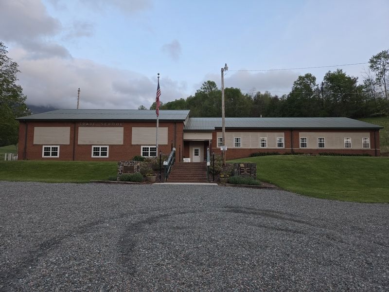
Location. 36° 20.846′ N, 81° 44.467′ W. Marker is in Trade, Tennessee, in Johnson County. It can be reached from Modock Road east of U.S. 421, on the right when traveling east. Location of the marker is the left of the the front steps at Trade Elementary School. Touch for map.
Photographed by Mark Parker, April 28, 2026
2. Wide view Trade Elementary School. Indigenous People Marker is left of the steps

Regionally, this marker is in East Tennessee. It is also in the American South, specifically in the Upper South, in Appalachia, and specifically in Southern Appalachia. Globally, it is in North America, the Western Hemisphere, the Western World, and the Anglosphere. Historically, it finds itself in what was once the original Cherokee Nation, the territory of the Mississippian Culture, one of the Confederate States of America, the State of Franklin, and the Antebellum South.
Other nearby markers. At least 8 other markers are within 9 miles of this marker, measured as the crow flies: Daniel Boone's Trail (here, next to this marker); The Trading Ground (approx. 0.2 miles away); Camp Mast (approx. 6.3 miles away in North Carolina); Cove Creek High School (approx. 6.3 miles away in North Carolina); Military Veterans of Western Watauga County (approx. 6.3 miles away in North Carolina); Maymead Stock Farm (approx. 7 miles away); John Smith Miller House (approx. 7.1 miles away in North Carolina); Elkland Depot
Photographed by Mark Parker, April 28, 2026
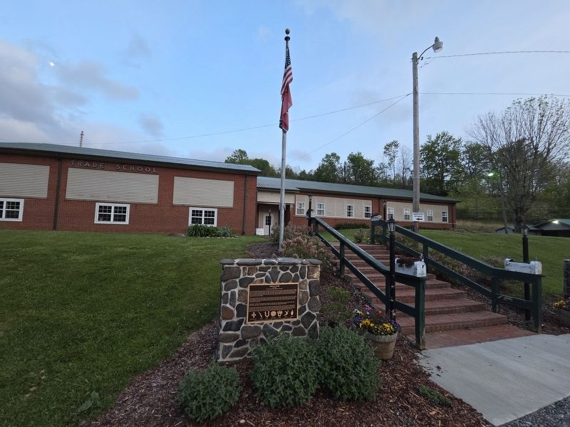
3. Indigenous People Marker at the steps to Trade Elementary School
Credits. This page was last revised on April 30, 2026. It was originally submitted on April 30, 2026, by Mark Parker of Hickory, North Carolina. This page has been viewed 12 times since then. Photos: 1, 2, 3. submitted on April 30, 2026, by Mark Parker of Hickory, North Carolina. • Devry Becker Jones was the editor who published this page.
