
East Dover Hundred in Kent County, Delaware — The American Northeast (Mid-Atlantic)
St. Jones River Wild Life and Habitats
Photographed by Pete Skillman, May 8, 2026
1. St. Jones River Wild Life and Habitats Marker
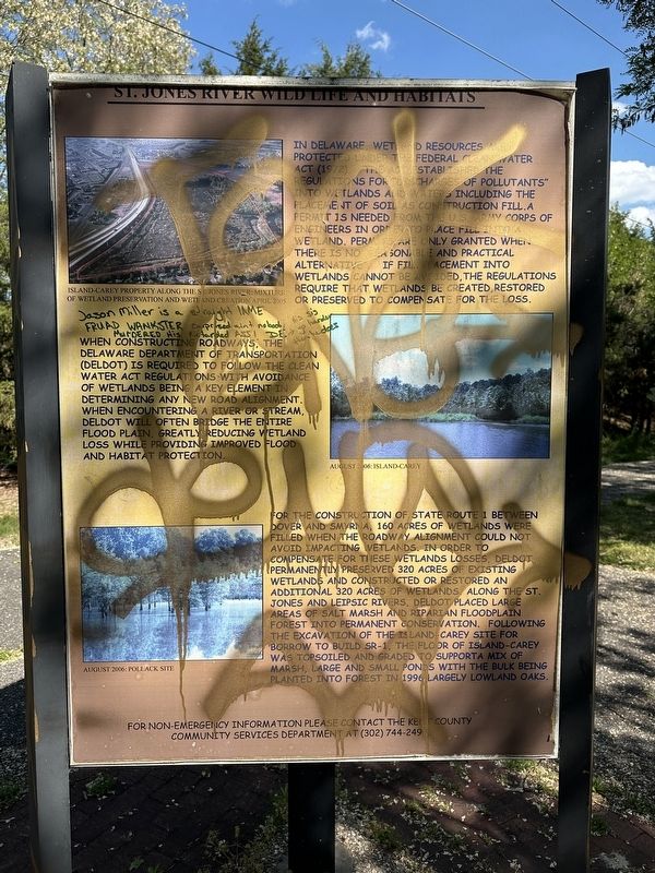
In Delaware, wetland resources are protected under the Federal Clean Water Act (1972). The act established the regulations for "discharges of pollutants" into wetlands and waters including the placement of soil as construction fill. A permit is needed from the U.S. Army Corps of Engineers in order to place fill into a wetland. Permits are only granted when there is no reasonable and practical alternative. If fill placement into wetlands cannot be avoided, the regulations require that wetlands be created, restored or preserved to compensate for the loss.
When constructing roadways, the Delaware Department of Transportation (DelDOT) is required to follow the Clean Water Act regulations with avoidance of wetlands being a key element in determining any new road alignment. When encountering a river or stream, DelDOT will often bridge the entire flood plain, greatly reducing wetland loss while providing improved flood and habitat protection.
For the construction of State Route 1 between Dover and Smyrna, 160 acres of wetlands were filled when the roadway alignment could not avoid impacting wetlands. In order to compensate
this page online
For non-emergency information please contact the Kent County Community Services Department at (302) 744-2490.
[Captions]:
Island-Carey property along the St. Jones River: mixture of wetland preservation and wetland creation April 2005
August 2006: Island-Carey
August 2006: Pollack Site
Topics. This historical marker is listed in these topic lists: Environment • Horticulture & Forestry • Roads & Vehicles • Waterways & Vessels. A significant historical year for this entry is 1996.
Location. 39° 8.274′ N, 75° 29.934′ W. Marker has been damaged. Marker is in Dover, Delaware, in Kent

Photographed by Pete Skillman, May 8, 2026
2. St. Jones River Wild Life and Habitats Marker - wide view

Regionally, this marker is in the American Mid-Atlantic, on the Delmarva Peninsula, and on the Eastern Seaboard. Globally, it is in the North Atlantic Region, North America, the Western Hemisphere, the Western World, and the Anglosphere. Historically, it finds itself in what was once New Netherland, one of the original Thirteen Colonies, and the Antebellum South.
Other nearby markers. At least 8 other markers are within 2 miles of this location, measured as the crow flies: Fish Resources and Water Quality of the St. Jones River (here, next to this marker); St. Jones River Wildlife and Habitats (approx. 0.6 miles away); Wolf Creek - A River Changes Course (approx. 0.6 miles away); September 11, 2001 Memorial (approx. 0.6 miles away); American Legion Veterans Memorial (approx. 0.7 miles away); Kent County Theatre Guild (approx. one mile away); Dover (approx. 1.3 miles away); Bell UH-1 Iroquois Helicopter (approx. 1.4 miles away). Touch for a list and map of all markers in Dover.
More about this marker. The marker has been damaged by graffiti. It is located along the St. Jones Greenway Trail.
Credits. This page was last revised on May 15, 2026. It was originally submitted on May 8, 2026, by Pete Skillman of Wilmington, Delaware. This page has been viewed 18 times since then. Photos: 1, 2. submitted on May 8, 2026, by Pete Skillman of Wilmington, Delaware.
