Mount Pleasant in Brant in Brant County, Ontario — Central Canada (North America)
Dr. Augusta Stowe Gullen
1857-1943
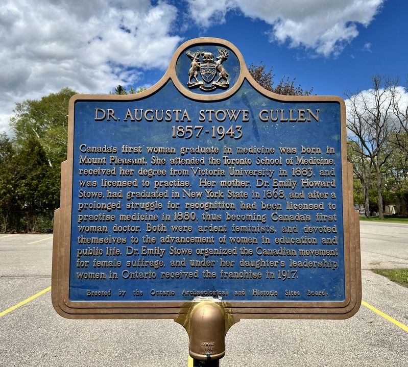
Photographed by Tim Boyd, May 10, 2026
1. Dr. Augusta Stowe Gullen Marker
Topics and series. This historical marker is listed in these topic lists: Civil Rights • Science & Medicine • Women. In addition, it is included in the Canada, Ontario Heritage Trust series list. A significant historical year for this entry is 1880.
Location. 43° 4.924′ N, 80° 18.733′ W. Marker is in Brant, Ontario, in Brant County. It is in Mount Pleasant. It is on Mount Pleasant Road 0.2 kilometers south of Ellis Avenue, on the right when traveling
this page online

Regionally, this marker is in the Hamilton-Halton-Brant Area and in Southwestern Ontario. It is also in Central Canada. Globally, it is in North America, the Western Hemisphere, the Western World, and the Anglosphere. Historically, it finds itself in what was once a British colony, the Viceroyalty of New France, the Haudenosaunee (Iroquois) Confederacy, and Rupert’s Land.
Other nearby markers. At least 8 other markers are within 8 kilometers of this marker, measured as the crow flies: Canada’s First Telephone Business Office 1877 (approx. 4.4 kilometers away); The Bell Homestead/ La Propriété Bell (approx. 4.4 kilometers away); The Invention of the Telephone/ L’Invention du Téléphone (approx. 4.4 kilometers away); The Battle of Malcolm’s Mills (approx. 5.8 kilometers away); Heritage in Water (approx. 7 kilometers away); The Original Six Nations Land Grant (approx. 7 kilometers away); The Cenotaph (approx. 7.3 kilometers away); Polish World War II Veterans Memorial (approx. 7.3 kilometers

Photographed by Tim Boyd, May 10, 2026
2. Dr. Augusta Stowe Gullen Marker
Facing south on Mt. Pleasant Road

circa 1880s
3. Dr. Augusta Stowe Gullen ca 1880s
The Canadian Encyclopedia (public domain)

circa 1890
4. Dr. Emily Stowe, ca 1890
Parks Canada (public domain)
Credits. This page was last revised on May 13, 2026. It was originally submitted on May 13, 2026, by Tim Boyd of Hamilton, Ontario. This page has been viewed 19 times since then. Photos: 1, 2, 3, 4. submitted on May 13, 2026, by Tim Boyd of Hamilton, Ontario. • Andrew Ruppenstein was the editor who published this page.
