Near Thurmont in Frederick County, Maryland — The American Northeast (Mid-Atlantic)
Roads to Gettysburg
Catoctin Mountain in the Gettysburg Campaign
| — | Gettysburg Campaign | — |
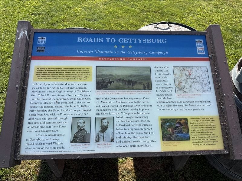
After Confederate Gen. Robert E. Lee's stunning victory at Chancellorsville in May 1863, he led the Army of Northern Virginia west to the Shenandoah Valley, then north through central Maryland and across the Mason-Dixon Line into Pennsylvania. Union Gen. George G. Meade, who replaced Gen. Joseph Hooker on June 28, led the Army of the Potomac in pursuit. Confederate cavalry commander Gen. J.E.B. Stuart cut Federal communications and rail lines and captured supplies. The armies collided at Gettysburg on July 1, starting a battle that neither general planned to fight there. Three days later, the defeated Confederates retreated, crossing the Potomac River into Virginia on July 14.
In front of you is Catoctin Mountain, a strategic obstacle during the Gettysburg Campaign. Moving north from Virginia, most of Confederate Gen. Robert E. Lee's Army of Northern Virginia marched west of the mountain, while Union Gen. George G. Meade's army remained to the east to protect the national capital. On June 29, 1863, a rainy Monday, the Union I and XI Corps tramped north from Frederick to Emmitsburg along parallel roads that passed through
this page online
After the bloody battle at Gettysburg, each army moved south toward Virginia along many of the same roads. Most of the Confederate infantry crossed Catoctin Mountain at Monterey Pass, to the north, and headed toward the Potomac River fords near Williamsport with the Union cavalry in pursuit. The Union I, III, and V Corps marched unmolested through Emmitsburg and Mechanicstown, then on to Frederick for fresh supplies before turning west in pursuit of Lee. Like the rest of the Federal infantry, the corps traveled different roads through this area, once again marching in the rain. Confederate Gen. J.E.B. Stuart's cavalry also passed this way on July 5 as he protected Lee's left flank. Stuart paused near Mechanicstown and then rode northwest over the mountain to rejoin the army. For Mechanicstown and the surrounding area, the war passed on.
[Sidebar:]
Less than half a mile from here, to your right as you exit on Roddy Road, is an artifact of the war. The Roddy Road Covered Bridge, completed by 1856, somehow survived even as the armies burned many other bridges. Perhaps because neither army was pursued or threatened with imminent attack here, both the Confederates and the Federals who passed this way left the bridge alone.
Erected by Maryland
Topics and series. This historical marker is listed in these topic lists: Bridges & Viaducts • Natural Features • Roads & Vehicles • War, US Civil. In addition, it is included in the Covered Bridges, and the Maryland Civil War Trails series lists. A significant historical date for this entry is June 29, 1863.
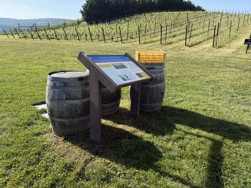
Location. 39° 38.73′ N, 77° 23.446′ W. Marker is near Thurmont, Maryland, in Frederick County. It is on Roddy Road half a mile north of Roddy Creek Road, on the left. Touch for map. Marker is at or near this postal address: 15010 Putman Rd, Thurmont MD 21788, United States of America. Touch for directions.

Regionally, this marker is in the Washington Metropolitan Area and in Central Maryland. It is also in the American Mid-Atlantic. Globally, it is in North America, the Western Hemisphere, the Western World, and the Anglosphere. Historically, it finds itself in what was once one of the original Thirteen Colonies and also the Antebellum South.
Other nearby markers. At least 8 other markers are within 2 miles of this marker, measured as the crow flies: To the Unknown Dead (approx. 1.8 miles away); Historic Buildings—Past and Present (approx. 1.8 miles away); Thurmont Rail History — The End of an Era (approx. 1.8 miles away); Thurmont Attractions (approx. 1.8 miles away); Creeger House (approx. 1.8 miles away); A Walk Along the Trolley Trail (approx. 1.8 miles away); Welcome to The Thurmont Trolley Trail! (approx. 1.8 miles away); History of the Trolley Trail (approx. 1.8 miles away). Touch for a list and map of all markers in Thurmont.
Credits. This page was last revised on May 18, 2026. It was originally submitted on May 18, 2026, by Devry Becker Jones of Washington, District of Columbia. This page has been viewed 38 times since then. Photos: 1, 2. submitted on May 18, 2026, by Devry Becker Jones of Washington, District of Columbia.
Editor’s want-list for this marker. A photo of the Roddy Road Covered Bridge. • A photo of the mountain. • Can you help?
