Near Rogers in Benton County, Arkansas — The American South (West South Central)
Cross Hollows
Photographed by Lee Hattabaugh, September 15, 2013
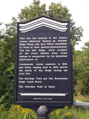
1. Cross Hollows Marker
This site was donated to the Benton County Historical Society by Scarlett Biggs Wilson and Lara Wilson Rosenblum in honor of their parents/grandparents, Guy and Nell Biggs, early pioneers of the Cross Hollows area. Cross Hollows is recognized for its historical significance of:
Confederate winter quarters in 1861, and Union staging area in 1862 before the Battle of Pea Ridge during the Civil War
The Heritage Trail and the Butterfield Stage Coach Route
The Cherokee Trail of Tears
Erected 2007 by The Benton County Historical Society.
Topics and series. This historical marker is listed in these topic lists: Indigenous Peoples and Communities • Roads & Vehicles • Settlements & Settlers • War, US Civil. In addition, it is included in the Butterfield Overland Mail series list. A significant historical year for this entry is 1861.
Location. 36° 16.866′ N, 94° 6.816′ W. Marker is near Rogers, Arkansas, in Benton County. It is on South Old Wire Road (County Road 83) 0.2 miles north of Dogwood Drive/Cross Hollows Road (County Road 1189), on the left when traveling north. Marker is located immediately
this page online

Regionally, this marker is in Northwest Arkansas, on the Ozark Plateau, in the Cherokee Heritage Region, and in Osage Territory. It is also in the American South, specifically in the Upper South, and in the Ozarks. Globally, it is in North America, the Western Hemisphere, the Western World, and the Anglosphere. Historically, it finds itself in what was once the territory of the Mississippian Culture, the Louisiana Purchase, one of the Confederate States of America, and the Antebellum South.
Other nearby markers. At least 8 other markers are within 2 miles of this marker, measured as the crow flies: A different marker also named Cross Hollows (here, next to this marker); First Baptist Church (approx. 1.9 miles away); Mudtown (approx. 1.9 miles away); The Lowell Historical Museum (approx. 1.9 miles away); Service Station and Garage (approx. 1.9 miles away); Original Site of Bloomington (Mudtown) Arkansas
Photographed by Lee Hattabaugh, September 15, 2013
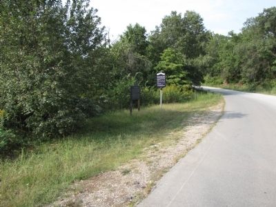
2. Cross Hollows Marker
looking north along Old Wire Road.
Photographed by Lee Hattabaugh, September 15, 2013
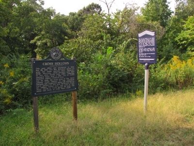
3. Cross Hollows Markers
Photographed by Lee Hattabaugh, September 15, 2013
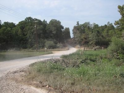
4. Cross Hollows
looking north at the intersection of Old Wire Road with Dogwood (left) and Cross Hollows (right). Marker is out of sight to the north over the crest of the ridge.
Credits. This page was last revised on May 26, 2026. It was originally submitted on September 24, 2013, by Lee Hattabaugh of Capshaw, Alabama. This page has been viewed 1,422 times since then and 70 times this year. Last updated on May 20, 2026, by Houston Hughes of Fayetteville, Arkansas. Photos: 1, 2, 3, 4. submitted on September 24, 2013, by Lee Hattabaugh of Capshaw, Alabama. • Devry Becker Jones was the editor who published this page.
