Rocky Hill in Capitol Region, Connecticut — The American Northeast (New England)
An Historic Timeline - Dividend Pond Archaeological District
Photographed by Conrad Ward, May 25, 2025
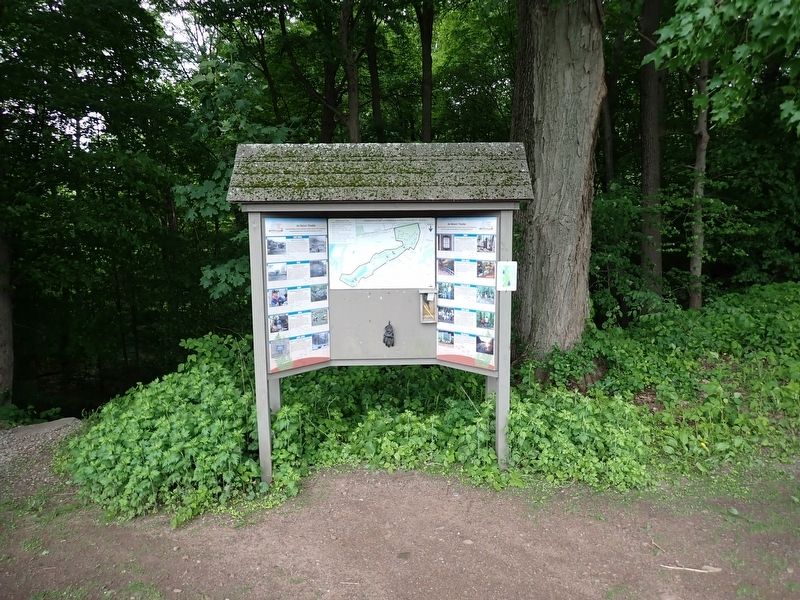
1. An Historic Timeline - Dividend Pond Archaeological District Marker
How did a Water-Powered Industrial Complex, begun in the Colonial-era, become Dividend Pond Trails and Archaeological Preserve?
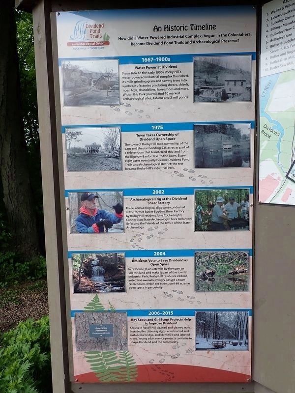
(left panel)
1667–1900s
Water power at Dividend
From 1667 to the early 1900s Rocky Hill’s water-powered industrial complex flourished, its mills grinding grain and sawing trees into lumber, its factories producing shears, chisels, hoes, toys, chandeliers, horseshoes and more. Within this park you will find 10 marked archaeological sites, 4 dams and 2 mill ponds.
1975
Town takes ownership of Dividend open space
The town of Rocky Hill took ownership of the dam and the surrounding 235 acres as part of a referendum that transferred this land from the Bigelow-Sanford Co. to the town. Sixty-eight acres eventually became Dividend Pond Trails and Archaeological District; the rest became Rocky Hill’s Industrial Park.
2002
Archaeological dig at the Dividend shear factory
Three archaeological digs were conducted at the former Butler-Sugden Shear Factory by Rocky Hill resident June Cooke (right), Connecticut State Archaeologist Nick Bellantoni (left), and the Friends of the Office
this page online
2004
Residents vote to save Dividend as open space
In response to an attempt by the town to sell this land and make it part of the town’s Industrial Park, Rocky Hill residents lobbied, voted and overwhelmingly passed a town referendum, which set aside these 68 acres as open space in perpetuity.
2006–2015
Boy Scout and Girl Scout projects help to improve Dividend
Scouts in Rocky Hill cleaned and cleared trails, installed no littering signs, constructed and installed a bridge, and identified and labeled trees. Young adult service projects continue to shape Dividend and the community.
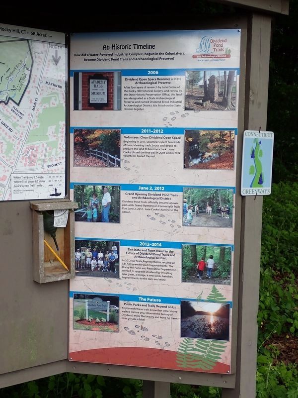
(right panel)
2006
Dividend Open Space Becomes a State Archaeological Preserve
After four years of research by June Cooke of the Rocky Hill Historical Society, and review by the State Historic Preservation Office, this land was designated as a State Archaeological Preserve and named Dividend Brook Industrial Archaeological District; it is listed on the State Historic Register.
2011–2012
Volunteers Clean Dividend Open Space
Beginning in 2011, volunteers spent hundreds of hours clearing trash, brush
Photographed by Conrad Ward, May 25, 2025
2. An Historic Timeline - Dividend Pond Archaeological District Marker
June 2, 2012
Grand Opening Dividend Pond Trails and Archaeological District
Dividend Pond Trails officially became a town park at its grand opening on Connecticut Trails Day, June 2, 2012. June Cooke’s family cut the ribbon.
2012–2014
The State and Town invest in the Future of Dividend Pond Trails and Archaeological District
In 2012 our State Representative secured an $81,500 grant for park improvements. The Rocky Hill Parks and Recreation Department worked to upgrade Dividend by installing new gates, a bridge, a new kiosk, benches, improvements to the dam and more.
The Future
Public Parks and Trails Depend on Us
As you walk these trails know that others have walked before you. Observe the history of Dividend, enjoy the beauty and leave no trace. Now go take a hike!
Topics. This historical marker is listed in these topic lists: Anthropology & Archaeology • Industry & Commerce • Parks & Recreational Areas • Waterways & Vessels. A significant historical date for this entry is June 2, 2012.
Location. 41° 38.811′ N,
Photographed by Conrad Ward, May 25, 2025
3. An Historic Timeline - Dividend Pond Archaeological District Marker

Regionally, this marker is in the Connecticut River Valley, in Greater Hartford, and in the Knowledge Corridor. It is also in the American Northeast and in New England. Globally, it is in North America, the Western Hemisphere, the Western World, and the Anglosphere. Historically, it finds itself in what was once Hartford County and also one of the original Thirteen Colonies.
Other nearby markers. At least 8 other markers are within walking distance of this marker: Welles & Wilcox Manufacturing (within shouting distance of this marker); Bulkeley's New Corne Mill (within shouting distance of this marker); Entrance to Edward Bulkeley Homestead (about 300 feet away, measured in a direct line); Bulkeley Mill Dam (about 300 feet away); C. E. Billings Manufacturing Co. (about 400 feet away); Reverend Gershom Bulkeley's Corne/Grist Mill (about 800 feet away); Butler and Sugden Shear Factory (approx. 0.4 miles away); Butler and Sugden Dam and Sluiceway (approx. half a mile away). Touch for a list and map of all markers in Rocky Hill.
Credits. This page was last revised on May 30, 2026. It was originally submitted on May 23, 2026, by Conrad Ward of Guilford, Connecticut. This page has been viewed 15 times since then. Photos: 1, 2, 3. submitted on May 23, 2026, by Conrad Ward of Guilford, Connecticut. • Michael Herrick was the editor who published this page.
