Near Loving in Eddy County, New Mexico — The American Mountains (Southwest)
Loving's Bend
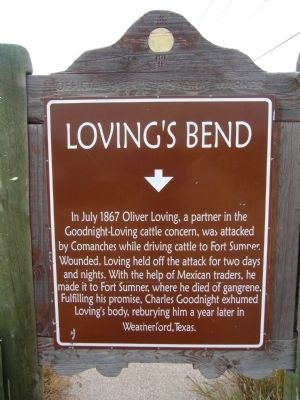
Photographed by Bill Kirchner, October 26, 2012
1. Loving's Bend Marker
Erected by New Mexico Historic Preservation Division.
Topics. This historical marker is listed in these topic lists: Animals • Indigenous Peoples and Communities • Roads & Vehicles • Wars, US Indian. A significant historical month for this entry is July 1867.
Location. Marker has been permanently removed. It was located near 32° 17.639′ N, 104° 6.143′ W. Marker was near Loving, New Mexico, in Eddy County. It was at the intersection of U.S. 285 and County Road 712, on the right when traveling south on U.S. 285. Touch for map. Marker was in this post office area: Loving NM 88256, United States of America.
We have been informed that this marker is no longer there and will not be replaced. This page is an archival view of what was.
Regionally,
this page online

Other nearby markers. At least 7 other markers are within 14 miles of this location, measured as the crow flies: Goodnight-Loving Trail (approx. 1.7 miles away); Josephine Cox "Grandma" Anderson (approx. 10.9 miles away); Mother Magdalen and the Sisters of Loretto (1852 - 1968) / Carlsbad (approx. 10.9 miles away); Carlsbad Irrigation Flume (approx. 13.7 miles away); Civilian Conservation Corps Carlsbad Campsite (approx. 13.7 miles away); a different marker also named Carlsbad Irrigation Flume (approx. 13.8 miles away); a different marker also named Carlsbad Irrigation Flume (approx. 13.9 miles away).
Other markers no longer nearby. Espejo's Trail (was approx. 4.7 miles away but has been confirmed missing); Eddy County Courthouse (was approx. 11½ miles away but
Photographed by Bill Kirchner, October 26, 2012
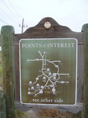
2. Back of Loving's Bend Marker
Points of Interest
New Mexico's Historic Markers typically have a map on the back side showing the location of other OSHM's. This is an excellent source of information when exploring for other Historical Markers and locations.
New Mexico's Historic Markers typically have a map on the back side showing the location of other OSHM's. This is an excellent source of information when exploring for other Historical Markers and locations.
More about this marker. Marker has been replaced with "Goodnight-Loving Trail" marker.
Related markers. Click here for a list of markers that are related to this marker.
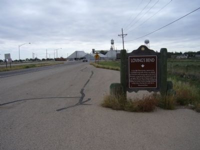
Photographed by Bill Kirchner, October 26, 2012
3. Loving's Bend Marker
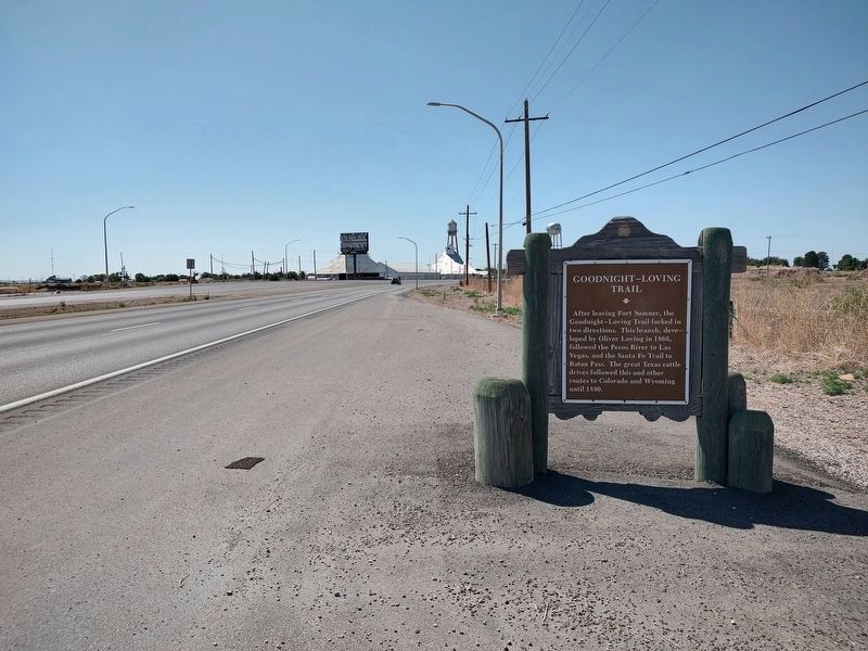
Photographed by Jimmy Emerson, May 24, 2026
4. Loving's Bend Marker Replaced with Goodnight -Loving Trail marker
Credits. This page was last revised on May 31, 2026. It was originally submitted on November 28, 2012, by Bill Kirchner of Tucson, Arizona. This page has been viewed 3,440 times since then and 344 times this year. Last updated on May 24, 2026, by Jimmy Emerson of Dalton, Georgia. Photos: 1, 2, 3. submitted on November 28, 2012, by Bill Kirchner of Tucson, Arizona. 4. submitted on May 31, 2026, by Jimmy Emerson of Dalton, Georgia. • Devry Becker Jones was the editor who published this page.
