
Port Royal in Beaufort County, South Carolina — The American South (South Atlantic)
Emancipation Day
| — | Reconstruction Era National Historical Park | — |
Photographed by Benjamin Rubin, May 30, 2026
1. Emancipation Day Marker
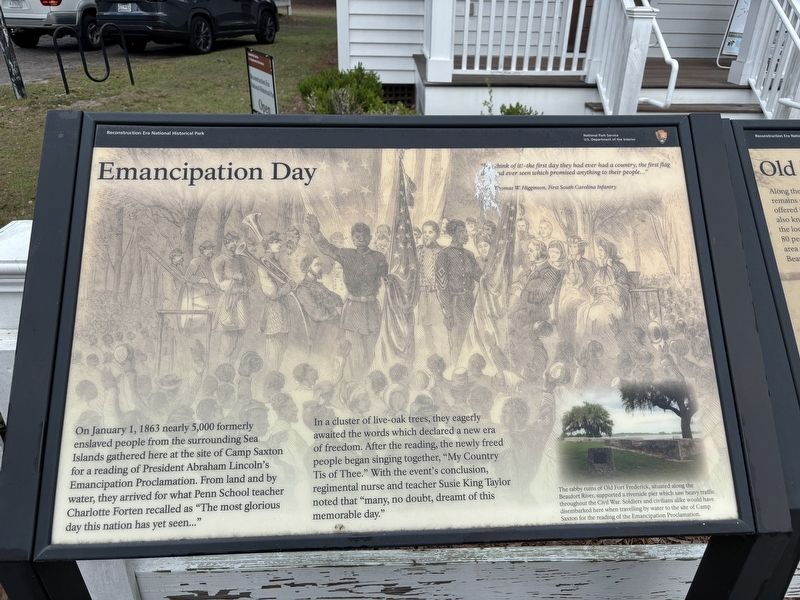
Thomas W. Higginson, First South Carolina Infantry
On January 1, 1863 nearly 5,000 formerly enslaved people from the surrounding Sea Islands gathered here at the site of Camp Saxton for a reading of President Abraham Lincoln's Emancipation Proclamation. From land and by water, they arrived for what Penn School teacher Charlotte Forten recalled as "The most glorious day this nation has yet seen..."
In a cluster of live-oak trees, they eagerly awaited the words which declared a new era of freedom. After the reading, the newly freed people began singing together, "My Country: Tis of Thee." With the event's conclusion, regimental nurse and teacher Susie King Taylor noted that "many, no doubt, dreamt of this memorable day."
(caption) The tabby ruins of Old Fort Frederick, situated along the Beaufort River, supported a riverside pier which saw heavy traffic throughout the Civil War. Soldiers and civilians alike would have disembarked here when travelling by water to the site of Camp Saxton for the reading of the Emancipation Proclamation.
Erected by National
this page online
Topics. This historical marker is listed in these topic lists: Abolition & Underground RR • African Americans • Civil Rights • War, US Civil. A significant historical date for this entry is January 1, 1863.
Location. 32° 23.292′ N, 80° 41.134′ W. Marker is in Port Royal, South Carolina, in Beaufort County. It can be reached from Pinckney Boulevard 0.1 miles east of Ribaut Road (U.S. 21), on the left when traveling east. Touch for map. Marker is at or near this postal address: 708 Pinckney Blvd, Port Royal SC 29935, United States of America. Touch for directions.

Regionally, this marker is in the Lowcountry and on the Sea Islands. It is also in the American South, specifically in the Deep South, and on the Eastern Seaboard. Globally, it is in the North Atlantic Region, North America, the Western Hemisphere, the Western World, and the Anglosphere. Historically, it finds itself in what was once New Spain, the territory of the Mississippian Culture, one of the original Thirteen Colonies, one of the Confederate States of America, and the Antebellum South.
Other nearby markers. At least 8 other markers are within one mile of this marker, measured as the crow flies: Old Fort Plantation (here, next to this marker); Camp Saxton (here, next to this marker); First South Carolina Infantry (here, next to this marker); "The Year of Jubilee Has Come!" (here, next to this marker); Emancipation Day / Camp Saxton Site (approx. 0.3 miles away); a different marker also named Camp Saxton (approx. 0.3 miles away); The Historic Union Church (approx. 0.9 miles away); Blue Channel Corporation (approx. one mile away). Touch for a list and map of all markers in Port Royal.
Also see . . . Reconstruction Era National Historical Park. National Park Service (Submitted on June 11, 2026.)
Credits. This page was last revised on June 11, 2026. It was originally submitted on May 31, 2026, by Benjamin Rubin of Columbia, South Carolina. This page has been viewed 18 times since then. Photo 1. submitted on May 31, 2026, by Benjamin Rubin of Columbia, South Carolina. • Bernard Fisher was the editor who published this page.
Editor’s want-list for this marker. Wide shot of marker and its surroundings. • Can you help?
