Upper Leacock Township in Leola in Lancaster County, Pennsylvania — The American Northeast (Mid-Atlantic)
Myer Homestead
Established 1759

Photographed by Glen Martin, June 7, 2026
1. Myer Homestead Marker
Eight generations of farmers followed and were a stable influence as community and church leaders, pump and furniture makers, blacksmiths, inventors, and educators.
Abram Hess married Caroline Myer in 1894 and continued farming, followed by their son, Titus M. Hess (dec. 1991) and wife, Anna Haldeman, their 6 children and grandchildren.
In 1976 the farm was identified by the U.S. Dept. of the Interior as a Bicentennial Family Farm. After 237 years of farming, in 1994, the heirs donated an easement to the Lancaster Farmland Trust as farmland forever.
Topics. This historical marker is listed in these topic lists: Agriculture • Cemeteries & Burial Sites • Immigration. A significant historical year for this entry is 1759.
Location. 40° 4.529′ N, 76° 9.172′ W. Marker is in Leola, Pennsylvania, in Lancaster County. It is in Upper Leacock Township. It is on East Eby Road, on the right when traveling west. Touch for map. Marker is at or near this
this page online

Regionally, this marker is in South-Central Pennsylvania, specifically in Pennsylvania Dutch Country, and in the Susquehanna Valley. It is also in the American Northeast and in the Mid-Atlantic. Globally, it is in North America, the Western Hemisphere, the Western World, and the Anglosphere. Historically, it finds itself in what was once the Haudenosaunee (Iroquois) Confederacy and also one of the original Thirteen Colonies.
Other nearby markers. At least 8 other markers are within 4 miles of this marker, measured as the crow flies: Mascot Roller Mills (approx. 0.9 miles away); Amish Country Homestead (approx. 2.6 miles away); Leacock Presbyterian Church (approx. 2.8 miles away); Intercourse (approx. 2.9 miles away); a different marker also named Intercourse (approx. 3.2 miles away); Bird-in-Hand (approx. 3.3 miles away); a different marker also named Intercourse (approx. 3.7 miles away); The Styer & Evans Building (approx. 3.9 miles away).
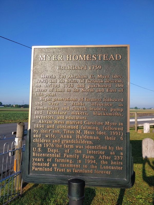
Photographed by Glen Martin, June 7, 2026
2. Myer Homestead Marker

Photographed by Glen Martin, June 7, 2026
3. Myer Homestead Marker

June 7, 2026
4. Myer Homestead Marker
Credits. This page was last revised on July 17, 2026. It was originally submitted on June 7, 2026, by Glen Martin of Ephrata, Pennsylvania. This page has been viewed 15 times since then. Photos: 1, 2, 3. submitted on June 7, 2026, by Glen Martin of Ephrata, Pennsylvania. 4. submitted on June 7, 2026. • Bill Pfingsten was the editor who published this page.
