Colebrook in Litchfield County, Connecticut — The American Northeast (New England)
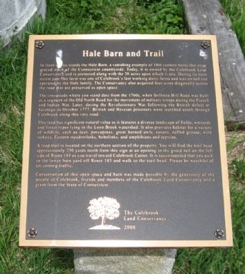
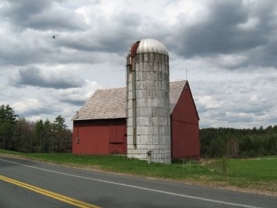
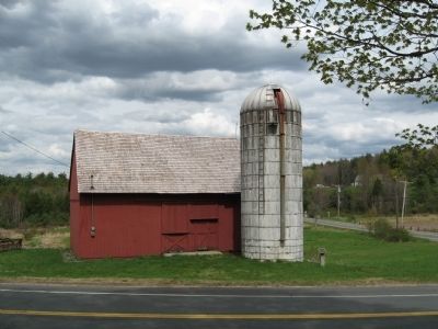
Hale Barn and Trail
The crossroads where you stand date from the 1760s, when Stillman Hill Road was built as a segment of the Old North Road for the movement of military troops during the French and Indian War. Later, during the Revolutionary War following the British defeat at Saratoga in October 1777, British and Hessian prisoners were marched south through Colebrook along this very road.
This land has significant natural value as it features a diverse landscape of fields, wetlands and forest types lying in the Loon Brook watershed. It also provides habitat for a variety of wildlife, such as deer, porcupines, great horned owls, ravens, ruffed grouse, wild turkeys, Eastern meadowlarks, bobolinks, and amphibians and reptiles,
A loop trail is located on the northern section of the property. You will find the trail head approximately 250 yards north from this sign at an opening in the guard rail on the left side of Route 183 as you travel toward Colebrook Center. It is recommended that you park in the lower barn yard off Route 183 and walk to the trail head. Please be watchful of on-coming traffic.
Conservation of this open space and barn was made possible by the generosity of the people of Colebrook, friends and members of the Colebrook Land Conservancy and a grant from the State of Connecticut.
The Colebrook Land Conservancy 2008
Erected 2008 by The Colebrook Land Conservancy.
Topics. This historical marker is listed in these topic lists: Agriculture • Colonial Era • Environment • Notable Buildings. A significant historical month for this entry is October 1777.
Location. 41° 58.768′ N, 73° 6.19′ W. Marker is in Colebrook, Connecticut, in Litchfield County. Marker is at the intersection of Colebrook Road (Route 183) and Stillman Hill Road (Connecticut Route 182), on the right when traveling south on Colebrook Road. Touch for map. Marker is in this post office area: Colebrook CT 06021, United States of America. Touch for directions.
Other nearby markers. At least 8 other markers are within 5 miles of this marker, measured as the crow flies. Colebrook (approx. 0.8 miles away); Colebrook Veterans Memorial (approx. 0.8 miles away); The Rock School (approx. 1.9 miles away); M110A2 Howitzer S/P (approx. 3˝ miles away); Winsted Korean Conflict - Persian Gulf Monument (approx. 3.9 miles away); Winsted Veterans Monument (approx. 3.9 miles away); Winchester Soldiers' Memorial (approx. 4.1 miles away); World War II Living Memorial (approx. 4.4 miles away). Touch for a list and map of all markers in Colebrook.
Credits. This page was last revised on June 16, 2016. It was originally submitted on April 29, 2010, by Michael Herrick of Southbury, Connecticut. This page has been viewed 1,045 times since then and 21 times this year. Photos: 1, 2, 3. submitted on April 29, 2010, by Michael Herrick of Southbury, Connecticut.


