Federal Hill in Baltimore, Maryland — The American Northeast (Mid-Atlantic)
Federal Hill
The Signal Towers on Federal Hill
| — | Baltimore National Heritage Area | — |
Photographed by Mark P. Brock-Cancellieri, May 1, 2026
1. Federal Hill Marker
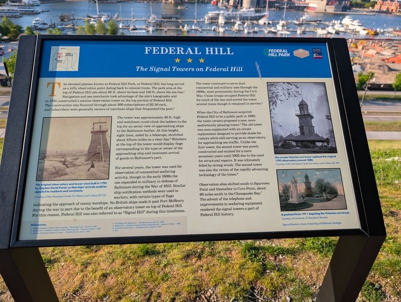
The tower was approximately 30 ft. high and watchmen could climb the ladders to the top for an aerial view of approaching ships to the Baltimore harbor. At this height, sight lines, aided by a telescope, stretched about fifteen miles on a clear day.3 Watchers at the top of the would display flags corresponding to the type or owner of the approaching ship and imminent arrival of goods to Baltimore's port.
For several years, the tower was used for observation of commercial seafaring activity, though in the early 1880s the use expanded to military in defense of Baltimore
this page online
The tower continued to serve dual commercial and miliary uses through the 1800s, most prominently during the Civil War. Union troops occupied Federal Hill for much of the war and moved the tower several times though it remained in service.4
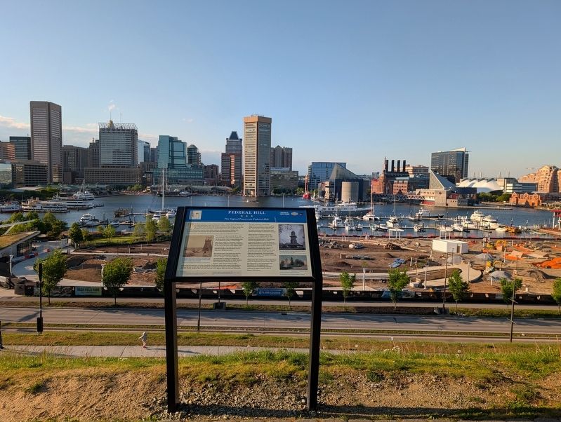
When the City of Baltimore acquired Federal Hill to be a public park in 1880, the tower owners proposed a new, more aesthetically pleasing tower.5 The old tower was soon supplanted with an ornate replacement designed to provide shade for visitors while still serving as an observatory for approaching sea traffic. Unlike the first tower, the second tower was poorly constructed and existed for a mere seventeen years until 1902 due to the need for structural repairs. It was ultimately felled by strong winds. The second tower was
Photographed by Mark P. Brock-Cancellieri, May 1, 2026
2. Federal Hill Marker
Observation sites shifted south to Sparrows Point and thereafter to Cove Point, about 60 miles south in the Chesapeake Bay.7 The advent of the telephone and improvements to seafaring equipment rendered the signal tower a part of Federal Hill history.
(captions]
The original observatory and tower were built in 1795 by Captain David Porter so that ships' arrivals could be signaled to residents and merchants. Courtesy of the Maryland Center for History and Culture (ID 52).
The ornate Victorian-era tower replaced the original 1795 observatory around 1880. Courtesy of the Maryland Center for History and Culture (ID 49).
A postcard from 1911 depicting the Victorian-era tower. Courtesy of University of Maryland Libraries.
Special thanks to Dave Schenning of Baltimore Heritage.
References:
1. National Register of Historic Places Inventory - Nomination Form - April 16, 1969
2. Federal Hill - A Baltimore National Historic District (pg 30) - Norman G. Rukert - 1980
3. Maritime Exchange in Service 25 years - The Baltimore Sun, June 7, 1924
4. The Federal Hill Observatory - The Baltimore Sun, April 29, 1865
5. Federal Hill - A Baltimore National Historic District (pg 34) - Norman G. Rukert - 1980
6. Tower Must Come Down - The Baltimore Sun, August 3, 1902
7. Ibid
Erected by Baltimore National Heritage Area / Federal Hill Park.
Topics. This historical marker is listed in these topic lists: Communications • Forts and Castles • Industry & Commerce • Parks & Recreational Areas • War of 1812 • War, US Civil • Waterways & Vessels. A significant historical year for this entry is 1795.
Location. 39° 16.825′ N, 76° 36.558′ W. Marker is in Baltimore, Maryland. It is in Federal Hill. It can be reached from Warren Avenue east of Battery Avenue, on the left when traveling east. Touch for map. Marker is at or near this postal address: 300 Warren Ave, Baltimore MD 21230, United States of America. Touch for directions.

Regionally, this marker is in Central Maryland. It is also in the American Mid-Atlantic, in the Chesapeake Bay Region, and on the Eastern Seaboard. Globally, it is in the North Atlantic Region, North America, the Western Hemisphere, the Western World, and the Anglosphere. Historically, it finds itself in what was once one of the original Thirteen Colonies and also the Antebellum South.
Other nearby markers. At least 8 other markers are within walking distance of this marker: Revolutionary War Patriots (within shouting distance of this marker); Major General Samuel Smith (about 300 feet away, measured in a direct line); a different marker also named Federal Hill (about 300 feet away); 223 East Montgomery Street (about 300 feet away); Colonel George Armistead (about 300 feet away); 215 East Montgomery Street (about 400 feet away); 222 East Churchill Street (about 400 feet away); a different marker also named Federal Hill (about 400 feet away). Touch for a list and map of all markers in Baltimore.
Another marker is no longer nearby. Federal Hill (was about 300 feet away but has been replaced with another marker now near it).
Also see . . . Federal Hill Park. Wikipedia (Submitted on June 15, 2026.)
Credits. This page was last revised on June 15, 2026. It was originally submitted on June 13, 2026, by Mark P. Brock-Cancellieri of Baltimore, Maryland. This page has been viewed 19 times since then. Photos: 1, 2. submitted on June 13, 2026, by Mark P. Brock-Cancellieri of Baltimore, Maryland. • Bernard Fisher was the editor who published this page.
