Carlisle in Cumberland County, Pennsylvania — The American Northeast (Mid-Atlantic)
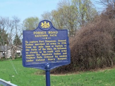
Forbes Road
Raystown Path
To capture Fort Duquesne, General Forbes marched an army, in 1758, from his main base at Carlisle to the forks of the Ohio. He followed as closely as he could with army wagons, the Raystown Indian and Traders Path, widened by axemen under Colonel Henry Bouquet.
Erected by Pennsylvania Historical and Museum Commission.
Topics and series. This historical marker is listed in these topic lists: Colonial Era • Forts and Castles • Roads & Vehicles • War, French and Indian. In addition, it is included in the Forbes Road, and the Pennsylvania Historical and Museum Commission series lists. A significant historical year for this entry is 1758.
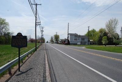
Location. 40° 12.086′ N, 77° 12.737′ W. Marker is in Carlisle, Pennsylvania, in Cumberland County. Marker is on U.S. 11, on the left when traveling west. Marker is west of Carlisle. Touch for map. Marker is in this post office area: Carlisle PA 17013, United States of America. Touch for directions.
Other nearby markers. At least 8 other markers are within walking distance of this marker. Carlisle (within shouting distance of this marker); The Charles Nisbet Campus of Dickinson College (approx. ¾ mile away); Dickinson Students Part Ways (approx. 0.8 miles away); The Benjamin Rush Campus of Dickinson College (approx. 0.8 miles away); Dickinson School of Law (approx. 0.8 miles away); Beta Pi Chapter of Kappa Sigma Fraternity (approx. 0.9 miles away); Dickinson College (approx. 0.9 miles away); Old West (approx. 0.9 miles away). Touch for a list and map of all markers in Carlisle.
Also see . . . Brigadier General John Forbes Expedition. Historynet website entry (Submitted on May 2, 2010, by Bill Pfingsten of Bel Air, Maryland.)
Credits. This page was last revised on September 20, 2023. It was originally submitted on May 2, 2010, by Bill Pfingsten of Bel Air, Maryland. This page has been viewed 1,302 times since then and 32 times this year. Photos: 1. submitted on May 2, 2010, by Bill Pfingsten of Bel Air, Maryland. 2. submitted on May 1, 2015, by Mike Wintermantel of Pittsburgh, Pennsylvania.

