
Richmond, Virginia — The American South (Mid-Atlantic)
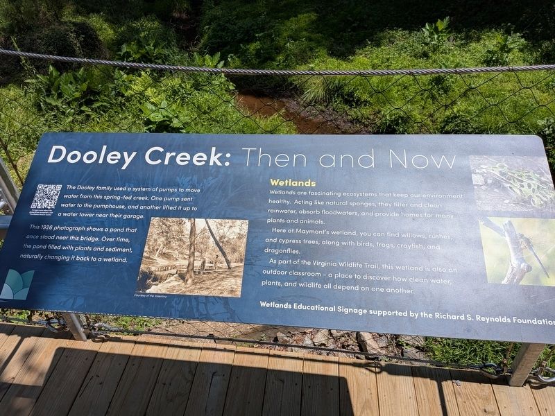
Dooley Creek: Then and Now
Photographed by Evan Dwyer, May 17, 2026
1. Dooley Creek: Then and Now Marker
This 1926 photograph shows a pond that once stood near this bridge. Over time, the pond filled with plants and sediment, naturally changing it back to a wetland.
Wetlands
Wetlands are fascinating ecosystems that keep our environment health. Acting like natural sponges, they filter and clean rainwater, absorb floodwaters, and provide homes for many plants and animals.
Here at Maymont's wetland, you can find willows, rushes, and cypress trees, along with birds, frogs, crayfish, and dragonflies.
As part of the Virginia Wildlife Trail, this wetland is also an outdoor classroom - a place to discover how clean water, plants, and wildlife all depend on one another.
Wetlands Educational Signage supported by the Richard S. Reynolds Foundation.
Erected by Maymont Foundation.
Topics. This historical marker is listed in these topic lists: Environment • Waterways & Vessels. A significant historical year for this entry is 1926.
Location. 37° 32.158′ N, 77° 28.853′ W.
this page online

Regionally, this marker is in Central Virginia. It is also in the American South and specifically in the Upper South. Globally, it is in North America, the Western Hemisphere, the Western World, and the Anglosphere. Historically, it finds itself in what was once the territory of the Mississippian Culture, one of the original Thirteen Colonies, one of the Confederate States of America, and the Antebellum South.
Other nearby markers. At least 8 other markers are within walking distance of this marker: Maymont Farm (approx. 0.2 miles away); River & Canal (approx. 0.2 miles away); Welcome to Maymont / Extraordinary Gift (approx. 0.2 miles away); Maymont, Gilded Age Estate (approx. 0.2 miles away); James & Sallie Dooley (approx. 0.2 miles away); Historic Estate (approx. 0.2 miles away); A Stately Home
Photographed by Evan Dwyer, May 17, 2026
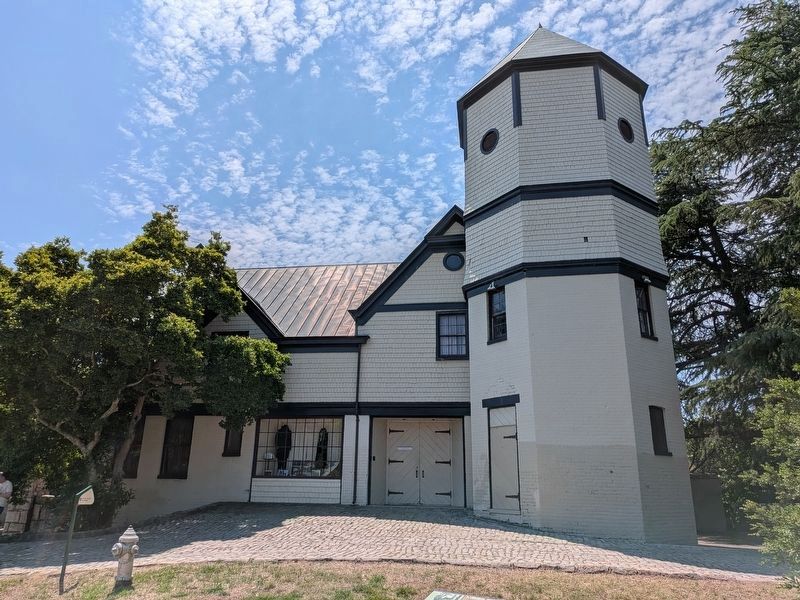
2. Water Ram Tower
The tower described in the marker is up the hill to the east, attached to the Dooley Stable (later their garage). The tower, which circulated water using a hydraulic ram, was built in 1908 as an addition to the ca. 1890 stable/garage building.
Other markers no longer nearby. Bald Eagles (was about 300 feet away, measured in a direct line but has been permanently removed); a different marker also named Bald Eagles (was about 400 feet away but has been permanently removed).
Credits. This page was last revised on July 19, 2026. It was originally submitted on July 2, 2026, by Evan Dwyer of Richmond, Virginia. This page has been viewed 15 times since then. Photos: 1, 2. submitted on July 2, 2026, by Evan Dwyer of Richmond, Virginia. • Andrew Ruppenstein was the editor who published this page.
