Madison in Dane County, Wisconsin — The American Midwest (Great Lakes)
Destroying and Saving a Sacred Landscape
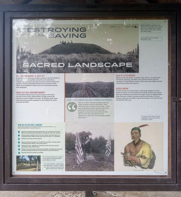
Photographed by McGhiever, July 24, 2025
1. Destroying and Saving a Sacred Landscape Marker
Gilman Mounds
Image credits Top Wisconsin Historical Society WHS-95142. Center WHS-58453. Bottom left Jim Welsh. Bottom center WHS-51985. Bottom right WHS-26882.
A damaged mound in northern Wisconsin in 1927.
Settlers Find Mounds in Their Way
If mounds stood in the way of urban progress, cities like Madison built over them and used the soil as fill. In the mid-1800s, vandals and pothunters dug open mounds to look for bones and artifacts. Farmers gradually plowed over the mounds in their fields. Around Madison's lakes more than a thousand mounds were destroyed.
Parks Help Save Remaining Mounds
The beautiful setting of most mound groups is one reason mounds survive today. Effigy builders usually constructed mounds on scenic heights over water. As Madison grew, those same picturesque places appealed to city residents for parks, and were set aside.
A Sauk County Farmer Talks About Plowing Effigy Mounds
"We were rather irked by the large number of Indian mounds we had to plow down. There must have been at least 25 on our land… Some were shaped like animals and some like birds, and all were from three to fivefeet high… I suppose we should not have destroyed them. But they were then regarded merely as obstacles to cultivation, and everybody plowed them down."
Click or scan to see
this page online
Value of Effigy Mounds
Effigy mounds still matter to people today. All of us can appreciate the beauty, meaning, and faith in the universe that the mounds represent. Current American Indian tribes value them highly and find connections to their own cultures.
Sacred Ground
In Dane County, Ho-Chunks lived in a few large villages and used dozens of camps. The Ho-Chunks did not build mounds, but revered them and sometimes used them for burials. Sacred to effigy builders when they were created, mounds are still sacred today. For these reasons, please do not walk on top of the mounds, and treat the area around them with care.
How Do You Restore a Mound?
[According to guidelines of the National Park Service, Ho-Chunk Nation, and Wisconsin Department of Natural Resources.]
❶ Mounds are burial sites protected by law. Get permission from the Wisconsin Historical Society before carrying out work near mounds.
❷ Remove dead and fallen trees from the mound, and trees
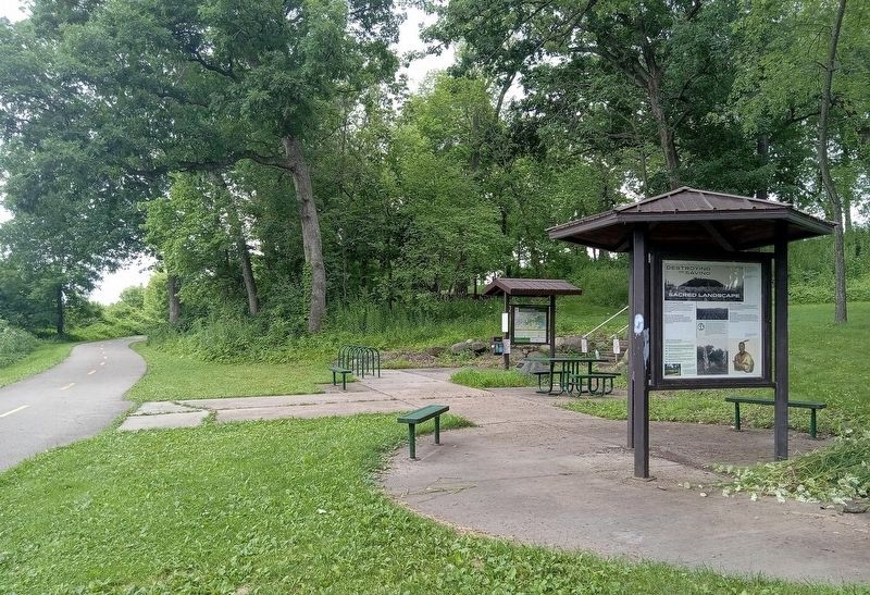
Photographed by McGhiever, July 24, 2025
2. Destroying and Saving a Sacred Landscape marker (right) along the Capitol City Trail
❸ Remove non-native invasive plants.
❹ Remove all trees less than 14" in diameter. Remove all dead, fallen, and hazard trees within 5 feet of the mound.
❺ Remove all trees, regardless of health and size, from the mound and within 5 feet of the mound.
❻ Restore the native plant community if possible. If stumps are removed, grinding equipment should not penetrate the soil of the mound.
❼ Mowing should be limited or avoided.
The Ho-Chunk Nation has restored a mound group at Kingsley Bend on the Wisconsin River.
Mrs. Joseph Mallon, a Menominee from Milwaukee, unveiled a marker at a 1914 ceremony that preserved eight mounds above Vilas Zoo.
Ho-Chunk chief O-Wan-Ich-Koh (Little Elk) in 1825 at the Treaty of Prairie du Chien.
Topics. This historical marker is listed in these topic lists: Cemeteries & Burial Sites • Indigenous Peoples and Communities • Parks & Recreational Areas • Settlements & Settlers.
Location. 43° 1.518′ N, 89° 21.038′ W. Marker is in Madison, Wisconsin, in Dane County. It is on the Capitol City Trail half a mile west of Lake Farm Road, on the left when traveling west. The marker is at the William C. Fairbanks Memorial Wayside along the paved Capitol City Trail. It is a half-mile walk or bike ride from the closest trailhead. Touch for map. Marker is in this post office area: Madison WI 53711, United States of America. Touch for directions.

Regionally, this marker is in Southeast Wisconsin. It is also in the American Midwest and in the Corn Belt. Globally, it is in North America, the Western Hemisphere, the Western World, and the Anglosphere. Historically, it finds itself in what was once the territory of the Mississippian Culture and also the Northwest Territory.
Other nearby markers. At least 8 other markers are within walking distance of this marker: The Gilman Mounds (here, next to this marker); Mounds for the Future (here, next to this marker); In Memory of Bud Morton 1907-1992 (approx. 0.3 miles away); Lewis Nine Springs E-Way (approx. 0.4 miles away); The Madison Metropolitan Sewerage District Wildlife Observation Area / From Wastewater to Habitat (approx. 0.4 miles away); MMSD Wildlife Observation Area (approx. 0.4 miles away); The Lewis Nine Springs E-Way / Philip and Elizabeth Lewis (approx. 0.4 miles away); Carlos J. Martin Memorial Native American Interpretive Site (approx. 0.9 miles away). Touch for a list and map of all markers in Madison.
Credits. This page was last revised on July 3, 2026. It was originally submitted on July 3, 2026, by McGhiever of Minneapolis, Minnesota. This page has been viewed 25 times since then. Photos: 1. submitted on July 3, 2026, by McGhiever of Minneapolis, Minnesota. 2. submitted on June 14, 2026, by McGhiever of Minneapolis, Minnesota.
