Fort Myer in Arlington in Arlington County, Virginia — The American South (Mid-Atlantic)
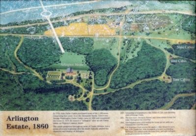
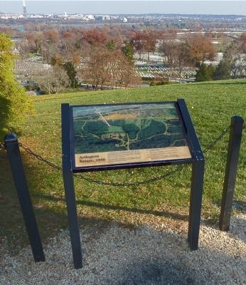
Arlington Estate, 1860
Photographed by Allen C. Browne, November 29, 2013
1. Arlington Estate, 1860 Marker
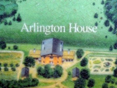
In 1778, John Parke Custis purchased most of the 1,100 acres comprising this estate from the Alexander family. John's son, George Washington Parke Custis, came in 1802 and completed the house in 1818. He named it “Arlington” after the old Custis estate on Virginia's eastern shore.
The estate prospered throughout most of Custis' lifetime, but a series of events beginning after his death radically altered the character of Arlington:
1857 -- Ownership is bequeathed to Mrs. Robert E. Lee, sole surviving child of George Custis.
1861 -- The Lees leave Arlington forever, and Union troops occupy the estate throughout the War.
1864 -- Two hundred acres surrounding the house are set aside as a cemetery for Civil War dead.
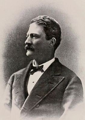
1882 -- U.S. Supreme Court returns the estate to Mrs. Robert E. Lee's son G.W. Custis Lee. With thousands of graves surrounding the house, Lee cannot make his home here, and sells Arlington to the government for $150,000.
Topics and series. This historical marker is listed in these topic lists: Cemeteries & Burial Sites • Colonial Era • War, US Civil. In addition, it is included in the
this page online
Location. Marker has been permanently removed. It was located near 38° 52.874′ N, 77° 4.343′ W. Marker was in Arlington, Virginia, in Arlington County. It was in Fort Myer. It could be reached from Sherman Drive 0.2 miles south of Lincoln Drive, on the left when traveling south. The marker stands on the edge of the walk in front of Arlington House in the Arlington Cemetery. Touch for map. Marker was at or near this postal address: 321 Sherman Drive, Fort Myer VA 22211, United States of America.
We have been informed that this marker is no longer there and will not be replaced. This page is an archival view of what was.
Regionally, this marker was in the Washington Metropolitan Area and in Northern Virginia. It was also in the American South, specifically in the Upper South, in the Mid-Atlantic, and on the Eastern Seaboard. Globally, it was in the North Atlantic Region, North America, the Western Hemisphere, the Western World, and the Anglosphere. Historically, it found itself in what was once the territory of the Mississippian Culture, one of

Photographed by Allen C. Browne, November 29, 2013
2. Arlington Estate, 1860 Marker
Other nearby markers. At least 8 other markers are within walking distance of this location: Evolving Vision (here, next to this marker); Paying Tribute (a few steps from this marker); Pierre Charles L’Enfant (a few steps from this marker); Platforms of Power (a few steps from this marker); Division and Unification (a few steps from this marker); Trophy of War (within shouting distance of this marker); Growing Season (within shouting distance of this marker); Piecing the Past Together (within shouting distance of this marker). Touch for a list and map of all markers in Arlington.
Another marker is no longer nearby. A Garden Sustains (was within shouting distance of this marker but has been permanently removed).
Also see . . . Arlington House, The Robert E. Lee Memorial. National Park Service (Submitted on December 13, 2013.)
Photographed by Allen C. Browne, November 29, 2013
3. Arlington House
Photographed by Wikipedia
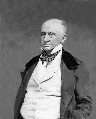
4. George Washington Parke Custis

Photographed by Wikipedia
5. Mary Custis Lee (Mrs. Robert E. Lee)
Photographed by Wikipedia
6. George Washington Custis Lee
Credits. This page was last revised on July 7, 2026. It was originally submitted on December 12, 2013, by Allen C. Browne of Silver Spring, Maryland. This page has been viewed 1,282 times since then and 60 times this year. Last updated on July 3, 2026, by Evan Dwyer of Richmond, Virginia. Photos: 1, 2, 3, 4, 5, 6. submitted on December 12, 2013, by Allen C. Browne of Silver Spring, Maryland. • Devry Becker Jones was the editor who published this page.
