Glass Point in Jamestown in James City County, Virginia — The American South (Mid-Atlantic)
An Ancient Road
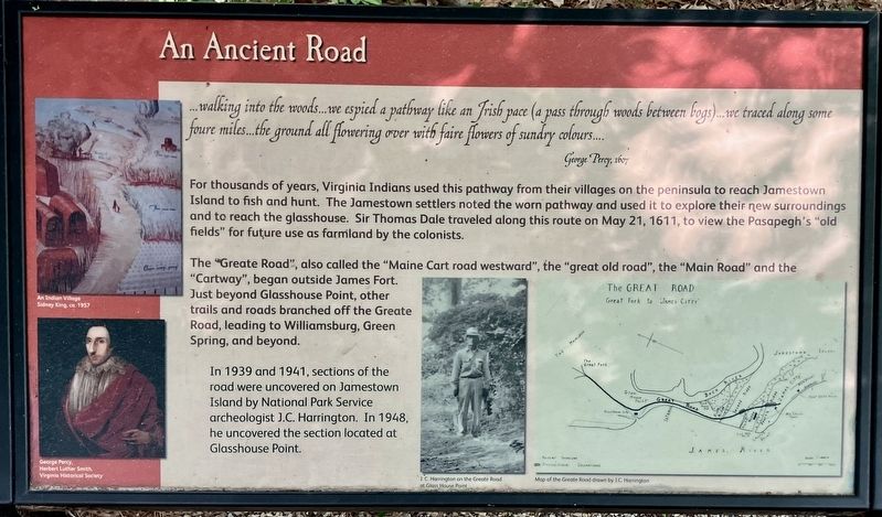
Photographed by Tracy Andersen Roberts, July 3, 2026
1. An Ancient Road Marker
George Percy, 1607
For thousands of years, Virginia Indians used this pathway from their villages on the peninsula to reach Jamestown Island to fish and hunt. The Jamestown settlers noted the worn pathway and used it to explore their new surroundings and to reach the glasshouse. Sir Thomas Dale traveled along this route on May 21, 1611, to view the Pasapegh's "old fields" for future use as farmland by the colonists.
The "Greate Road", also called the "Maine Cart road westward", the "great old road", the "Main Road" and the "Cartway", began outside James Fort. Just beyond Glasshouse Point, other trails and roads branched off the Greate Road, leading to Williamsburg, Green Spring, and beyond.
In 1939 and 1941, sections of the road were uncovered on Jamestown Island by National Park Service archeologist J.C. Harrington. In 1948, he uncovered the section located at Glasshouse Point.
(captions)
An Indian Village
Sidney King, ca. 1957
George Percy
Herbert Lather Smith
Virginia Historical Society
J.C. Harrington on the Greate Road at Glass House Point
Map of the Greate Road drawn by J.C. Harrington
Topics.
this page online
Location. 37° 13.237′ N, 76° 47.069′ W. Marker is in Jamestown, Virginia, in James City County. It is in Glass Point. It can be reached from Colonial National Historical Parkway 0.6 miles south of Jamestown Road (Virginia Route 31), on the right when traveling south. Touch for map. Marker is in this post office area: Jamestown VA 23081, United States of America. Touch for directions.

Regionally, this marker is on Virginia’s Peninsula, in Coastal Virginia, and in the Hampton Roads Metropolitan Area. It is also in the American South, specifically in the Upper South, in the Tidewater, and on the Eastern Seaboard. Globally, it is in the North Atlantic Region, North America, the Western Hemisphere, the Western World, and the Anglosphere. Historically, it finds itself in what was once the territory of the Mississippian Culture, one of the original Thirteen Colonies, one of the Confederate States of America, and the Antebellum

Photographed by Tracy Andersen Roberts, July 3, 2026
2. marker shown in full
Other nearby markers. At least 8 other markers are within walking distance of this marker: Interpreting the Glasshouse (a few steps from this marker); Original Glasshouse, 1608 (within shouting distance of this marker); Glasshouse Ruins (within shouting distance of this marker); Glassmaking - 1608 (within shouting distance of this marker); The Glasshouse (about 300 feet away, measured in a direct line); Jamestown (about 700 feet away); Boatbuilding (approx. 0.2 miles away); Fishing (approx. 0.2 miles away). Touch for a list and map of all markers in Jamestown.
Also see . . . National Park Service entry, "The Greate Road - An Early Highway pre-1607 - 1700s".
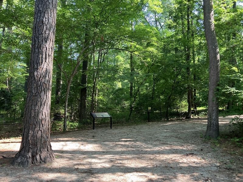
Only a few days after arriving at Jamestown in May 1607, settler George Percy wrote that he and his party “espied a pathway” and were “desirous to knowe whither it would bring us.” What they were traversing was probably a trail used by the nearby Paspahegh Indians. It would become the “Greate Road” of the English, a route that led from James Forte across the isthmus to the west of Glasshouse Point on the mainland, where Polish and German craftsmen were to establish(Submitted on July 18, 2026, by Tracy Andersen Roberts of Atlanta, Georgia.)a glassblowing industry in 1608.Photographed by Tracy Andersen Roberts, July 3, 20263. marker shown on approach path
Credits. This page was last revised on July 19, 2026. It was originally submitted on July 18, 2026, by Tracy Andersen Roberts of Atlanta, Georgia. This page has been viewed 16 times since then. Photos: 1, 2, 3. submitted on July 18, 2026, by Tracy Andersen Roberts of Atlanta, Georgia. • Bernard Fisher was the editor who published this page.
