Urban Core in Jacksonville in Duval County, Florida — The American South (South Atlantic)
Site of Cow Ford
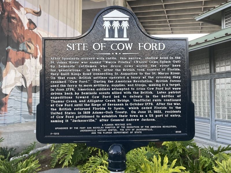
Photographed by Tim Fillmon, July 26, 2026
1. Site of Cow Ford Marker
After Spaniards arrived with cattle, this narrow, shallow bend in the St. Johns River was named "Wacca Pilatka" (Where Cows Splash Out) by Seminole cattlemen who drove Cows across the river here for generations. In 1763, after the British took control of Florida, they built Kings Road connecting St. Augustine to the St. Marys River. On that road, British settlers operated a ferry at the crossing they renamed "Cow Ford.” During the American Revolution, British forces used the ferry to move artillery, supplies, and troops, making it a target. In June 1776. American soldiers attempted to cross Cow Ford but were driven back by Seminole scouts allied with the British. Later patriot expeditions toward Cow Ford led to defeats in the battles of Thomas Creek and Alligator Creek Bridge. Unofficial raids continued at Cow Ford until the Siege of Savannah in October 1779. After the war, the British returned Florida to Spain, which ceded Florida to the United States in 1819 Adams-Onís Treaty. On June 15, 1822, residents of Cow Ford petitioned to establish their town as a US port of entry, naming it "Jacksonville," after
this page online
A Florida Heritage Site
Erected 2026 by The Fort San Nicholas Chapter of the Daughters of the American Revolution, Jacksonville History Center, the City of Jacksonville, and the Florida Department of State. (Marker Number F-1313.)
Topics. This historical marker is listed in these topic lists: Colonial Era • Roads & Vehicles • Waterways & Vessels. A significant historical year for this entry is 1763.
Location. 30° 19.43′ N, 81° 39.918′ W. Marker is in Jacksonville, Florida, in Duval County. It is in Urban Core. It can be reached from West Coastline Drive 0.1 miles south of Water Street. Marker is located under the Acosta Bridge and can be accessed by parking at the end of South Pearl Street and West Coastline Drive and walking along the river to the Acosta Bridge. Touch for map. Marker is in this post office area: Jacksonville FL 32202, United States of America. Touch for directions.

Regionally, this marker is in Florida’s First Coast. It is also in the American South and on the Eastern Seaboard. Globally, it is in the North Atlantic Region, North America, a Gulf of Mexico state, the
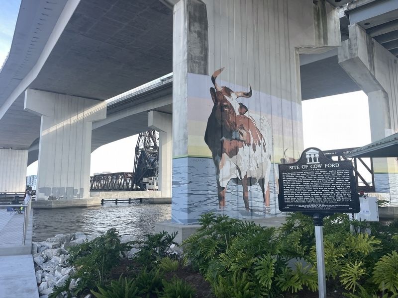
Photographed by Tim Fillmon, July 26, 2026
2. Site of Cow Ford Marker
Other nearby markers. At least 8 other markers are within walking distance of this marker: Sinking of the Maple Leaf (approx. ¼ mile away); El Modelo Cigar Factory (approx. ¼ mile away); Henry “Hank” Thomas (approx. ¼ mile away); Andrew Jackson (approx. 0.4 miles away); Historic King's Road British East Florida (approx. 0.4 miles away); Jacksonville National Bank - 1902 (approx. 0.4 miles away); The Line of Intrenchments (approx. half a mile away); Dr. Martin Luther King Jr. (approx. half a mile away). Touch for a list and map of all markers in Jacksonville.
Another marker is no longer nearby. The St. Johns (was approx. 0.4 miles away but has been confirmed missing).
Credits. This page was last revised on July 27, 2026. It was originally submitted on July 27, 2026, by Tim Fillmon of Webster, Florida. This page has been viewed 15 times since then. Photos: 1, 2. submitted on July 27, 2026, by Tim Fillmon of Webster, Florida.
