Madison in Dane County, Wisconsin — The American Midwest (Great Lakes)
Mounds for the Future
Photographed by McGhiever, July 24, 2025
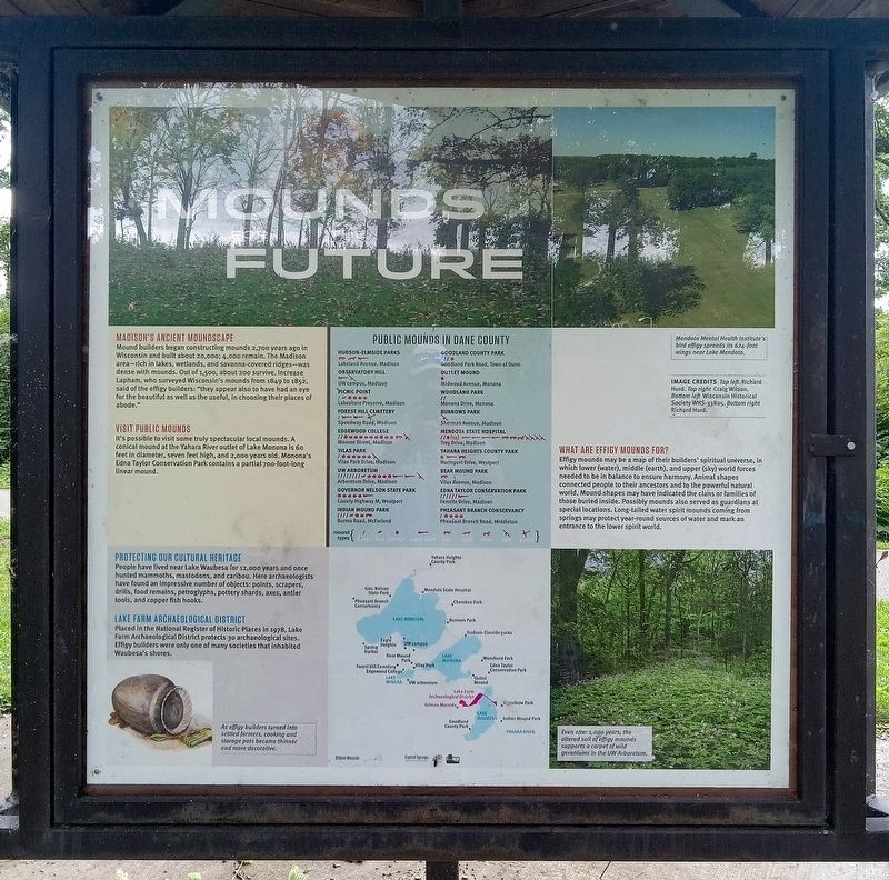
1. Mounds for the Future Marker
Madison's Ancient Moundscape
Mound builders began constructing mounds 2,700 years ago in Wisconsin and built about 20,000. 4,000 remain. The Madison area–rich in lakes, wetlands, and savanna-covered ridges—was dense with mounds. Out of 1,500, about 200 survive. Increase Lapham, who surveyed Wisconsin's mounds from 1849 to 1852, said of the effigy builders: "they appear also to have had an eye for the beautiful as well as the useful, in choosing their places of abode."
Visit Public Mounds
It's possible to visit some truly spectacular local mounds. A conical mound at the Yahara River outlet of Lake Monona is 60 feet in diameter, seven feet high, and 2,000 years old. Monona's Edna Taylor Conservation Park contains a partial 700-foot-long linear mound.
Protecting Our Cultural Heritage
People have lived near Lake Waubesa for 12,000 years and once hunted mammoths, mastodons, and caribou. Here archaeologists have found an impressive number of objects: points, scrapers, drills, food remains, petroglyphs, pottery shards, axes, antler tools, and copper fish hooks.
Lake Farm Archaeological District
Placed in the National
this page online
As effigy builders turned into settled farmers, cooking and storage pots became thinner and more decorative
Public Mounds in Dane County
Hudson-Elmside Parks
Lakeland Avenue, Madison
Observatory Hill
UW campus, Madison
Picnic Point
Lakeshore Preserve, Madison
Forest Hill Cemetery
Speedway Road, Madison
Edgewood College
Monroe Street, Madison
Vilas Park
Vilas Park Drive, Madison
UW Arboretum
Arboretum Drive, Madison
Governor Nelson State Park
County Highway M, Westport
Indian Mound Park
Burma Road, McFarland
Goodland County Park
Goodland Park Road, Town of Dunn
Outlet Mound
Midwood Avenue, Monona
Woodland Park
Monona Drive, Monona
Burrows Park
Sherman Avenue, Madison
Mendota State Hospital
Troy Drive, Madison
Yahara Heights County Park
Northport Drive, Westport
Bear Mound Park
Vilas Avenue, Madison
Edna Taylor Conservation Park
Femrite Drive, Madison
Pheasant Branch Conservancy
Pheasant Branch Road, Middleton
Mendota Mental Health Institute's bird effigy spreads its 624-foot wings near Lake Mendota.
Image Credits: Top left Richard Hurd. Top right Craig Wilson. Bottom left Wisconsin Historical Society WHS-33805. Bottom right Richard Hurd.
What Are Effigy Mounds For?
Effigy
Photographed by McGhiever, July 24, 2025
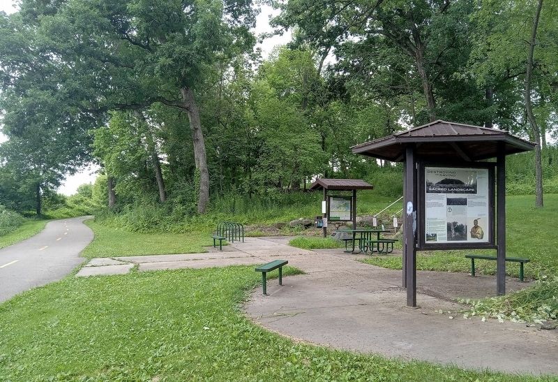
2. The Gilman Mounds kiosk (right) along the Capitol City Trail
Even after 1,000 years, the altered soil of effigy mounds supports a carpet of wild geraniums in the UW Arboretum.
Topics. This historical marker is listed in these topic lists: Anthropology & Archaeology • Cemeteries & Burial Sites • Indigenous Peoples and Communities • Religion & Religious Structures.
Location. 43° 1.518′ N, 89° 21.037′ W. Marker is in Madison, Wisconsin, in Dane County. It is on the Capitol City Trail half a mile west of Lake Farm Road, on the left when traveling west. The marker is at the William C. Fairbanks Memorial Wayside along the paved Capitol City Trail. It is a half-mile walk or bike ride from the closest trailhead. Touch for map. Marker is in this post office area: Madison WI 53711, United States of America. Touch for directions.

Regionally, this marker is in Southeast Wisconsin. It is also in the American Midwest and in the Corn Belt. Globally, it is in North America, the Western Hemisphere, the Western World, and the Anglosphere. Historically, it finds itself in what was once the territory of the Mississippian Culture and also the Northwest Territory.
Other nearby markers. At least 8 other markers are within walking distance of this marker: The Gilman Mounds (here, next to this marker); Destroying and Saving a Sacred Landscape (here, next to this marker); In Memory of Bud Morton 1907-1992 (approx. 0.3 miles away); Lewis Nine Springs E-Way (approx. 0.4 miles away); The Madison Metropolitan Sewerage District Wildlife Observation Area / From Wastewater to Habitat (approx. 0.4 miles away); MMSD Wildlife Observation Area (approx. 0.4 miles away); The Lewis Nine Springs E-Way / Philip and Elizabeth Lewis (approx. 0.4 miles away); Carlos J. Martin Memorial Native American Interpretive Site (approx. 0.9 miles away). Touch for a list and map of all markers in Madison.
Credits. This page was last revised on August 3, 2026. It was originally submitted on August 3, 2026, by McGhiever of Minneapolis, Minnesota. This page has been viewed 16 times since then. Photos: 1. submitted on August 3, 2026, by McGhiever of Minneapolis, Minnesota. 2. submitted on June 14, 2026, by McGhiever of Minneapolis, Minnesota.
