Near Warm Springs in Bath County, Virginia — The American South (Mid-Atlantic)
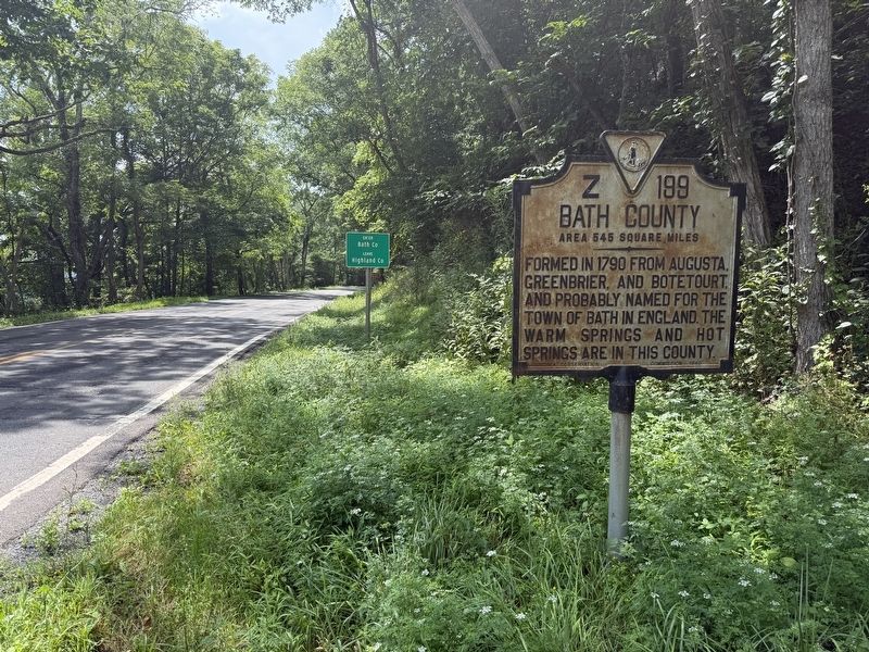
Bath County
Area 545 square miles
⎯⎯⎯
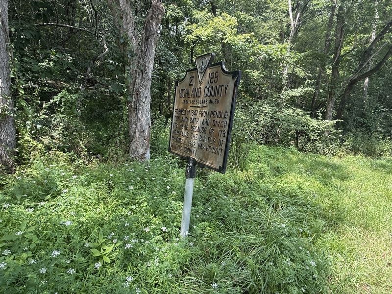
Highland County
Area 422 square miles

Bath County Area 545 square miles. Formed in 1790 from Augusta, Greenbrier, and Botetourt and probably named for the Town of Bath in England. The Warm Springs and Hot Springs are in this county.
Highland County Area 422 square miles. Formed in 1847 from Pendleton and Bath, and given its name because of its mountains. The Battle of McDowell, 1862, was fought in this county.
Erected 1940 by Virginia Conservation Commission. (Marker Number Z-199.)
Topics and series. This historical marker is listed in these topic lists: Natural Features • Political Subdivisions • War, US Civil • Waterways & Vessels. In addition, it is included in the Virginia Department of Historic Resources (DHR) series list. A significant historical year for this entry is 1790.
Location. 38° 13.302′ N, 79° 42.425′ W. Marker is near Warm Springs, Virginia, in Bath County. It is on Jackson River Road (U.S. 220) half a mile south of Bolar Lane, on the right when traveling south. Touch for map. Marker is at or near this postal address: 26606 Jackson River Road, Warm Springs VA 24484, United States of America. Touch for directions.

Regionally,
this page online
Other nearby markers. At least 8 other markers are within 13 miles of this marker, measured as the crow flies: Fort Lewis (approx. 8.2 miles away); Fort George on the Bullpasture River (approx. 9.7 miles away); The Virginia Springs Resorts (approx. 12.2 miles away); Settlement on Warm Springs Mountain (approx. 12.2 miles away); Welcome to Warm Springs Mountain Preserve! (approx. 12.2 miles away); The Land and Natural Resources of Bath County (approx. 12.2 miles away); Life at the Tollhouse (approx. 12.2 miles away); The Turnpike Movement in Virginia, 1825-1835 (approx. 12.2 miles away).

Credits. This page was last revised on August 9, 2026. It was originally submitted on August 9, 2026, by Devry Becker Jones of Washington, District of Columbia. This page has been viewed 9 times since then. Photos: 1, 2, 3, 4. submitted on August 9, 2026, by Devry Becker Jones of Washington, District of Columbia.
