Warm Springs in Bath County, Virginia — The American South (Mid-Atlantic)
Welcome
Make Your Dreams Come True!
| — | Welcome to Bath County Virginia | — |
Bath
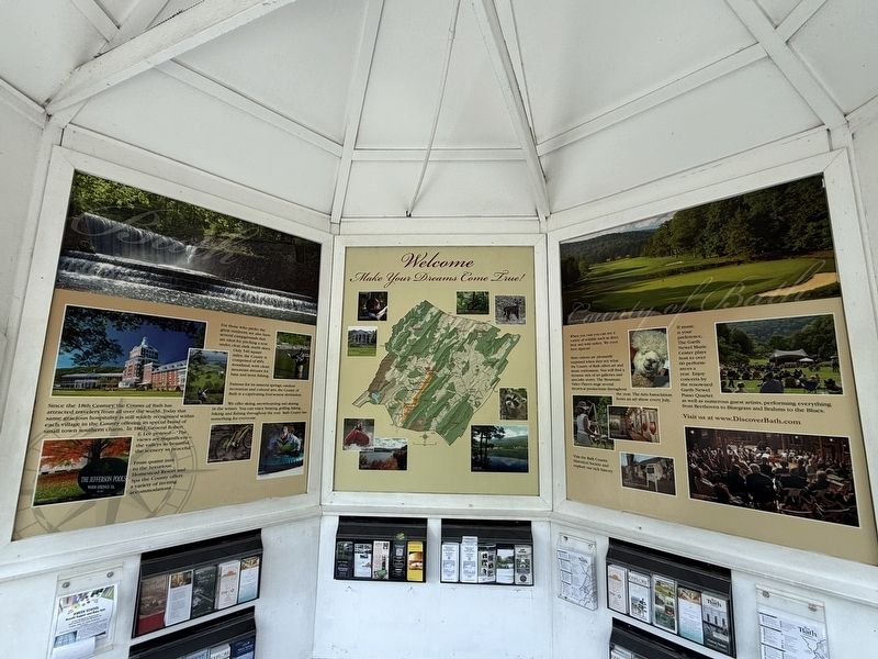
Since the 18th Century, the County of Bath has attracted travelers from all over the world. Today that same gracious hospitality is still widely recognized within each village in the County offering its special brand of small town southern charm. In 1861, General Robert E. Lee penned — "The views are magnificent—the valleys to beautiful, the scenery so peaceful."
From quaint inns to the luxurious Homestead Resort and Spa the County offers a variety of inviting accommodations.
For those who prefer the great outdoors, we also have several campgrounds that are ideal for pitching a tent under, clear, dark, starlit skies. Only 540 square miles, the County is comprised of 89% woodland, with clean mountain streams for bass and trout fishing.
Famous for its mineral springs, outdoor recreation and cultural arts, the County of Bath is a captivating four-season destination.
We offer skiing, snowboarding and skating in the winter. You can enjoy boating, golfing, hiking, biking and fishing throughout the year. Bath County has something for everyone.
County of Bath
When you visit you can see a variety of wildlife
this page online
Most visitors are pleasantly surprised when they see what the County of Bath offers art and music enthusiasts. You will find a dynamic mix of art galleries and specialty stores. The Mountain Valley Players stage several theatrical productions throughout the year. The Arts Association hosts an art show every July.
If music is your preference, The Garth Newel Music Center plays host to over 60 performances a year. Enjoy concerts by the renowned Garth Newel Piano Quartet as well as numerous guest artists, performing everything from Beethoven to Bluegrass and Brahms to the Blues.
Visit us at www.DiscoverBath.com
Visit the Bath County Historical Society and explore our rich history.
Unbroken Forests
Atop almost any mountain in Bath County, one gazes across a sea of ridges rolling to the horizon — an unexpected, unbroken forest in a well-traversed part of America. The native Algonquin people once gazed across these same undulating rows of blue mountain ridges and proclaimed them Allegheny, meaning "endless."
Located in the heart of the Central Appalachians, a chain

Although such views appear largely seamless to the eye, the County is a patchwork quilt of conservation lands. The United States Forest Service, Virginia Department of Conservation and Recreation, Virginia Department of Game and Inland Fisheries, and The Nature Conservancy collectively manage more than 200,000 acres here — conserving one of the largest, most intact forests in the eastern United States.
Underground World
Generations of travelers and even presidents have come to take the healing waters of springs in such namesakes as Warm Springs, Hot Springs, Bath Alum, and Healing Springs. Yet even though the springs are well known, few people are familiar with the unique geology and biological diversity in the underground world beneath our feet.
As rain falls and passes through the soil, it picks
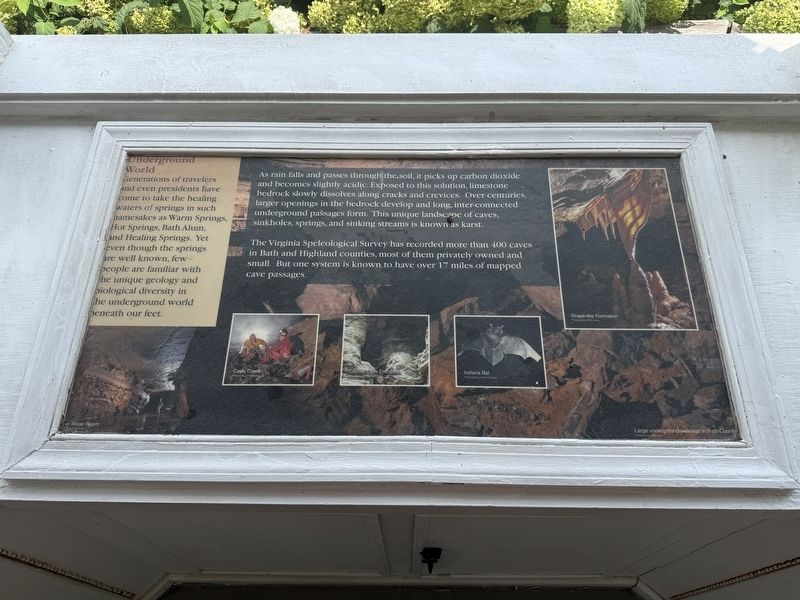
The Virginia Speleological Survey has recorded more than 400 caves in Bath and Highland counties, most of them privately owned and small. But one system is known to have over 17 miles of mapped cave passages.
Pristine Waters
Widely considered Virginia's most pristine river, the Cowpasture rises in neighboring Highland County and winds freely for some 75 miles through a rural landscape of farm fields and rolling pastures. The Cowpasture and Jackson rivers merge near the town of Iron Gate to form the James river, which flows on to the Chesapeake Bay.
The springs and streams rising on the mountains here in Bath County contribute directly to our health and well-being. They provide clean, safe drinking water to the communities in the valleys below. And combined with the pastoral landscapes and mountain splendor,
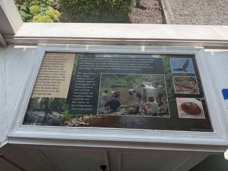
The upper James River basin harbors several endemic species, meaning they are found nowhere else on Earth. For instance, roughead shiner, a globally rare fish, thrives in the Cowpasture's clear, rocky pools.
Erected by Visit Bath County, Inc.
Topics. This historical marker is listed in these topic lists: Natural Features • Notable Places • Parks & Recreational Areas • Waterways & Vessels. A significant historical year for this entry is 1861.
Location. 38° 3.175′ N, 79° 46.858′ W. Marker is in Warm Springs, Virginia, in Bath County. It is on Sam Snead Highway (U.S. 220) north of Mountain Valley Road (Virginia Route 39), on the left. Touch for map. Marker is at or near this postal address: 12968 Sam Snead Hwy, Warm Springs VA 24484, United States of America. Touch for directions.

Regionally, this marker is in Virginia’s Shenandoah Valley, in the Alleghany Highlands, and specifically in the Potomac Highlands. It is also in the American South, specifically in the Upper South, in Appalachia, and specifically in Southern Appalachia. Globally,
Other nearby markers. At least 8 other markers are within walking distance of this marker: Warm Springs Baths (a few steps from this marker); Early Bath County Courthouses (within shouting distance of this marker); The Rev. Dr. William H. Sheppard (about 500 feet away, measured in a direct line); Terrill Hill (approx. ¼ mile away); Mary Johnston (approx. half a mile away); Overshoot Wheel (approx. 0.6 miles away); Waterwheel Restaurant Building (approx. 0.6 miles away); The Dinwiddie Mantle (approx. 0.6 miles away). Touch for a list and map of all markers in Warm Springs.
Credits. This page was last revised on August 9, 2026. It was originally submitted on August 9, 2026, by Devry Becker Jones of Washington, District of Columbia. This page has been viewed 8 times since then. Photos: 1, 2, 3, 4, 5. submitted on August 9, 2026, by Devry Becker Jones of Washington, District of Columbia.
