Grottoes in Augusta County, Virginia — The American South (Mid-Atlantic)
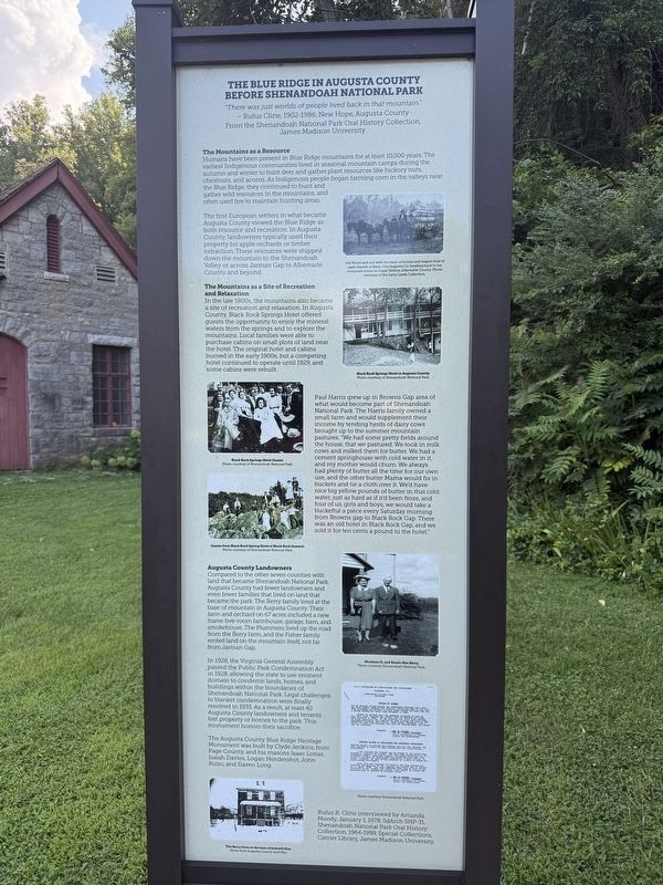
The Blue Ridge in Augusta County Before Shenandoah National Park
Photographed by Devry Becker Jones (CC0), August 8, 2026
1. The Blue Ridge in Augusta County Before Shenandoah National Park Marker
"There was just worlds of people lived back in that mountain."
— Rufus Cline, 1902-1986, New Hope, Augusta County
From the Shenandoah National Park Oral History Collection, James Madison University
The Mountains as a Resource
Humans have been present in Blue Ridge mountains for at least 10,000 years. The earliest Indigenous communities lived in seasonal mountain camps during the autumn and winter to hunt deer and gather plant resources like hickory nuts, chestnuts, and acorns. As Indigenous people began farming corn in the valleys near the Blue Ridge, they continued to hunt and gather wild resources in the mountains, and often used fire to maintain hunting areas.
The first European settlers in what became Augusta County viewed the Blue Ridge as both resource and recreation. In Augusta County, landowners typically used their property for apple orchards or timber extraction. These resources were shipped down the mountain to the Shenandoah Valley or across Jarman Gap to Albemarle County and beyond.
The Mountains as a Site of Recreation and Relaxation
In the late 1800s, the mountains also became a site of recreation
this page online
Paul Harris grew up in Browns Gap area of what would become part of Shenandoah National Park. The Harris family owned a small farm and would supplement their income by tending herds of dairy cows brought up to the summer mountain pastures. "We had some pretty fields around the house, that we pastured. We took in milk cows and milked them for butter. We had a cement springhouse with cold water in it, and my mother would churn. We always had plenty of butter all the time for our own use, and the other butter Mama would fix in buckets and tie a cloth over it. We'd have nice big yellow pounds of butter in that cold water, just as hard as if it'd been froze, and four of us, girls and boys, we would take
Photographed by Devry Becker Jones (CC0), August 8, 2026
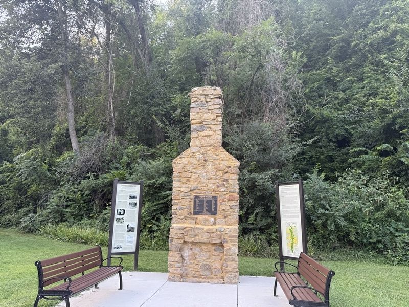
2. Blue Ridge Heritage Project memorial and markers
Augusta County Landowners
Compared to the other seven counties that became Shenandoah National Park, Augusta County had fewer landowners and even fewer families that lived on land that became the park. The Berry family lived at the base of mountain in Augusta County. Their farm and orchard on 67 acres included a new frame five-room farmhouse, garage, barn, and smokehouse. The Plummers lived up the road from the Berry farm, and the Fisher family rented the land on the mountain itself, not far from Jarman Gap.
In 1928, the Virginia General Assembly passed the Public Park Condemnation Act of 1928, allowing the state to use eminent domain to condemn lands, homes, and buildings within the buildings of Shenandoah National Park. Legal challenges to blanket condemnation were finally resolved in 1935. As a result, at least 40 Augusta County landowners and tenants lost property or homes to the park. This monument honors their sacrifice.
The Augusta County Blue Ridge Heritage Monument was built by Clyde Jenkins, from Page County, and his masons Isaac Lonas, Isaiah Davies, Logan Hendershot, John Rizzo, and Daven Long.
Rufus R. Cline interviewed by Amanda Moody, January 1, 1978, SdArch SNP-31, Shenandoah National Park Oral History Collection, 1964-1999, Special Collections, Carrier Library, James Madison University.
Erected by Blue Ridge Heritage Project.
Topics. This historical marker is listed in these topic lists: Agriculture • Indigenous Peoples and Communities • Parks & Recreational Areas • Settlements & Settlers. A significant historical date for this entry is January 1, 1978.
Location. 38° 15.53′ N, 78° 50.082′ W. Marker is in Grottoes, Virginia, in Augusta County. It is on Grand Cavern Road west of South River Road, on the left when traveling west. Touch for map. Marker is at or near this postal address: 5 Grand Cavern Rd, Grottoes VA 24441, United States of America. Touch for directions.

Regionally, this marker is in the Shenandoah Valley. It is also in the American South and specifically in the Upper South. Globally, it is in North America, the Western Hemisphere, the Western World, and the Anglosphere. Historically, it finds itself in what was once the territory of the Mississippian Culture, one of the original Thirteen Colonies, one of the Confederate States of America, and the Antebellum South.
Other nearby markers. At least 8 other markers are within walking distance of this marker: Augusta Memorial (here, next to this marker); Honoring Their Sacrifice (here, next to this marker); a different marker also named Civil War Tourism Attraction (a few steps from this marker); Grand Caverns Inn (within shouting distance of this marker); The Gladys E. Kellow Garden (within shouting distance of this marker); George Caleb Bingham (approx. half a mile away); Veterans Memorial (approx. 0.7 miles away); a different marker also named Veterans Memorial (approx. 0.7 miles away). Touch for a list and map of all markers in Grottoes.
Another marker is no longer nearby. Civil War Tourism Attraction (was a few steps from this marker but has been replaced with another marker now near it).
Additional keywords. rural displacement
Credits. This page was last revised on August 11, 2026. It was originally submitted on August 10, 2026, by Devry Becker Jones of Washington, District of Columbia. This page has been viewed 14 times since then. Photos: 1, 2. submitted on August 10, 2026, by Devry Becker Jones of Washington, District of Columbia.
