Milton in Norfolk County, Massachusetts — The American Northeast (New England)
Indian Trail
1630 - 1930
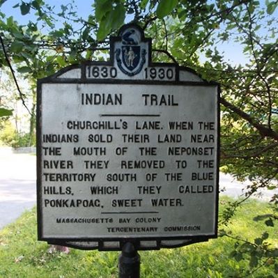
Photographed by Russell C. Bixby, August 31, 2011
1. Indian Trail Marker
Churchill's Lane. When the Indians sold their land near the mouth of the Neponset River they removed to the territory south of the Blue Hills, which they called Ponkapoag, sweet water.
Erected 1930 by Massachusetts Bay Colony-Tercentenary Commission.
Topics and series. This historical marker is listed in these topic lists: Colonial Era • Indigenous Peoples and Communities • Roads & Vehicles • Settlements & Settlers. In addition, it is included in the Massachusetts Bay Colony—Tercentenary Commission Markers series list.
Location. 42° 15.869′ N, 71° 3.846′ W. Marker is in Milton, Massachusetts, in Norfolk County. It is at the intersection of Adams Street and Churchills Lane, on the right when traveling east on Adams Street. Touch for map. Marker is at or near this postal address: 229 Adams St, Milton MA 02186, United States of America. Touch for directions.

Regionally, this marker is in Greater Boston. It is also in the American Northeast, in New England, and on the Eastern Seaboard. Globally, it is in the North Atlantic Region, North America,
this page online
Other nearby markers. At least 8 other markers are within 2 miles of this marker, measured as the crow flies: Birthplace of George Herbert Walker Bush (approx. 0.2 miles away); Bridge and Grist Mill (approx. half a mile away); Milton Cemetery (approx. 0.6 miles away); Mark S. Charbonnier & Richard T. Dever Memorial (approx. 1.1 miles away); Natural Shoreline (approx. 1.1 miles away); Historic Shoreline (approx. 1.1 miles away); A. Michael Mullane (approx. 1½ miles away); Maloney Circle (approx. 1.9 miles away). Touch for a list and map of all markers in Milton.
Related markers. Click here for a list of markers that are related to this marker. Other Markers with information about Ponkapoag and the Massachusett Tribe.
Also see . . .
1. Historical Markers Erected by Massachusetts Bay Colony Tercentenary Commission (1930). Original 1930 publication by the Commonwealth of Massachusetts of Tercentenary Commission Markers, commemorating the three hundredth anniversary of the Massachusetts Bay Colony. (Submitted on August 31, 2011, by Russell Chaffee Bixby of Bernardston, Massachusetts.)
2. Milton Historical Society. The Milton Historical Society is a non-profit organization, founded in 1904 to collect, preserve, publish and exhibit artifacts and records relating to the town of Milton.
There's an article about the Indians of Milton inthe Milton Sampler section. (Submitted on October 15, 2011, by Russell Chaffee Bixby of Bernardston, Massachusetts.)
Credits. This page was last revised on August 17, 2026. It was originally submitted on August 31, 2011, by Russell Chaffee Bixby of Bernardston, Massachusetts. This page has been viewed 1,080 times since then and 75 times this year. Last updated on August 15, 2026, by G.W.Bartlett of Hingham, Massachusetts. Photo 1. submitted on August 31, 2011, by Russell Chaffee Bixby of Bernardston, Massachusetts. • Devry Becker Jones was the editor who published this page.
