
Middelland in Rotterdam, South Holland, Netherlands — Northwestern Europe
Claes de Vrieselaan
Photographed by Andrew Ruppenstein, March 20, 2024
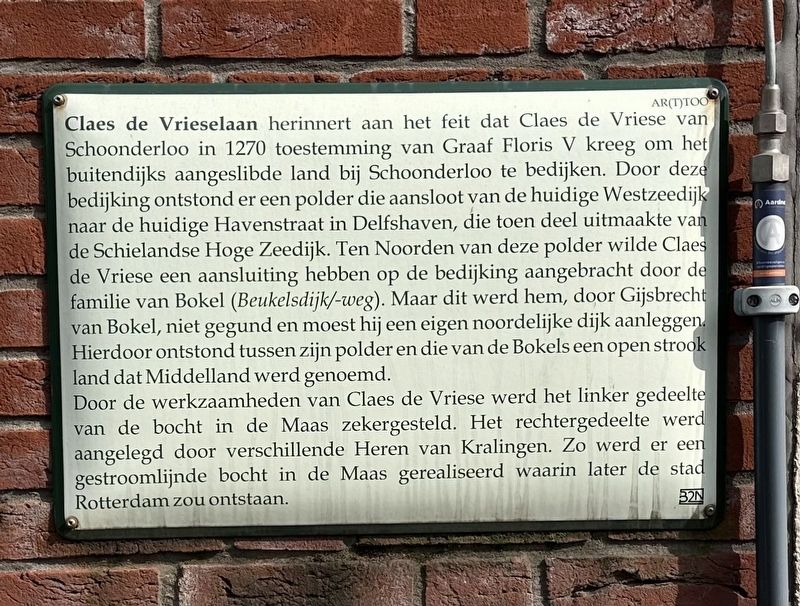
1. Claes de Vrieselaan Marker

Door de werkzaamheden van Claes de Vriese werd het linker gedeelte van de bocht in de Maas zekergesteld. Het rechtergedeelte werd aangelegd door verschillende Heren van Kralingen. Zo werd er een gestroomlijnde bocht in de Maas gerealiseerd waarin later de stad Rotterdam zou ontstaan.
Claes de Vrieselaan commemorates the fact that, in 1270, Claes
this page online
Claes de Vriese’s work secured the left section of the bend in the Meuse River, while the right section was developed by various Lords of Kralingen. This resulted in a streamlined bend in the Meuse, the location where the city of Rotterdam would later emerge.
Erected by the 32N.
Topics. This historical marker is listed in these topic lists: Man-Made Features • Roads & Vehicles • Waterways & Vessels. A significant historical year for this entry is 1270.
Location. 51° 54.811′ N,
Photographed by Andrew Ruppenstein, March 20, 2024
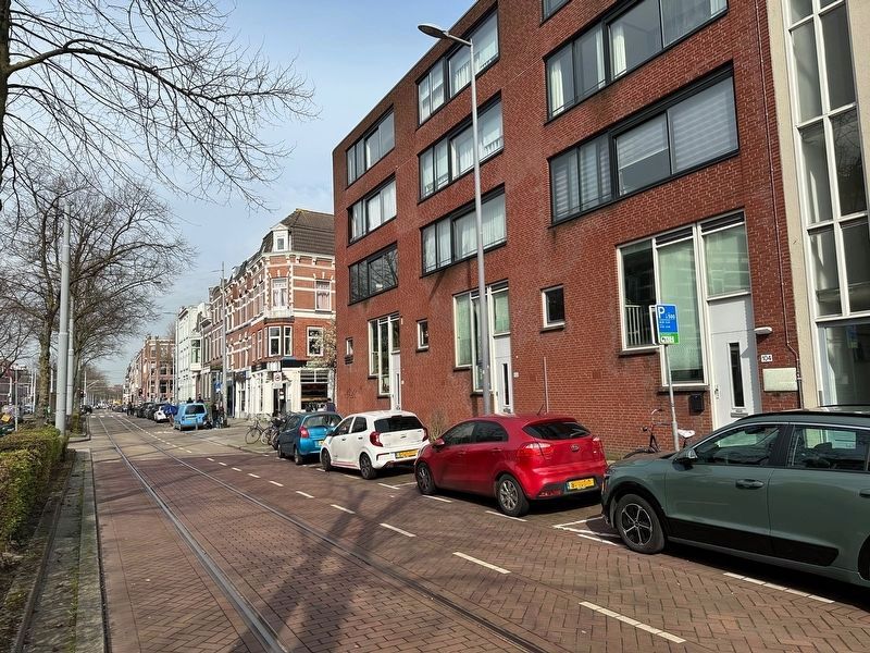
2. Claes de Vrieselaan Marker - wide view, looking north on Claes de Vrieselaan
The marker is visible here on the very right.

Regionally, it is in Europe, the European Union, Atlantic Europe, the Benelux Low Countries, the Schengen Area, Western Europe, and the Western World. Historically, it finds itself in what was once the Roman Empire and specifically also the Holy Roman Empire.
Other nearby markers. At least 8 other markers are within walking distance of this marker: Israëlietisch Oudeliedengesticht / Jewish Old Age Home (about 150 meters away, measured in a direct line); Branco van Dantzig (approx. 0.3 kilometers away); Het Israëlietisch Weeshuis / The Jewish Orphanage (approx. 0.3 kilometers away); Herenhuis / Mansion (approx. 0.3 kilometers away); Lew Jom Sjoel (approx. 0.3 kilometers away); Jacobus Henricus van ‘t Hoff (approx. 0.4 kilometers away); Toni Koopmanplein (approx. 0.6 kilometers away); Henegouwerlaan (approx. 0.7 kilometers away). Touch for a list and map of all markers in Rotterdam.
Credits. This page was last revised on August 17, 2026. It was originally submitted on August 17, 2026, by Andrew Ruppenstein of Lamorinda, California. This page has been viewed 6 times since then. Photos: 1, 2. submitted on August 17, 2026, by Andrew Ruppenstein of Lamorinda, California.
