
Naperville in Will County, Illinois — The American Midwest (Great Lakes)
First Claim on the Confluence
Photographed by Sean P. Flynn, August 18, 2026
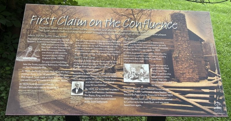
1. First Claim on the Confluence Marker
Where Did the Scotts Come From?
The owner of a schooner named after himself, Stephen J. Scott married Hadassah Trask around 1806 and moved to Unadilla, New York, on the Susquehanna River. Schooners (like the one shown at left) were the transport trucks of New England in the 1800s.
Ten years and five children later the Scotts moved to Baltimore, Maryland, on the Chesapeake Bay. In 1826, the Scotts (in their early 40s) and their children (from 10 to 18 years old) headed west. That August, Scott made a claim at Grosse Point, now portions of Wilmette and Evanston, Illinois. In 1829, Scott discovered that his Grosse Point claim was no longer valid.
The US Government had deeded most of Wilmette and part of Evanston-1,280 acres that included Scott's claim to the half-Potawatomi wife and children of Antoine Ouilmette (namesake of Wilmette), as a reward for convincing area Indians to sign a treaty ceding much of
this page online
Scott's New Claim
In the fall of 1830, Stephen Scott made a claim on the wooded land above "the Forks" of the DuPage River that he and his son Willard had seen on a hunting trip.
According to local histories, Scott and his son Willard lived here through the winter of 1830-1831, known as the Winter of the Deep Snow and described as "four feet of snow for two months."
By 1835, the Scotts had neighbors on the land between the rivers—the Royce, King, and Strong families—and it became known as the Scott Settlement.
The Scotts in Illinois
Stephen Scott is also known as Evanston's first settler, and the Scotts are considered to be early Chicagoans. Stephen Scott was named "constable pro tem" for the Chicago region in 1829.
In 1834, Scott and another settler took over the well-known Laughton brothers' tavern, an early stagecoach stop on the Des Plaines River, when the owners died.
Scott also owned a sawmill on the West Branch near "the Forks" in partnership with another settler, turning logs into much-needed lumber for the area.
In 1837, Stephen and Hadassah moved across the river to Naper Settlement,
Photographed by Sean P. Flynn, August 18, 2026
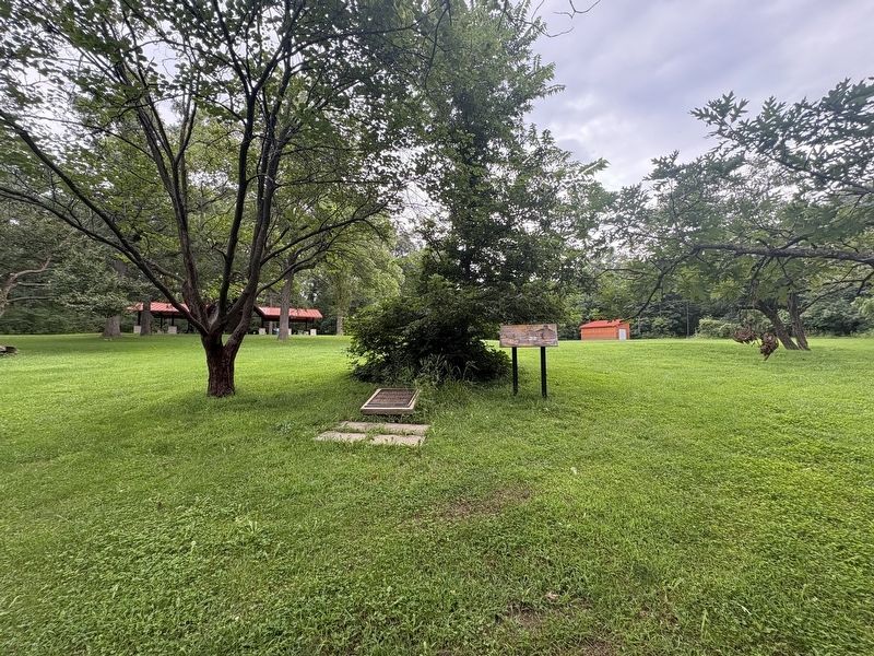
2. Two markers about the Scott Settlement
Topics. This historical marker is listed in these topic lists: Indigenous Peoples and Communities • Settlements & Settlers • Waterways & Vessels • Women. A significant historical year for this entry is 1830.
Location. 41° 42.744′ N, 88° 8.423′ W. Marker is in Naperville, Illinois, in Will County. It can be reached from Knoch Knolls Road 1.2 miles east of 95th Street, on the right when traveling east. The marker is in Knoch Knolls Park, near the Rus Pavilion. Touch for map. Marker is at or near this postal address: 336 Knoch Knolls Road, Naperville IL 60565, United States of America. Touch for directions.

Regionally, this marker is in Greater Chicago. It is also in the American Midwest. Globally, it is in North America, on the Great Lakes, in the Western Hemisphere, in the Western World, and in the Anglosphere. Historically, it finds itself in what was once the territory of the Mississippian Culture and also the Northwest Territory.
Photographed by Sean P. Flynn, August 18, 2026
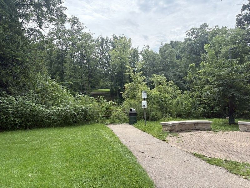
3. A view of the Scott Settlement site from across the DuPage River's West Branch
Other nearby markers. At least 8 other markers are within walking distance of this marker: Scott Settlement (here, next to this marker); Knoch Knolls Park (within shouting distance of this marker); Where the Rivers Meet (within shouting distance of this marker); Not Prairie, Not Woods (about 300 feet away, measured in a direct line); Are You Curious About the River? (about 400 feet away); The Land Where the Rivers Meet (about 600 feet away); a different marker also named Where the Rivers Meet (about 600 feet away); a different marker also named Where the Rivers Meet (about 600 feet away). Touch for a list and map of all markers in Naperville.
More about this marker. A separate plaque about the Scott Settlement is just next to this marker.
Photographed by Sean P. Flynn, August 18, 2026
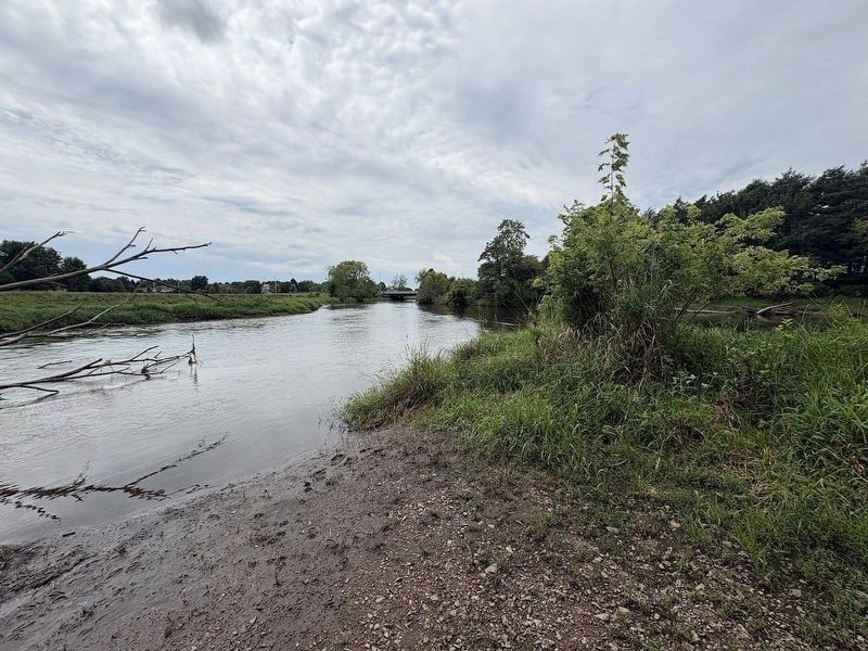
4. The confluence of the east and west branches of the DuPage River
The location of "The Forks" is a roughly one-mile hike southwest from this marker. In this southwest-facing photo, the east branch on the left merges with the west branch on the right. The DuPage River then travels south another 25 miles or so until feeding into the Des Plaines River near Channahon.
Credits. This page was last revised on August 20, 2026. It was originally submitted on August 19, 2026, by Sean P. Flynn of Oak Park, Illinois. This page has been viewed 7 times since then. Photos: 1, 2. submitted on August 19, 2026, by Sean P. Flynn of Oak Park, Illinois. 3, 4. submitted on August 20, 2026, by Sean P. Flynn of Oak Park, Illinois.
