Altamont in Albany County, New York — The American Northeast (Mid-Atlantic)
Welcome to Altamont
A Long Path Trail Town
⎯⎯⎯
Altamont
Where History and Nature Meet

Photographed by Trudi Jacobson, August 20, 2026
1. Center Panel
Welcome to Altamont, a Long Path Trail Town
About the Long Path
The Long Path is a long-distance hiking trail connecting New York City with the Adirondack Park. This unique trail offers hikers a challenging and rewarding journey through New York's beautiful and iconic natural areas showcasing diverse landscapes made up of forests, mountains, valleys, rivers, and communities.
Conceived in the 1930s, the Long Path was originally envisioned to be an orienteering venture between scenic and historic points in New York State. Its proponents encouraged hikers to embrace exploration and use maps and compasses to navigate between these points making each journey a unique adventure of discovery. Today, the Long Path is a project of the New York-New Jersey Trail Conference and follows a marked trail. The aqua-blazed route travels through many significant historic and geologic regions including the Hudson River Valley and Palisades, Harriman State Park, Shawangunk Ridge, Catskill Mountains, Schoharie Valley, and the Helderberg Escarpment. Work to improve the Long Path continues along the length of the trail, in particular
this page online
The Long Path is built and maintained by partnerships between land managers and people just like you. Around the Village of Altamont the Long Path is maintained by the Long Path North Hiking Club.
To learn more, find maps, and get involved as a volunteer, scan the QR code or visit www.TheLongPath.org
Altamont, Where History and Nature Meet
Conservation Vision: the Helderberg Greenway
Altamont is the hub of the Helderberg Greenway, a community initiative to connect Thacher Park with the Bozen Kill corridor via a continuous green belt of conserved public and private lands offering access to hiking trails.
For generations, Altamont and the Helderberg Escarpment have been recognized as a destination of natural beauty that is convenient to reach but beyond urban crowding and suburban sprawl.
The splendid setting and unique geology have been valued for centuries. This land was part of the traditional ancestral territory of the Mohican People and was traversed by their western Mohawk neighbors. The first Dutch settlers called the escarpment "Hellebergh," which in their

Photographed by Trudi Jacobson, August 20, 2026
2. Left Panel
Abundant in exposures that record geologic processes, the Helderberg Escarpment is studied by geologists worldwide. Rich in fossil evidence of biological evolution, the area continues to foster diverse flora and fauna.
The Helderberg Greenway will help preserve this legacy by buffering and protecting the unique natural landscapes that contribute to Altamont's distinctive and valued sense of place.
If you would like to volunteer or contribute to this effort, or for more information on the Helderberg Greenway, please scan the QR code or visit www.HistoricAltamont.org.
Erected by Historic Altamont.
Topics. This historical marker is listed in these topic lists: Environment • Indigenous Peoples and Communities • Paleontology • Parks & Recreational Areas.
Location. 42° 42.063′ N, 74° 1.909′ W. Marker is in Altamont, New York, in

Photographed by Steve Stoessel, August 22, 2026
3. Right Panel (A Bulletin Board)

Regionally, this marker is in Upstate New York, in the Capital District, and in the Albany Metropolitan Area. It is also in the American Northeast and in the Mid-Atlantic. Globally, it is in North America, the Western Hemisphere, the Western World, and the Anglosphere. Historically, it finds itself in what was once New Netherland and also one of the original Thirteen Colonies.
Other nearby markers. At least 8 other markers are within walking distance of this marker: First National Bank of Altamont / Primer Banco Nacional de Altamont (a few steps from this marker); Old Hellebergh (within shouting distance of this marker); Dedicated (within shouting distance of this marker); Altamont, New York (within shouting distance of this marker); Delaware & Hudson (within shouting distance of this marker); a different marker also named Altamont (within shouting distance of this

Photographed by Steve Stoessel, August 22, 2026
4. Welcome to Altamont/ Altamont Marker
More about this marker. The third panel of the sign unit is used for local notices.

Photographed by Trudi Jacobson, August 20, 2026
5. Kiosk Containing the Three Panels
Photographed by Steve Stoessel, August 22, 2026
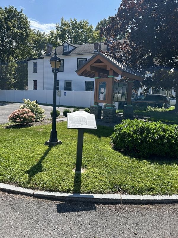
6. Welcome to Altamont/ Altamont Marker
The wooden structure in the background is the Welcome to Altamont marker.
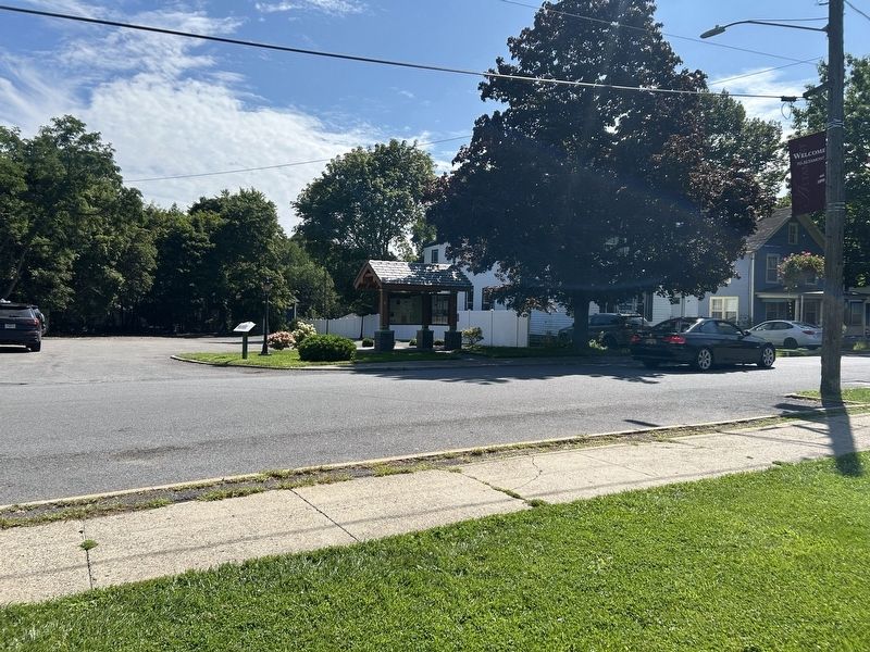
Photographed by Steve Stoessel, August 22, 2026
7. Welcome to Altamont/ Altamont Marker
Credits. This page was last revised on October 15, 2026. It was originally submitted on August 20, 2026, by Trudi Jacobson of Slingerlands, New York. This page has been viewed 31 times since then. Photos: 1. submitted on August 21, 2026, by Trudi Jacobson of Slingerlands, New York. 2. submitted on August 20, 2026, by Trudi Jacobson of Slingerlands, New York. 3, 4. submitted on August 23, 2026, by Steve Stoessel of Niskayuna, New York. 5. submitted on August 23, 2026, by Trudi Jacobson of Slingerlands, New York. 6, 7. submitted on August 23, 2026, by Steve Stoessel of Niskayuna, New York. • J. J. Prats was the editor who published this page.
