Mahncke Park in San Antonio in Bexar County, Texas — The American South (West South Central)
1719 Acequia Madre and Diversion Dam

Photographed by Alice Mansell, August 18, 2026
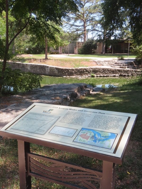
1. 1719 Acequia Madre and Diversion Dam Marker
The large limestone blocks in front of you are part of an interpretive structure that replicate the original Diversion Dam that once stood here. At this bend in the San Antonio River, the Spanish and American Indians of the Province of Texas built the Diversion Dam to channel the river water to the massive 1719 Acequia Madre, an irrigation canal and major source of water for San Antonio. The dam crossed the river at what is now the Witte Museum and funneled water into the 1719 Acequia Madre. The 1719 Acequia Madre flowed south along what is now Broadway, more than two miles through the farms of South Texas, on its journey to what became the Mission San Antonio de Valero (the Alamo) and then back into the San Antonio River.
Mapa de Presidio de San Antonio de Béxar, i sus Misiones de la Provincia de Texas, 1764
The John Carter Brown Library at Brown University
Church of the Alamo, 1839-1840
Gift of Keith Gledhill, Witte Museum Collection
Witte Museum campus with overlay of 1719 Acequia Madre Diversion Dam
Erected by The Witte Museum.
Topics. This historical marker is listed in these topic lists:
this page online
Location. 29° 27.793′ N, 98° 28.008′ W. Marker is in San Antonio, Texas, in Bexar County. It is in Mahncke Park. It can be reached from Broadway north of Tuleta Drive. Marker is on a trail accessible from the Brackenridge Park’s Brackenridge Joske Pavilion Trail and also from The Broadway Boardwalk shopping and business center located at 4119 Broadway which has a footpath and bridge to the marker. Touch for map. Marker is at or near this postal address: 4119 Broadway, San Antonio TX 78209, United States of America. Touch for directions.

Regionally, this marker is in South Texas. It is also in the American South. Globally, it is in North America, a Gulf of Mexico state, the Western Hemisphere, the Western World, and the Anglosphere. Historically, it finds itself in what was once New Spain, the Republic of Texas, and one of the Confederate States of America.
Other nearby markers. At least 8 other markers are within walking distance of this marker: Onderdonk Artist Studio
Photographed by Alice Mansell, August 18, 2026
2. View from marker across San Antonio River towards the Witte Museum
More about this marker. Many picnic tables are located in sight of the marker, all are under tall and shady trees.
Regarding 1719 Acequia Madre and Diversion Dam. This Spanish and local Indians diversion of the San Antonio River to irrigate farm fields was the third such water project built in 1719 in the San Antonio area. The first diversion was at the nearby San Pedro Creek and the second was the Upper Labor Acequia off the west side of the San Antonio River at this site. Later in 1719 at this site was built a dam to divert water from the San Antonio River’s east side to create the Acequia Madre, also known as the Alamo Acequia. (I. Wayne Cox, “The Spanish Acequias of San Antonio,” Maverick Publishing Company, 2005)

Photographed by Alice Mansell, August 18, 2026
3. 1719 Acequia Madre and Diversion Dam Marker
View from a few steps away from the marker is the reconstructed diversion ditch (acequia) branching off from the east side of the San Antonio River to recreate part of what was the Acequia Madre, also known as the Alamo Acequia.

Photographed by Alice Mansell, August 18, 2026
4. 1719 Acequia Madre and Diversion Dam Marker
View towards the marker from the pathway via The Broadway Boardwalk center and across the bridge over the San Antonio River.
Credits. This page was last revised on September 4, 2026. It was originally submitted on August 31, 2026, by Alice Mansell of Los Altos, California. This page has been viewed 12 times since then. Photos: 1, 2, 3, 4. submitted on August 31, 2026, by Alice Mansell of Los Altos, California. • James Hulse was the editor who published this page.
