Lakeside At Frisco Bridges in Collin County, Texas — The American South (West South Central)
Tribes and Trails
Kathy Seei Park
Photographed by James Hulse, September 3, 2026
1. Tribes and Trails Marker
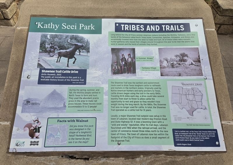
Long before the City of Frisco existed, American Indians including the Wichita, Tonkawa, and a few bands of the Delaware called North Texas home. Comanches, Apaches, Kickapoos, and Kiowa also occasionally traveled here from the west to trade and hunt. All of these tribes were nomadic hunter-gatherers who moved their villages around throughout the year to be near the plants that were in season and the herds of animals they hunted.
In Summer, Kiowa Pinehart F.A. Boston Public Library
Tonkawa Village Photo credit: Frisco Heritage Museum
The Shawnee Trail was the earliest and easternmost route used to drive Texas longhorn cattle to railheads and markets in the northern states. Originally used by Native American hunters and early pioneers to Texas, cattle drivers began using the trail in the early 1840s. Traveling 10-15 miles each day, a drive could take several months from start to finish to allow cattle the opportunity to rest and graze so they wouldn’t lose weight during the long march. By the 1880s, the Shawnee Trail was no longer used for cattle. In total, the Shawnee Trail operated as a cattle trail for 31
this page online
Locally, a major Shawnee Trail outpost was setup in the town of Lebanon, located near modern-day Preston Road and State Highway 121. It was a booming town with a “wild and woolly” reputation. After its trail days, Lebanon flourished until 1902 when the railroad arrived, and the center of commerce moved three miles north to the new town of Frisco. The town of Lebanon now lies within the footprint of the City of Frisco as does a small segment of the Shawnee Trail.
“Call it a buffalo trail...or the Texas Trail, Preston White Rock Road, an immigrant trail of the ‘Divide’ Road. Or call it the Cattle Trail, the Shawnee Trail, or the Kansas Trail. Or just call it Preston Road. By any name it is the oldest north-south road in North Central Texas.”
—Adelle Rogers Clark
Shawnee Trail Cattle Drive, Anita Pauwels, 2003. The public art installation in this park is a walkable history lesson of the Shawnee Trail. Photo credit: Martin Iles
During the spring, summer, and fall, the Wichita people settled in North Texas to farm and hunt. They used the abundant prairie grass in the area to make tall grass houses. These houses could
Photographed by James Hulse
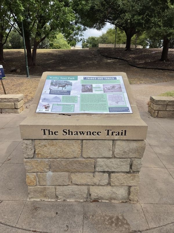
2. Tribes and Trails Marker
Photo credit: University of North Texas Libraries
Facts with Walnut
Did you know this park was designed in the shape of a longhorn’s head? Parkwood Blvd. is the horns! Do you see it on the map?
Erected by City of Frisco.
Topics. This historical marker is listed in these topic lists: Indigenous Peoples and Communities • Parks & Recreational Areas • Roads & Vehicles. A significant historical year for this entry is 1902.
Location. 33° 6.259′ N, 96° 49.037′ W. Marker is in Frisco, Texas, in Collin County. It is in Lakeside At Frisco Bridges. It is on Seei Cir west of Parkwood Boulevard, on the left when traveling west. Touch for map. Marker is at or near this postal address: 3155 Parkwood Blvd, Frisco TX 75034, United States of America. Touch for directions.

Regionally, this marker is in the Prairies & Lakes Region and in the Dallas-Fort Worth Metropolitan Area. Globally, it is in North America, a Gulf of Mexico state, the Western Hemisphere, the Western World, and the Anglosphere. Historically, it finds itself in what was once New Spain, the Republic of Texas, one of the Confederate
Photographed by James Hulse, September 3, 2026
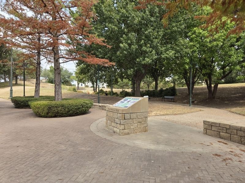
3. Tribes and Trails Marker
Other nearby markers. At least 8 other markers are within walking distance of this marker: Twin Wells (within shouting distance of this marker); Mayor Kathy A. Seei (within shouting distance of this marker); a different marker also named Tribes and Trails (within shouting distance of this marker); The Trail Drive Company (approx. 0.2 miles away); Trail Driving Prior to 1845 (approx. 0.4 miles away); The Texas Longhorn (approx. 0.4 miles away); The Cow Camp (approx. 0.4 miles away); The Trail Crew (approx. 0.4 miles away). Touch for a list and map of all markers in Frisco.
More about this marker. This is one of two duplicate markers within the park
Credits. This page was last revised on September 4, 2026. It was originally submitted on September 3, 2026, by James Hulse of Medina, Texas. This page has been viewed 14 times since then. Photos: 1, 2, 3. submitted on September 4, 2026, by James Hulse of Medina, Texas.
