
Near Chase City in Charlotte County, Virginia — The American South (Mid-Atlantic)
Charlotte County
⎯⎯⎯
Mecklenburg County
Photographed by Bernard Fisher, May 18, 2010
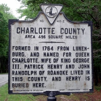
1. Charlotte County Marker (obverse)
Charlotte County. Area 496 square miles. Formed in 1764 from Lunenburg, and named for Queen Charlotte, wife of King George III. Patrick Henry and John Randolph of Roanoke lived in this county, and Henry is buried here.
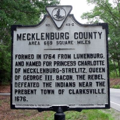
Mecklenburg County. Area 669 square miles. Formed in 1764 from Lunenburg, and named for Princess Charlotte, of Mecklenburg-Strelitz, queen of George III. Bacon the Rebel defeated the Indians near the present town of Clarksville, 1676.
Erected 1928 by Conservation & Development Commission. (Marker Number Z-43.)
Topics and series. This historical marker is listed in these topic lists: Colonial Era • Indigenous Peoples and Communities • Political Subdivisions • War, US Revolutionary • Women. In addition, it is included in the Virginia Department of Historic Resources (DHR) series list. A significant historical year for this entry is 1764.
Location. 36° 48.288′ N, 78° 34.005′ W. Marker is near Chase City, Virginia, in Charlotte County. It is at the intersection of Jeb Stuart Highway (Virginia Route 92) and Godseys Lane, on the right when traveling west on Jeb Stuart Highway. Touch for map.
this page online

Regionally, this marker is in Virginia’s Piedmont, in Southside Virginia, and specifically in Central Virginia. It is also in the American South and specifically in the Upper South. Globally, it is in North America, the Western Hemisphere, the Western World, and the Anglosphere. Historically, it finds itself in what was once the territory of the Mississippian Culture, one of the original Thirteen Colonies, one of the Confederate States of America, and the Antebellum South.
Other nearby markers. At least 8 other markers are within 6 miles of this marker, measured as the crow flies: Wylliesburgh (approx. 3.7 miles away); Paul Carrington (approx. 3.8 miles away); Roanoke Plantation (approx. 4 miles away); a different marker also named Staunton Bridge Action (approx. 4 miles away); The War of 1812 / War of 1812 Opposition — John Randolph (approx. 4.2 miles away); a different marker also named Salem School (approx. 4.6 miles away); Thyne Institute (approx. 5.3 miles away); a different marker also named Thyne Institute
Photographed by Bernard Fisher, May 18, 2010
2. Mecklenburg County Marker (reverse)
Other markers no longer nearby. Staunton Bridge Action (was approx. 4 miles away but has been replaced with another marker now near it); Salem School (was approx. 4.6 miles away but has been replaced with another marker now near it); a different marker also named Thyne Institute (was approx. 5.3 miles away but has been replaced with another marker now near it).
Also see . . .
1. Charlotte County, Virginia. (Submitted on May 21, 2010, by Bernard Fisher of Richmond, Virginia.)
2. Mecklenburg County, Virginia. (Submitted on May 21, 2010, by Bernard Fisher of Richmond, Virginia.)
Photographed by Bernard Fisher, May 18, 2010
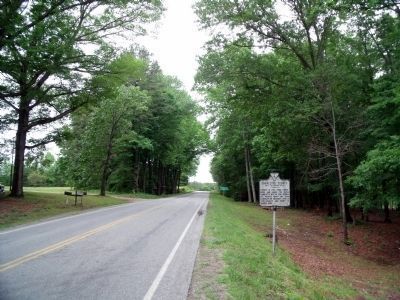
3. Jeb Stuart Highway (facing west)
Photographed by Bernard Fisher, May 18, 2010
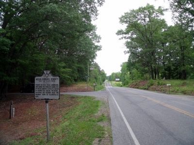
4. Jeb Stuart Highway (facing east)
Credits. This page was last revised on July 6, 2021. It was originally submitted on May 21, 2010, by Bernard Fisher of Richmond, Virginia. This page has been viewed 1,032 times since then and 33 times this year. Photos: 1, 2, 3, 4. submitted on May 21, 2010, by Bernard Fisher of Richmond, Virginia.
