
Newhall in Santa Clarita in Los Angeles County, California — The American West (Pacific Coastal)
La Puerta
"The Door"
Photographed by Craig Baker, September 5, 2026
1. La Puerta Marker
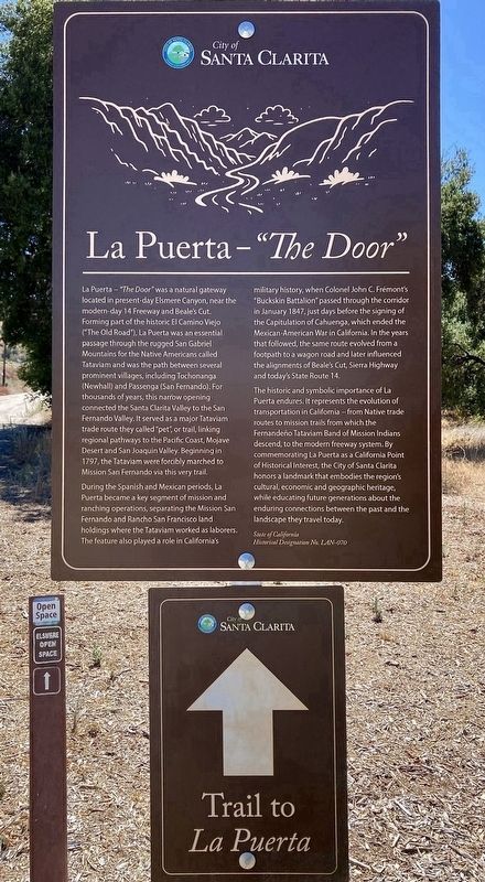
La Puerta - "The Door" was a natural gateway located in present-day Elsmere Canyon, near the modern-day 14 Freeway and Beale's Cut. Forming part of the historic El Camino Viejo ("The Old Road"), La Puerta was an essential passage through the rugged San Gabriel Mountains for the Native Americans called Tataviam and was the path between several prominent villages, including Tochonanga (Newhall) and Passenga (San Fernando). For thousands of years, this narrow opening connected the Santa Clarita Valley to the San Fernando Valley. It served as a major Tataviam trade route they called "pet", or trail, linking regional pathways to the Pacific Coast, Mojave Desert and San Joaquin Valley. Beginning in 1797, the Tataviam were forcibly marched to Mission San Fernando via this very trail.
During the Spanish and Mexican periods, La Puerta became a key segment of mission and ranching operations, separating the Mission San Fernando and Rancho San Francisco land holdings where the Tataviam worked as laborers. The feature also played a role in California's military history, when Colonel John C. Frémont's "Buckskin Battalion" passed through the corridor in January 1847, just days before the signing of the Capitulation of Cahuenga, which ended the Mexican-American War in California. In the years that followed, the same route evolved from a footpath to a wagon road and later influenced the alignments of Beale's Cut, Sierra Highway and today's State Route 14.
The historic and symbolic importance of La Puerta endures. It represents the evolution of transportation in California - from Native trade routes to mission trails from which the Fernandeño Tataviam Band of Mission Indians descend, to the modern freeway system. By commemorating La Puerta as a California Point of Historical
this page online
State of California historical designation number LAN-070.
Erected 2026 by City of Santa Clarita. (Marker Number LAN-070.)
Topics. This historical marker is listed in these topic lists: Exploration • Hispanic Americans • Indigenous Peoples and Communities • Roads & Vehicles. A significant historical month for this entry is January 1847.
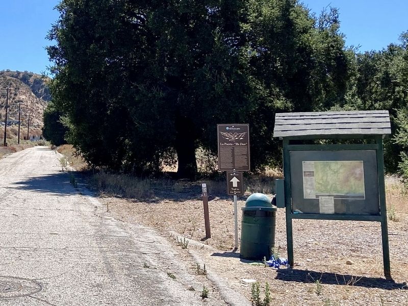
Location. 34° 21.333′ N, 118° 30.455′ W. Marker is in Santa Clarita, California, in Los Angeles County. It is in Newhall. It is on Remsen Street just east of Sierra Highway. Touch for map. Marker is at or near this postal address: 22784 Remsen St, Newhall CA 91321, United States of America. Touch for directions.

Regionally, this marker is in Greater Los Angeles and in the Transverse Ranges. It is also on the American Pacific Coast. Globally, it is in North America, on the Ring of Fire, in the Pacific Rim, in the Western Hemisphere,
Photographed by Craig Baker, September 5, 2026
2. La Puerta Marker
Other nearby markers. At least 8 other markers are within 2 miles of this marker, measured as the crow flies: Live Oak Manor Rock Arch (within shouting distance of this marker); Lyons Station (approx. half a mile away); Last Horse Drawn Hearse of Los Angeles County (approx. half a mile away); Eternal Valley (approx. half a mile away); Mark Twain (approx. half a mile away); a different marker also named La Puerta (approx. ¾ mile away); Pioneer Oil Refinery (approx. 1.2 miles away); Ramona Chapel (approx. 1½ miles away). Touch for a list and map of all markers in Santa Clarita.
Another marker is no longer nearby. Beale's Cut (was approx. 0.9 miles away but has been confirmed missing).
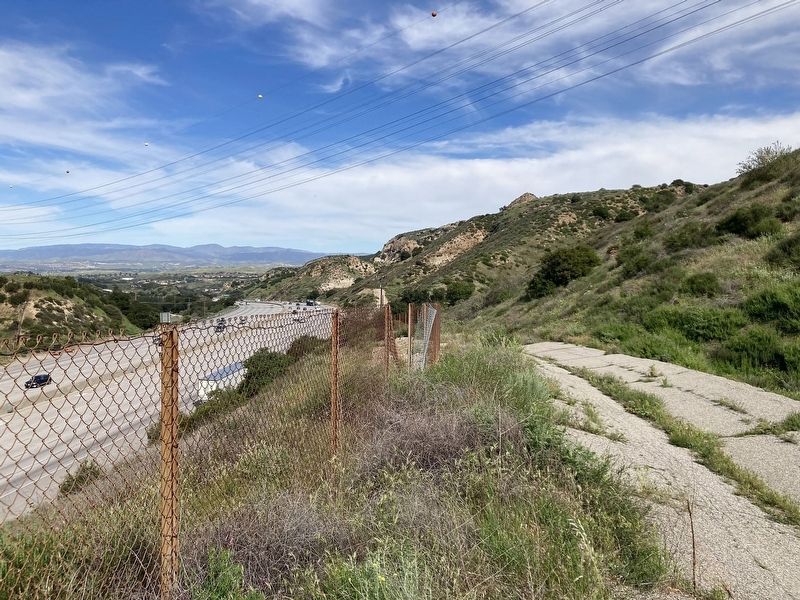
Regarding La Puerta. Hike 1 mile from the marker to the historic site. Nothing remains of the original trail at La Puerta.
This is a California Point of Historical Interest (not a California Historical Landmark).
Photographed by Craig Baker, September 5, 2026
3. La Puerta Marker
Photographed by Craig Baker, March 3, 2026
4. La Puerta location
The trail at the location follows a service road next to the 14 freeway.
Credits. This page was last revised on September 8, 2026. It was originally submitted on September 5, 2026, by Craig Baker of Sylmar, California. This page has been viewed 12 times since then. Photos: 1, 2, 3. submitted on September 5, 2026, by Craig Baker of Sylmar, California. 4. submitted on March 3, 2026, by Craig Baker of Sylmar, California.
