Alamo Plaza in San Antonio in Bexar County, Texas — The American South (West South Central)
The Mission Period
1716 - 1793
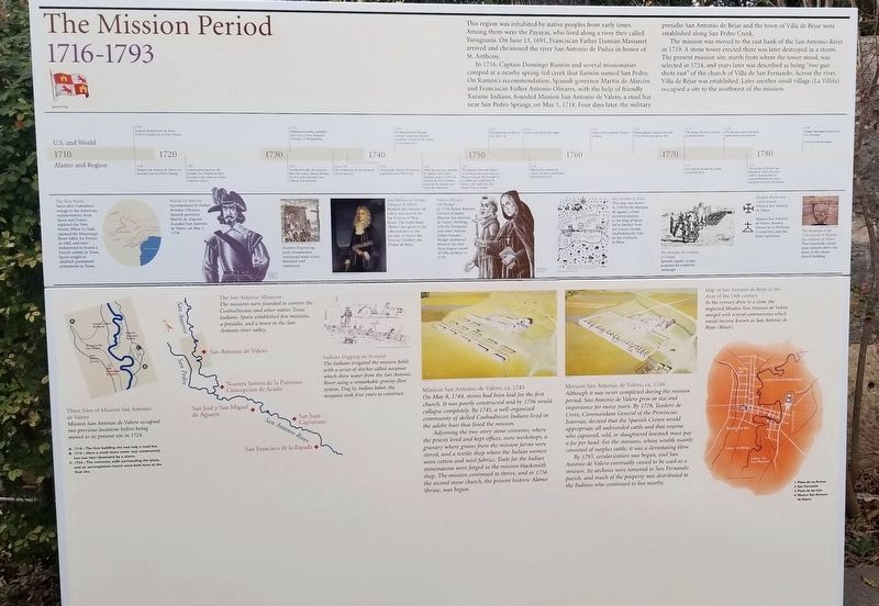
This region was inhabited by native peoples from early times. Among them were the Payayas, who lived along a river they called Yanaguana. On June 13, 1691, Franciscan Father Damián Massanet arrived and christened the river San Antonio de Padua in honor of St. Anthony.
In 1716, Captain Domingo Ramón and several missionaries camped at a nearby spring-fed creek that Ramón named San Pedro. On Ramón's recommendation, Spanish governor Martín de Alarcón and Franciscan Father Antonio Olivares, with the help of friendly Xarame Indians, founded Mission San Antonio de Valero, a mud hut near San Pedro Springs, on May 1, 1718. Four days later, the military presidio San Antonio de Béjar and the town of Villa de Béjar were established along San Pedro Creek.
The mission was moved to the east bank of the San Antonio River in 1719. A stone tower erected there was later destroyed in a storm. The present mission site, north from where the tower stood, was selected in 1724, and years later was described as being “two gun shots east” of the church of Villa de San Fernando. Across the river, Villa de Béjar was established. Later another small village (La Villita) occupied a site to the southwest of the mission.
[A time line contrasting events in the U.S. and World and Alamo and Region helps set the stage for undertanding the Mission Period]
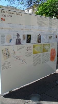
[Diagrams and drawings cover much of the marker and have accompanying text, which is transcribed below]
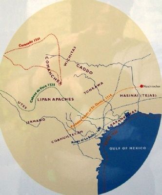
The New World [see photo #4]
Soon after Columbus' voyage to the Americas, representatives from Spain and France explored the New World. When La Salle claimed the Mississippi River Valley for France in 1682, and later endeavored to found a French colony in Texas, Spain sought to establish permanent settlements in Texas.
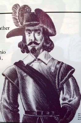
Martín De Alarcón [see photo #5]
Accompanied by Father Antonio Olivares, Spanish governor Martín de Alarcón founded San Antonio de Valero on May 1, 1718.
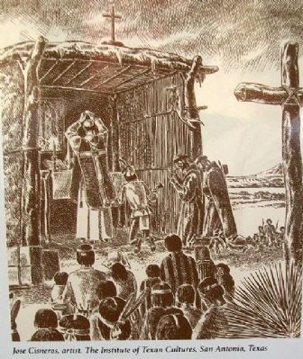
Humble Beginnings [see photo #6]
Early missionaries conducted mass under thatched-roof enclosures.
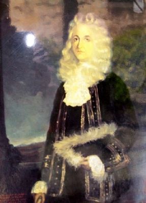
Don Baltizar de Zúniga, Marques de Valero [see photo #7]
Mission San Antonio de Valero was named for the Viceroy of New Spain. The name Béjar (Béxar) was given to the villa and later to the presidio to honor the Viceroy's brother, the Duque de Béjar.
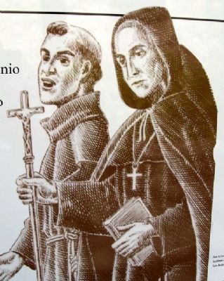
Fathers Olivares and Margil [see photo #8]
In 1718, Father Antonio Olivares founded Mission San Antonio de Valero. Working with the Pamposas and other Indians, Father Antonio Margil established Mission San José three leagues south of Villa de Béjar in 1720.
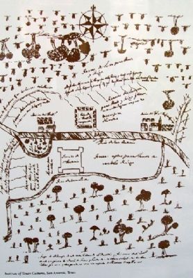
San Antonio de Béjar [see photo #9]
This map was drawn in 1730 by the Marques de Aguayo, whose recommendation to the king of Spain led to families from the Canary Islands establishing the Villa de San Fernando de Béjar.
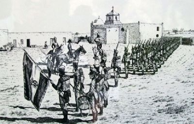
The Presidio de La Bahía at Goliad [see photo #10]
Spanish regular troops prepared for a military campaign.
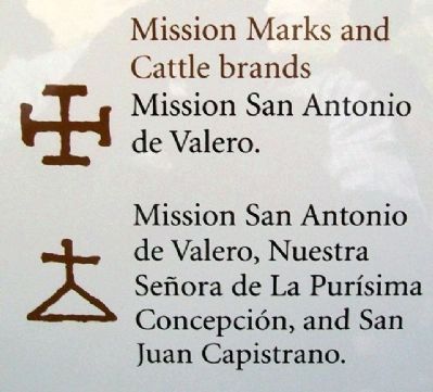
Mission Marks and Cattle brands [see photo #11]
Mission San Antonio de Valero [and] Mission San Antonio de Valero, Nuestra Senora de La Purísma Concepción, and San Juan Capistrano.
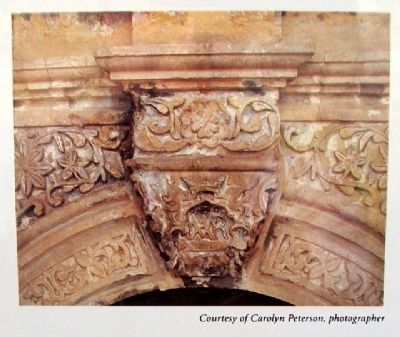
The Keystone of the 1756 church of Mission San Antonio de Valero [see photo #12]
This beautifully carved stone remains above the doors of the Alamo church building.
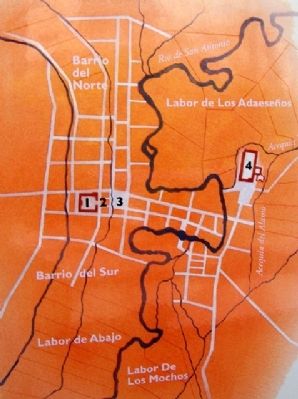
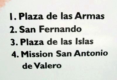
Map of San Antonio de Béjar at the close of the 18th century [see photos #13/14]
As the century drew to a close, the neglected Mission San Antonio de Valero merged with several communities which would become known as San Antonio de Béjar (Béxar).
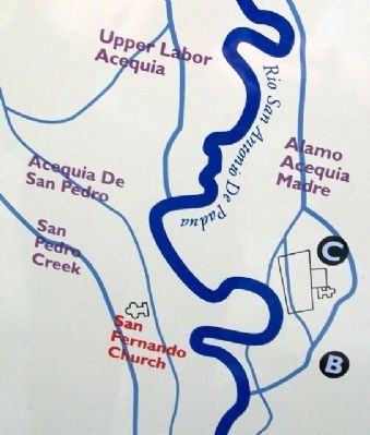
Three Sites of Mission San Antonio de Valero [see photo #15]
Mission San Antonio de Valero occupied two previous locations before being moved to its present site in 1724.
A. 1718 - The first building site had only a mud hut.
B. 1719 - Here a small stone tower was constructed, but was later destroyed by a storm.
C. 1724 - The convento, walls surrounding the plaza, and an uncompleted
church were built here at the final site.
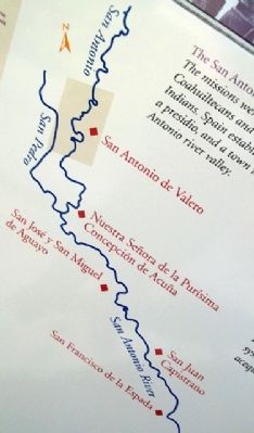
The San Antonio Missions [see photo #16]
The missions were founded to convert the Coahuiltecans and other native Texas Indians. Spain established five missions, a presidio, and a town in the San Antonio river valley.
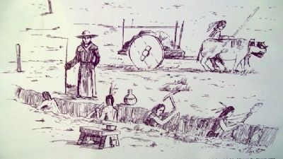
Indians Digging an Acequia [see photo #17]
The Indians irrigated the mission fields with a series of ditches called acequias which drew water from the San Antonio River using a remarkable gravity-flow system. Dug by Indian labor, the acequias took four years to construct.
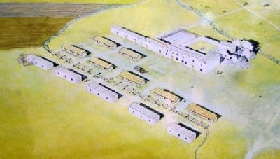
Mission San Antonio de Valero, ca. 1745 [see photo #18]
On May 8, 1744, stones had been laid for the first church. It was poorly constructed and by 1756 would collapse completely. By 1745, a well-organized community of skilled Coahuiltecan Indians lived in the adobe huts that lined the mission.
Adjoining the two-story stone convento, where the priests lived and kept offices, were workshops, a granary where grains from the mission farms were stored, and a textile shop where the Indian women wove cotton and wool fabrics. Tools for the Indian stonemasons were forged in the mission blacksmith shop. The mission continued to thrive, and in 1756 the second stone church, the present historic Alamo Shrine, was begun.
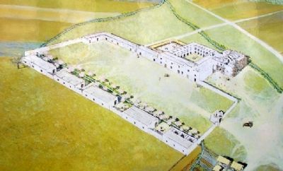
Mission San Antonio de Valero, ca. 1760 [see
photo #19]
Although it was never completed during the mission period, San Antonio de Valero grew in size and importance for many years. By 1778, Teodoro de Croix, Commandant General of the Provincias Internas, decreed that the Spanish Crown would appropriate all unbranded cattle and that anyone who captured, sold, or slaughtered livestock must pay a fee per head. For the missions, whose wealthy mainly consisted of surplus cattle, it was a devastating blow.
By 1793, secularization was begun, and San Antonio de Valero eventually ceased to be used as a mission. Its archives were removed to San Fernando parish, and much of the property was distributed to the Indians who continued to live nearby.
Erected by Daughters of the Republic of Texas.
Topics and series. This historical marker is listed in these topic lists: Churches & Religion • Colonial Era • Exploration • Native Americans. In addition, it is included in the El Camino Real de los Tejas National Historic Trail series list. A significant historical month for this entry is May 1851.
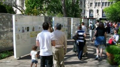
Location. 29° 25.558′ N, 98° 29.163′ W. Marker is in San Antonio, Texas, in Bexar County. It is in Alamo Plaza. Marker can be reached from the intersection of Alamo Plaza and East Houston Street. Marker is one of a series found between the Convento Courtyard and the Gift Shop on the Alamo Mission compound grounds. Touch for map. Marker is at or near this postal address: 300 Alamo Plaza, San Antonio TX 78205, United States of America. Touch for directions.
Other nearby markers. At least 8 other markers are within walking distance of this marker. The Decline of Spanish Rule (here, next to this marker); The Struggle for Independence (here, next to this marker); The Birth of the Republic of Texas (a few steps from this marker); Strong Foundations (a few steps from this marker); An Archaeological Puzzle (a few steps from this marker); From Republic to Early Statehood (a few steps from this marker); Japanese Monument to The Heroes of the Alamo (a few steps from this marker); From Warehouse to Shrine (a few steps from this marker). Touch for a list and map of all markers in San Antonio.
Also see . . . The Mission Community. (Submitted on May 22, 2010, by William Fischer, Jr. of Scranton, Pennsylvania.)
Credits. This page was last revised on February 2, 2023. It was originally submitted on May 21, 2010, by William Fischer, Jr. of Scranton, Pennsylvania. This page has been viewed 3,888 times since then and 55 times this year. Photos: 1. submitted on December 24, 2021, by James Hulse of Medina, Texas. 2, 3, 4, 5, 6, 7, 8, 9, 10, 11, 12, 13, 14, 15, 16, 17, 18, 19, 20. submitted on May 22, 2010, by William Fischer, Jr. of Scranton, Pennsylvania.
