Near Williamsburg in James City County, Virginia — The American South (Mid-Atlantic)
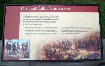
This land called Tsenacomoco
Colonist William Strachey, writing in 1612, noted that in springtime some Virginia Indians “…disperse themselves in small companies and live upon such beasts as they can kill with their bows and arrows. [They dine upon] crabs, oysters, land tortoises, strawberries, mulberries and such like; …they feed upon the roots of tuckahoe berryes, ground nuts, fish and green wheat (corn).”
On Jamestown Island, Glasshouse Point, and here at Neck of Land, archaeologists found fire-cracked rock from campfires, stone flakes from tool making, pottery sherds, projectile points, and deposits of oyster shell, all evidence of hunting and fishing camps, many dating to the Woodland period.
(captions)
John Smith trades with Powhatan Indians Sidney King, ca.1963
English settlers in a Powhatan Indian town Sidney King, c.1957
Topics. This historical marker is listed in these topic lists: Colonial Era • Native Americans • Settlements & Settlers. A significant historical year for this entry is 1607.
Location. 37° 13.173′ N, 76° 46.211′ W. Marker is near Williamsburg, Virginia, in James City County. Marker can be reached from Colonial Parkway, one mile east of Jamestown Road (Virginia Route 31). This marker is located at the Jamestown Information Station. Touch for map. Marker is in this post office area: Williamsburg VA 23185, United States of America. Touch for directions.
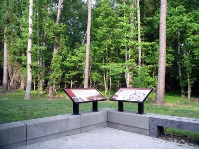
Other nearby markers. At least 8 other markers are within walking distance of this marker. Colonist on Neck of Land (here, next to this marker); Remembering Ancestors (approx. 0.2 miles away); On Roads of Water (approx. 0.6 miles away); Colonial Parkway (approx. 0.7 miles away); Excellent Good Timber (approx. 0.7 miles away); Governor Yeardley’s Lot 1620’s (approx. 0.7 miles away); Neck of Land (approx. ¾ mile away); Jamestown (approx. ¾ mile away). Touch for a list and map of all markers in Williamsburg.
Also see . . .
1. Colonial Parkway. (Submitted on May 23, 2010.)
2. Tsenacommacah. Wikipedia (Submitted on November 9, 2021.)
3. Tsenacomoco (Powhatan Paramount Chiefdom). Encyclopedia Virginia (Submitted on November 9, 2021.)
Credits. This page was last revised on November 9, 2021. It was originally submitted on May 23, 2010, by Bernard Fisher of Richmond, Virginia. This page has been viewed 1,395 times since then and 48 times this year. Photos: 1, 2, 3, 4. submitted on May 23, 2010, by Bernard Fisher of Richmond, Virginia.


