Ketchikan in Ketchikan Gateway Borough, Alaska — Northwest (North America)
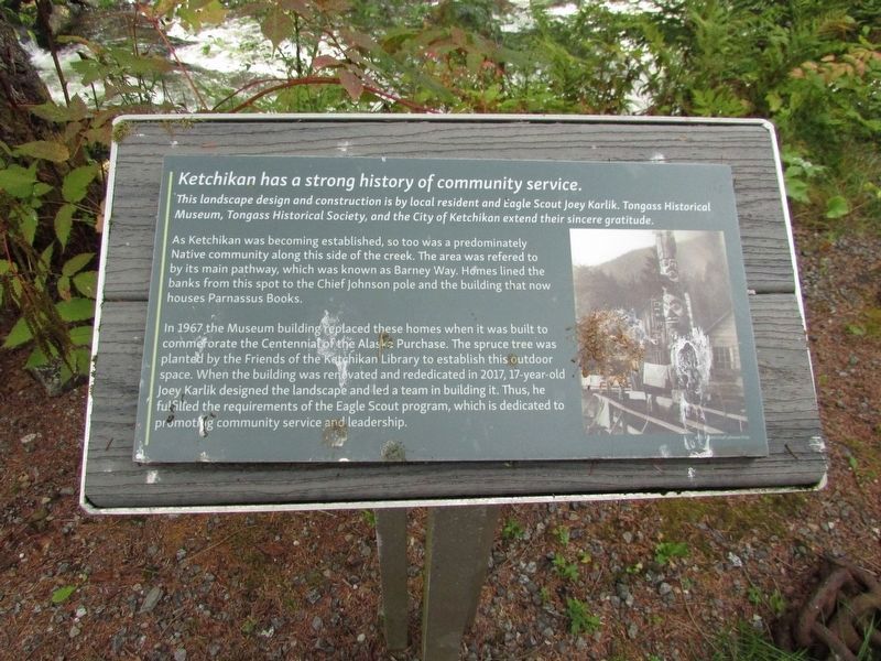
Ketchikan has a strong history of community service
Photographed by Bill Coughlin, September 2, 2026
1. Ketchikan has a strong history of community service Marker
This landscape design and construction is by local resident and Eagle Scout Joey Karlik. Tongass Historical Museum, Tongass Historical Society, and the City of Ketchikan extend their sincere gratitude.
As Ketchikan was becoming established, so too was a predominately Native community along this side of the creek. The area was referred to as its main pathway, which was known as Barney Way. Homes lined the banks from this spot to the Chief Johnson pole and the building that now houses Parnassus Books.
In 1967 the Museum building replaced these homes when it was built to commemorate the Centennial of the Alaska Purchase. The spruce tree was planted by the Friends of the Ketchikan Library to establish this outdoor space. When the building was renovated and rededicated in 2017, 17-year-old Joey Karlik designed the landscape and led a team in building it. Thus, he fulfilled the requirements of the Eagle Scout program, which is dedicated to promoting community service and leadership.
Topics. This historical marker is listed in these topic lists: Horticulture & Forestry • Indigenous Peoples and Communities • Parks & Recreational Areas
this page online
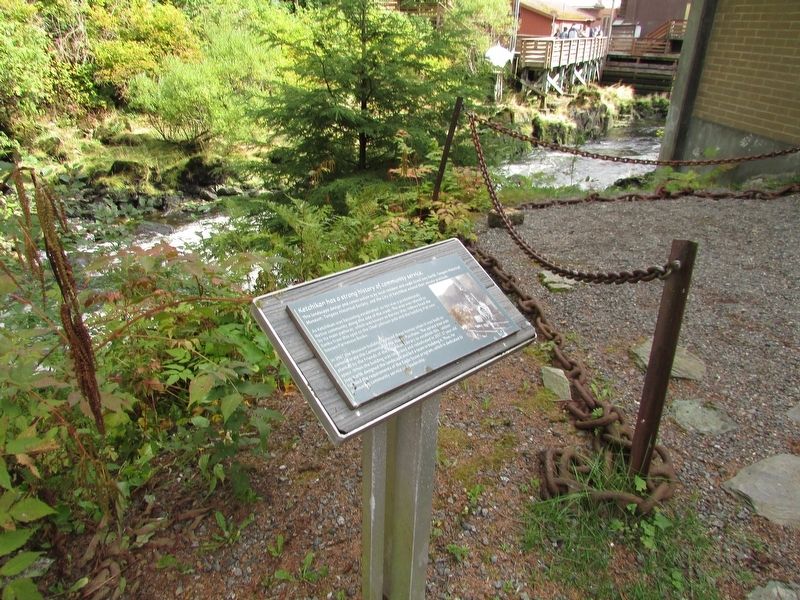
Location. 55° 20.562′ N, 131° 38.604′ W. Marker is in Ketchikan, Alaska, in Ketchikan Gateway Borough. It can be reached from Bawden Street, on the right when traveling north. Marker is located behind the Tongass Historical Museum. Touch for map. Marker is in this post office area: Ketchikan AK 99901, United States of America. Touch for directions.

Regionally, this marker is in Southeast Alaska, in Tlingit and Haida & Tsimshian Region. It is also on the American Pacific Coast. Globally, it is in North America, in the Inside Passage, on the Pacific Rim, in the Western Hemisphere, in the Western World, and in the Anglosphere. Historically, it finds itself in what was once the Russian Empire.
Other nearby markers. At least 8 other markers are within walking distance of this marker: This is the beginning of a salmon’s final run (here, next to this marker); The Creek is the heart of the town (a few steps from this marker); Raven Stealing the Sun Kootéeyaa (a few steps from this marker); Chief Johnson Totem Pole (within shouting distance of this marker);
Photographed by Bill Coughlin, September 2, 2026
2. Ketchikan has a strong history of community service Marker
More about this marker. A photograph of the Chief Johnson Totem Pole appears on the right side of the marker.
Credits. This page was last revised on September 11, 2026. It was originally submitted on September 11, 2026, by Bill Coughlin of Woodland Park, New Jersey. This page has been viewed 10 times since then. Photos: 1, 2. submitted on September 11, 2026, by Bill Coughlin of Woodland Park, New Jersey.
