Near Aberdeen in Harford County, Maryland — The American Northeast (Mid-Atlantic)
Spesutia P. E. Church
Old Post Road
| — | Established 1666 | — |
Photographed by William Pfingsten, June 24, 2007
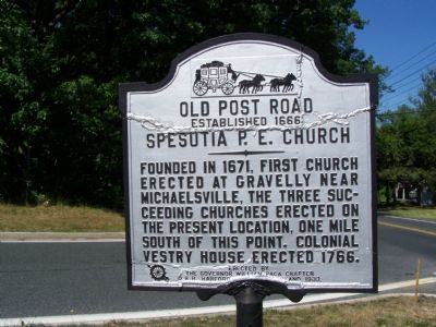
1. Old Post Road: Spesutia P. E. Church Marker
Founded in 1671. First church erected at Gravelly near Michaelsville, the three succeeding churches erected on the present location, one mile south of this point. Colonial vestry house erected 1766.
Erected 1933 by the Governor William Paca Chapter D.A.R. Harford County, MD.
Topics and series. This historical marker is listed in these topic lists: Cemeteries & Burial Sites • Colonial Era • Religion & Religious Structures • Roads & Vehicles. In addition, it is included in the Daughters of the American Revolution (DAR) series list. A significant historical year for this entry is 1666.
Location. 39° 29.259′ N, 76° 11.483′ W. Marker is near Aberdeen, Maryland, in Harford County. It is at the intersection of Old Philadelphia Road (Maryland Route 7) and Perryman Road ( Route 159) on Old Philadelphia Road. Road has been realigned and intersection has been changed to a traffic circle. Touch for map. Marker is at or near this postal address: 1204 Perryman Rd, Aberdeen MD 21001, United States of America. Touch for directions.

Regionally, this marker is in the Baltimore Metro Region and in Central Maryland.
this page online
Other nearby markers. At least 8 other markers are within 3 miles of this marker, measured as the crow flies: Spesutia Church (approx. 1.2 miles away); James B. Baker House (approx. 2 miles away); Aberdeen Proving Ground (approx. 2 miles away); “The General’s Highway” (approx. 2.1 miles away); Aberdeen Proving Ground Memorial (approx. 2.2 miles away); Aberdeen 9/11 Memorial (approx. 2.2 miles away); 2008 Restoration of P.B. & W. Railroad Crossing and Later Pennsylvania Railroad Watchman's Shed (approx. 2.2 miles away); Hall’s Cross Roads (approx. 2.2 miles away). Touch for a list and map of all markers in Aberdeen.
More about this marker. P.E. was a common abbreviation for “Protestant Episcopal”
Photographed by William Pfingsten, June 24, 2007
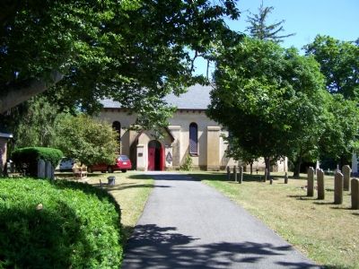
2. Today’s Spesutia Church: St. George's Episcopal

Photographed by Kevin Vincent, September 12, 2026
3. Spesutia P. E. Church Marker
Credits. This page was last revised on September 16, 2026. It was originally submitted on June 24, 2007, by Bill Pfingsten of Bel Air, Maryland. This page has been viewed 3,173 times since then and 42 times this year. Last updated on September 12, 2026, by Kevin Vincent of Arlington, Virginia. Photos: 1, 2. submitted on June 24, 2007, by Bill Pfingsten of Bel Air, Maryland. 3. submitted on September 12, 2026, by Kevin Vincent of Arlington, Virginia. • Devry Becker Jones was the editor who published this page.
