Near Granby in Grand County, Colorado — The American Mountains (Southwest)
The Nation's Backbone
Photographed by Leslie Eudy
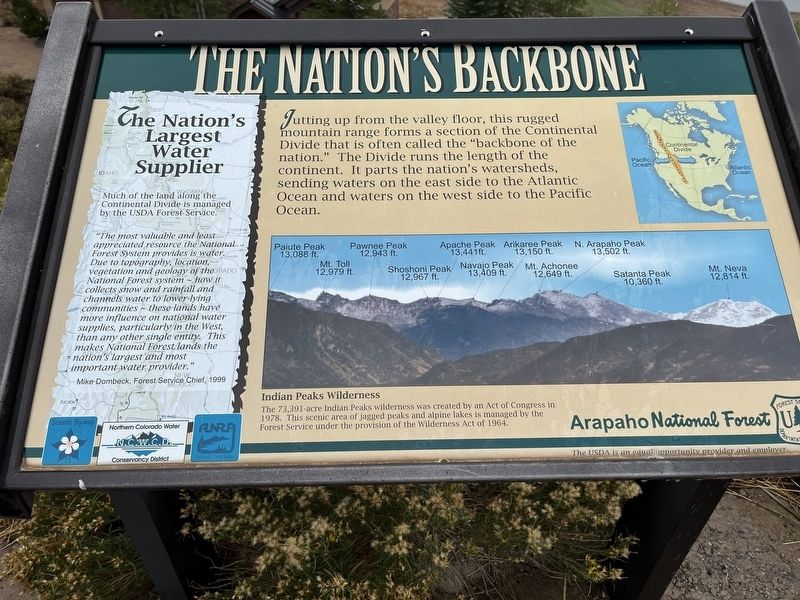
1. The Nation's Backbone Marker
The Nation’s Backbone
Jutting up from the valley floor, this rugged mountain range forms a section of the Continental Divide that is often called the “backbone of the nation.” The Divide runs the length of the continent. It parts the nation’s watersheds, sending waters on the east side to the Atlantic Ocean and waters on the west side to the Pacific Ocean.
Indian Peaks Wilderness
The 73,391-acre Indian Peaks wilderness was created by an Act of Congress in 1978. This scenic area of jagged peaks and alpine lakes is managed by the Forest Service under the provision of the Wilderness Act of 1964.
The Nation’s Largest Water Supplier
Much of the land along the Continental Divide is managed by the USDA Forest Service.
“The most valuable and least appreciated resource the National Forest System provides is water. Due to topography, location, vegetation and geology of the National Forest system ~ how it collects snow and rainfall and channels water to lower-lying communities ~ these lands have more influence on national water supplies, particularly in the West, than any other single entity. This makes National Forest lands the nation’s largest and most important water provider.”
this page online
Mike Dombeck, Forest Service Chief, 1999
Topics. This historical marker is listed in these topic lists: Environment • Parks & Recreational Areas • Waterways & Vessels.
Location. 40° 9.192′ N, 105° 53.322′ W. Marker is near Granby, Colorado, in Grand County. It is on U.S. 34, on the right when traveling north. Marker is along Grand Lake, south of Indian Peaks Marina. Touch for map. Marker is in this post office area: Granby CO 80446, United States of America. Touch for directions.

Regionally, this marker is in the Colorado High Rockies and on the Continental Divide. It is also in the American Mountain West. Globally, it is in North America, the Rocky Mountains, the Western Hemisphere, the Western World, and the Anglosphere.
Other nearby markers. At least 8 other markers are within 8 miles of this marker, measured as the crow flies: Against the Flow (here, next to this marker); Not Even Ghosts, But Rather Phantoms (here, next to this marker); Ancient Peoples Lived Near Windy Gap (approx. 5.7 miles away); The Smith-Eslick Cottage Camp (approx. 7.6 miles away); The Smith Eslick Cottage Court

Photographed by Leslie Eudy, September 17, 2026
2. The Nation's Backbone Marker Wide View
Marker is in the middle.
Credits. This page was last revised on September 18, 2026. It was originally submitted on September 18, 2026, by Leslie Eudy of Golden, Colorado. This page has been viewed 4 times since then. Photos: 1, 2. submitted on September 18, 2026, by Leslie Eudy of Golden, Colorado. • Andrew Ruppenstein was the editor who published this page.
